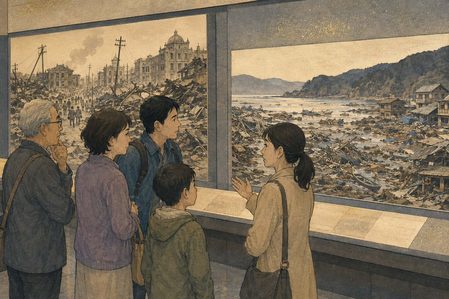
From inside the Miyagi 3.11 Tsunami Disaster Memorial Museum, the landscape is part of the exhibition. Its circular room is wrapped in glass. Look one way and there is Hiyoriyama, the hill to which people fled on March 11, 2011. Look another and there is Kadonowaki Elementary School, its burned shell preserved after tsunami-borne fires. Around the building is Ishinomaki Minamihama Tsunami Memorial Park, a former neighborhood where more than 500 people died.
Before the Great East Japan Earthquake, roughly 4,500 people in 1,800 households lived around this ground near the mouth of the Old Kitakami River. Earthquake, tsunami, fire and subsidence erased streets and homes. The museum’s highest roofline rises 6.9 meters, the level at which tsunami water stood here. There is no neutral white cube in which to consider catastrophe: the building insists that visitors keep looking outside.
On September 1, that room will acquire a second historical horizon. Miyagi Prefecture is opening a special exhibition titled in Japanese Futatsu no Daishinsai o, Watashi no Sonae ni—roughly, “From Two Great Earthquakes to My Own Preparedness.” About 28 A1-size panels will set the 1923 Great Kanto Earthquake beside the 2011 Great East Japan Earthquake. The show runs through October 4, with free admission; a museum interpreter is scheduled to explain it at 10 a.m. on opening day.
The prefecture says its goal is to strengthen people’s imagination of future danger and enable each person to take action to protect his or her own life. The emphasis on agency is necessary. It is also dangerous if it becomes a transfer of responsibility from public institutions to isolated individuals. Earthquake-resistant buildings, warning systems, accessible evacuation routes, truthful official communication and long-term health support are not private purchases. The history of both disasters is a history of what self-help, mutual aid and government can—and cannot—do without one another.
The comparison must begin with difference
Japan calls both events daishinsai—great earthquake disasters—but the word describes social catastrophe, not identical geology or identical ways of dying.
The 1923 Kanto earthquake began at 11:58 a.m. at a depth of 23 kilometers in western Kanagawa Prefecture. Its magnitude was 7.9. Japan’s present seven-level seismic-intensity scale did not exist, but damage evidence suggests shaking equivalent to today’s maximum intensity 7 along parts of the Sagami Bay coast and southern Boso Peninsula. Homes collapsed across an increasingly modern metropolitan region.
Then fire changed the scale of the disaster. The shock came as households prepared lunch over open stoves and charcoal braziers. Water mains failed. Numerous fires exceeded the available firefighting force and merged under strong, shifting winds. A Cabinet Office history attributes roughly nine in ten deaths to fire. Yet the disaster also produced a 12-meter tsunami at Atami, severe liquefaction and landslides; at Nebukawa, a debris flow buried a community. “Tokyo burned” is true, but radically incomplete.
The earthquake of March 11, 2011, was a magnitude-9.0 rupture offshore at a depth of 24 kilometers, along the plate boundary east of Tohoku. Kurihara in northern Miyagi recorded intensity 7. The tsunami devastated a long Pacific coastline, and the accident at Tokyo Electric Power Company’s Fukushima Daiichi Nuclear Power Station turned it into a compound natural, technological and displacement disaster.
The Reconstruction Agency’s July 2026 summary lists 19,787 dead, including disaster-related deaths, 2,549 missing and 122,204 homes destroyed as of March 1. About 470,000 people were displaced at the outset. Miyagi alone reports 10,571 dead—9,639 direct deaths and 932 disaster-related deaths—and 1,215 missing as of the end of February 2026. These categories extend beyond the wave: “disaster-related death” recognizes people whose health failed under evacuation, interrupted care and prolonged dislocation.
| Dimension | Great Kanto Earthquake | Great East Japan Earthquake | Preparedness question |
|---|---|---|---|
| Shock | Sept. 1, 1923, 11:58 a.m.; M7.9; shallow Kanto rupture | March 11, 2011, 2:46 p.m.; M9.0; offshore megathrust | Have plans been tested for different times and separated family members? |
| Fatal mechanism | About 90% fire; also collapse, tsunami and landslide | Drowning was 90.6% among bodies examined by police; nuclear evacuation and related deaths followed | Does “earthquake preparation” cover cascading hazards? |
| Information | Broken communications and false rumors that enabled killings | Warning, power and communications failures; uncertain information online | Which sources will be trusted, and what action cannot wait? |
| After survival | More than two million people lost housing; water, relief and transport failed | 470,000 initially displaced; long evacuation and related deaths | Do plans include medicine, toilets, care and months after the first night? |
In 1923, misinformation became a weapon
Disaster history often seeks a clean lesson. Anchor furniture. Build with fire-resistant materials. Keep emergency water. The Great Kanto Earthquake did prompt structural reform: in 1924, Japan amended the Urban Building Law to introduce a seismic-force requirement, an early legal attempt to make the built environment answer to earthquakes.
But 1923 also left a lesson that cannot be solved with hardware. False rumors accused Koreans of arson and armed revolt. Vigilante groups, and parts of the police and military, carried out killings. The Cabinet Office’s expert history describes fragmentary information and prior prejudice accelerating into a runaway search for meaning. Authorities did not merely fail to stop the rumor; some participated in its spread and violence.
That history belongs inside disaster preparedness because the victims were not killed by ground motion. They were killed through decisions made under fear. In a digital emergency, official posts, cropped video, synthetic imagery and anonymous claims can all move faster than a correction. Advising the public to “avoid misinformation” is too vague. Institutions need trusted channels before a crisis, rapid corrections in multiple languages, transparent uncertainty and safeguards against official amplification of scapegoating.
The point also changes how a museum should use images. A dramatic picture is never merely decoration in a history of rumor. It tells viewers what to believe they are seeing. Evidence, reconstruction and imagination must remain visibly distinct.
In 2011, the shortest instruction carried the greatest weight
Among bodies examined by police through March 2012, 90.6 percent of deaths were classified as drowning. That is not a percentage of the present total, which includes later disaster-related deaths, but it explains the memorial museum’s austere central message: to survive a tsunami, escape it. The permanent displays use real tsunami footage and the voices of 90 people from 79 organizations. The Japan Meteorological Agency’s current guidance is equally direct. If a warning is issued, or if a person near the sea feels strong shaking or long, slow shaking, move away from the shore to higher, safer ground. Do not return until warnings and advisories are lifted; successive waves can arrive.
That instruction is not an argument for waiting on a phone. When a tsunami source is close to land, the official warning may not arrive before the water. Felt shaking is itself the trigger.
Yet “evacuate immediately” is not equally easy for everyone. A person who uses a wheelchair, an older resident living alone, a hospital patient, a child awaiting pickup, a tourist who cannot read a sign and a worker responsible for closing a floodgate face different clocks. Personal resolve needs a usable route, an accessible destination and a plan for assistance that does not require rescuers to sacrifice themselves.
Nearby Kadonowaki Elementary School preserves one crucial case. Pupils and staff present at school followed their training and moved to Hiyoriyama, saving many lives. Around Minamihama and Kadonowaki as a whole, however, more than 500 residents died or remain missing. A successful school evacuation should be studied without turning it into a comforting account of the neighborhood. Training worked in one chain of decisions; preparedness failed to protect hundreds elsewhere.
Japan created days of remembrance. Habits are harder
September 1 became Disaster Prevention Day in 1960, both to preserve the lesson of the Kanto catastrophe and to concentrate attention during typhoon season. Miyagi has another date. On June 12, 1978, a magnitude-7.4 earthquake off Miyagi badly damaged the prefecture. Miyagi’s ordinance now designates June 12 as Prefectural Disaster Prevention Day. March 11 is a prefectural day of remembrance; November 5 is national Tsunami Preparedness Day.
The accumulation of dates is useful only if it produces repetition. A household can use March 11 and September 1 to rotate food and water, test the emergency-message service, replace batteries, check prescriptions, tighten furniture anchors and walk an evacuation route. A school can test what happens when parents cannot arrive. A care facility can rehearse with fewer staff, at night, with elevators unavailable.
1923 The Kanto disaster combines shaking, fire, tsunami, landslide and lethal rumor.
1924 Japan adds a seismic-force provision to the Urban Building Law.
1960 September 1 is established as Disaster Prevention Day.
1978 The Miyagi-ken-oki earthquake becomes another prefectural warning from history.
2011 Earthquake, tsunami and nuclear accident produce mass death and long displacement.
2021 The Minamihama park opens; the memorial museum follows on June 6.
2026 The museum asks visitors to turn two catastrophes into their own preparedness.
A museum designed as a gateway, not an endpoint
The Miyagi museum did not appear automatically after the rubble was cleared. Ishinomaki asked for a prefectural memorial facility in 2013. The national government decided in 2014 to establish a memorial park. Miyagi convened an expert panel in 2017 and, the following year, defined the central facility as a gateway linking disaster ruins, museums and storytelling groups across the prefecture.
Ishinomaki Minamihama Tsunami Memorial Park opened on March 28, 2021. The museum’s opening was delayed about two months by the coronavirus pandemic and took place on June 6. Its concept is “a place that carries memory into the future in order to protect irreplaceable life.” The interior is about 40 meters in diameter; thin columns and transparent walls keep the recovered landscape in view.
That gateway idea matters to the new exhibition. The Great Kanto Earthquake is not Miyagi’s local memory. Placing it in Minamihama asks visitors to borrow experience across time and geography. A firestorm in Tokyo and Yokohama can sharpen questions about water failure, open space and urban evacuation. A tsunami in Tohoku can make a Kanto resident reconsider coastal travel, relatives outside the city and the limits of a hazard assumption. Memory becomes preventive only when it travels.
Generated images create a test of museum trust
Miyagi Prefecture’s announcement includes a striking disclosure: some panels use AI-generated images fitted to their content or intended image. That does not establish misuse. Generated art can illustrate an abstract process or help a designer represent a scene for which no photograph exists.
But a disaster-memory institution carries an unusually high duty to distinguish record from representation. A photograph, survivor testimony, government document, measured inundation mark and later illustration have different evidentiary status. If they are made to look interchangeable, the exhibition teaches the wrong media habit even when its written facts are correct.
The risk is not theoretical in a show that includes 1923. False claims became a mechanism of killing then. In 2026, images can be generated, detached from context and recirculated in seconds. Clear labeling on each image, a visible explanation of its basis and a design that does not imitate archival evidence would turn the technology into an opportunity for media literacy. A blanket disclosure in a press release is not a substitute for what visitors see at the panel.
The prefecture has not yet said which panels use generated imagery, which system produced it, how historians reviewed it or how each image will be marked. Nor has Japan.co.jp viewed the installed exhibition before opening. Those are questions for September 1, not grounds for a verdict in advance.
Five changes to make before leaving the parking lot
Disaster exhibitions can produce emotion without action. The experience feels morally complete: a visitor has witnessed, grieved and learned. The preparedness gap begins when the visitor goes home unchanged.
A practical exit task is to write five changes into a phone before leaving Minamihama. Based on current guidance from Miyagi Prefecture, the Cabinet Office and the Japan Meteorological Agency, the list should cover more than an emergency bag.
- Map hazards separately. Check earthquake shaking, tsunami, flood, landslide and fire risk for home, work and school. A designated shelter for one hazard may be unsafe for another.
- Make the first room survivable. Anchor tall furniture and appliances, keep heavy objects away from beds and preserve an exit path. Survival begins before evacuation.
- Stock life, not just calories. Miyagi advises at least three days of water—three liters per person per day—and food, with a week desirable for a large disaster. Add toilets, medicine, infant or allergy supplies, power, glasses, hearing-aid batteries and pet needs.
- Plan for silence. Agree on meeting places, an out-of-area contact and how to use Japan’s 171 disaster-message service when mobile calls fail. Decide who collects children and who checks a neighbor needing assistance.
- Walk the plan. Test the route in daylight and darkness, and identify an alternative. Near the coast, strong or prolonged shaking means moving to higher ground without waiting for an alert.
Preparedness has a social edge. A week of supplies cannot carry a neighbor down stairs. A hazard map cannot interpret itself for a visitor. A family plan cannot reopen a hospital. The honest lesson is neither “the government will save everyone” nor “everyone is on their own.” Public systems have to create the conditions in which personal and neighborhood action is possible.
The measure of an exhibition comes later
The year 1923 has passed beyond ordinary living memory. Children born after March 11, 2011, are now reaching high school. Disaster transmission is therefore moving from direct testimony toward a second task: making inherited memory usable for people who cannot remember the original day.
Numbers matter, but causal chains matter more. Why did broken water lines turn ignition into conflagration? Why did prior prejudice make absurd rumor believable? Why did rehearsed movement save one school population while evacuation failed elsewhere? Why did people continue to die after reaching shelter? Each chain points toward a decision that can still be changed—building codes, communication, route design, medication continuity, social trust.
After the museum, visitors step back onto the footprint of Minamihama. The hill remains visible. So do a damaged school, a memorial plaza and the open land where houses once stood. The exhibition’s success will not be measured by whether every panel is read. It will be measured later, invisibly: a bookcase anchored, water replaced, a false post left unshared, a wheelchair route rehearsed, a family moving uphill before a warning arrives.
Memory alone does not protect life. Repeated action gives memory a chance.
- Miyagi Prefecture — Announcement of Futatsu no Daishinsai o, Watashi no Sonae ni (Aug. 26, 2026; Japanese)
- Miyagi Prefecture — Miyagi 3.11 Tsunami Disaster Memorial Museum
- Miyagi Prefecture — Official English guide to Ishinomaki recovery and memorial sites
- Miyagi Prefecture — Development history of the disaster-memory facility
- Japan Meteorological Agency — Overview of the 1923 Kanto earthquake
- Cabinet Office expert report — 1923 Great Kanto Earthquake
- Cabinet Office expert report, Part 2 — Emergency response, rumor and killings
- Cabinet Office — Lessons from the September 1, 1923 disaster
- Japan Meteorological Agency — The 2011 off the Pacific coast of Tohoku Earthquake
- Reconstruction Agency — Current state of reconstruction (July 2026)
- Miyagi Prefecture — Great East Japan Earthquake damage summary, updated through February 2026
- Japan Meteorological Agency — How to protect yourself from tsunami
- Miyagi Prefecture — Household disaster preparation
- Cabinet Office — Natural-disaster preparedness checklist
- Miyagi Prefecture — June 12 Prefectural Disaster Prevention Day
Editor’s note: The exhibition has no announced official English title; the rendering in this article is descriptive. The museum’s official English name follows Miyagi Prefecture’s English materials. The Japanese exhibition-purpose phrase is paraphrased in English rather than presented as an official translation. Disaster totals are labeled by scope and reference date. The event announcement shortens the address to Minamihama, while the museum’s permanent listing uses Minamihama-cho; this article follows the permanent facility listing. The supplied exchange-rate update—August 26 at 7:24 p.m. UTC—has been converted to August 27 at 4:24 a.m. Japan Standard Time.