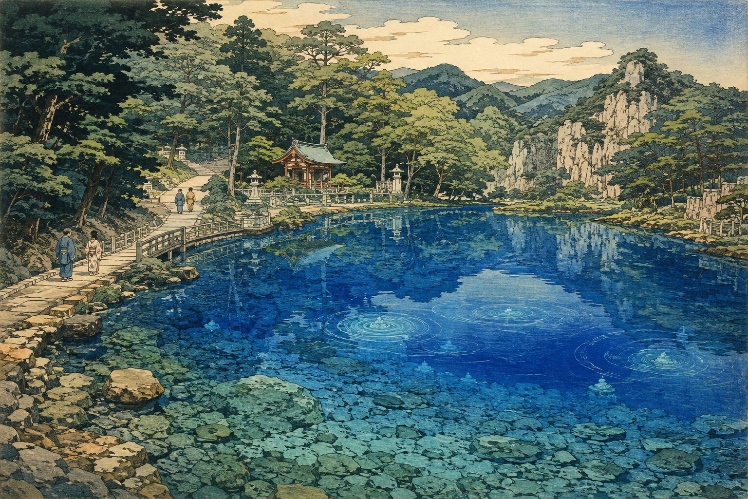
Under the trees, the pond is never a single color. Near the edge, pale sand and stones show through. Where sunlight reaches the center, green-blue deepens toward indigo. Shadows of leaves cross the surface; grains of sand around the spring vents seem to stir. Move a step and a patch reflecting the sky changes places with one that opens a view four meters down.
Beppu Benten Pond is not a great lake. The official Mine-Akiyoshidai Geopark description puts its circumference at about 40 meters and its central depth at roughly four. Japan's Ministry of the Environment describes water near 14°C and discharge around 180 liters a second. Its clarity allows the bottom to remain visible. The blue is more than a photographer's saturation slider. Yet explanations that reduce it to one mysterious mineral are no better.
Two histories flow into the pond at once. In one, rain dissolves rock, passes through fractures and caves, and returns to daylight along a fault. In the other, a settler desperate for water follows a message in a dream, enshrines Benzaiten and receives a spring. The first asks how water reaches this place. The second asks how people should live after receiving it. Neither has to erase the other.
Blue is made in the water, not by a “blue substance”
The explanation is not simply the reason the sky is blue. As the U.S. Geological Survey explains, pure water itself has a faint blue color. Water molecules absorb the red end of visible light more readily than the blue end. The farther light travels through water, the more red is removed. What returns to the eye is therefore relatively richer in blue. A precise 1997 measurement by Raymond Pope and Edward Fry established pure water's absorption spectrum across the visible range and placed its minimum absorption in the blue region.
The effect is difficult to notice in a drinking glass. In a transparent pool, however, sunlight can travel meters to pale sand or stone, reflect and pass back through the water. The round trip lengthens the optical path, removing more red. If suspended silt and brown dissolved organic material are limited, the water's blue is less easily masked. A light bottom acts as a returning screen. Depth, substrate, sun, tree shade, surface reflection, viewing angle and camera exposure combine, so the same spring can appear jade, turquoise or cobalt.
It is therefore too simple to say that calcium from limestone “dyes the water blue.” It is equally inadequate to say the pond merely reflects the sky. Chemistry can affect transparency and the appearance of the bottom, but calcium ions are not a blue pigment. Japan.co.jp found no published site-specific optical study that measured the pond's reflectance wavelength by wavelength and separated the contribution of every factor. What can be said firmly is that water's selective absorption of red, exceptional clarity, depth and light returning from the bottom provide a physically sound explanation for the blue appearance.
| Claim | Assessment | Evidence and limit |
|---|---|---|
| “Water absorbs red light more strongly than blue.” | Established physics | Supported by the measured absorption spectrum of pure water and USGS guidance. |
| “Clarity, four-meter depth, a light bottom and sunlight strengthen the blue.” | Sound site explanation | Consistent with official depth and clarity. The share of each factor has not been measured here. |
| “Dissolved cobalt creates the cobalt blue.” | Unsupported | Cobalt blue is a color name. No official water analysis cited here identifies cobalt as the cause. |
| “It always looks exactly as blue as a photograph.” | False | Weather, hour, shade, position and exposure change apparent color. |
A 300-million-year-old sea carries water beneath Yamaguchi
To understand the blue, begin with white limestone. The official geopark history starts about 300 million years ago on a submarine volcano in an ocean far from the continent. Calcium-carbonate remains made by organisms such as corals accumulated there for roughly 80 million years. Plate movement transported that record of ancient marine ecosystems until it became part of the accretionary geology of what is now Japan.
Once exposed, the limestone was worked by rain and groundwater. Rain takes up carbon dioxide from air and soil, becoming weakly acidic. It slowly dissolves calcium carbonate, enlarging fractures and creating sinkholes known as dolines, subterranean channels and caves. Akiyoshidai's limestone area covers roughly 100 square kilometers, and geopark materials count more than 450 caves concentrated there. The grassland may look still. Under it is a three-dimensional drainage system.
For Beppu Benten Pond itself, the geopark's official geosite description says groundwater is believed to arrive from the direction of Mount Hanaoyama to the northwest and emerge along a fault. “Believed” matters. The public evidence does not establish the precise recharge point of every drop, one residence time underground or a single pipe-like route from rain to spring. Karst groundwater may pass through fractures, open conduits and neighboring rocks. Science provides a strong model of the route without pretending that the entire labyrinth is mapped as one line.
In April 2026, the Mine-Akiyoshidai Karst Plateau joined UNESCO's Global Geoparks, becoming Japan's 11th. The recognition covers 47,264 hectares connecting Mine's strata, fossils, mines, karst, culture and communities. It was not a new certificate for the pond's color. It placed the region within an international commitment to protect Earth history, teach it and build sustainable tourism around it.
A defined part of the wider groundwater landscape was already internationally recognized. In 2005, the 563-hectare Akiyoshidai Groundwater System was listed under the Ramsar Convention for its cave wetlands, formations and specialized animals associated with Akiyoshidō, Taishōdō and Kagekiyodō. That is important regional context. It must not be rewritten as proof that Beppu Benten Pond itself sits within that specific 563-hectare Ramsar boundary.
On a dry karst plateau, a spring is more than an outlet
Karst creates a paradox. Rain falls, yet it can disappear quickly into fractures and dolines, leaving relatively little water on the surface. Water may be abundant underground but hard to reach from the plateau above. A place where groundwater returns in volume is therefore not only a geological outlet. It can determine where daily life becomes possible.
Beppu Benten Pond's water has long served domestic and agricultural needs. It continues into irrigation and the neighboring municipal trout farm. The blue surface a visitor watches for a few minutes is working infrastructure. Water does not stop inside the frame of a scenic photograph. It moves toward faucets, fields, fish ponds and meals.
A separate folk observance on the same western Akiyoshidai offers useful comparison. Mine's cultural-property account of the Yowara Mori Festival associates its background with prayers over the water scarcity characteristic of the karst plateau. This does not prove the origin of the Beppu legend. It does show that the scarcity of accessible surface water could carry religious and ritual weight in neighboring communities.
“100 Famous Waters” does not mean “drink untreated forever”
Beppu Benten Pond was selected for the Environment Agency's 100 Famous Waters in 1985. The program was created to rediscover outstanding waters and strengthen public awareness of protecting aquatic environments. The ministry's pond page describes water near 14°C, an appropriate amount of calcium, high transparency and discharge around 180 liters a second, noting its long familiarity as drinking water.
The Environment Ministry also states clearly that Famous Waters selection does not guarantee potability. Water quality can change with rainfall, surrounding land use, pipes, storage and microorganisms. The official environmental and tourism pages reviewed for this article do not publish a complete 2026 laboratory panel with sampling date, every analyte and detection limit. “It is transparent” and “people have drunk it historically” are not current sanitary test results.
Official visitor guidance identifies faucets for take-away water between the pond and parking lot. The water is free, with donations encouraged for its upkeep. Anyone intending to drink it should not scoop directly from the pond, should follow the latest signs at the site and should use a clean container. Where health consequences matter—particularly for infants, pregnant people or those with weakened immunity—local authorities or a medical professional should guide the decision. Cultural recognition of a famous spring and sanitary judgment on water collected on a particular day are different jobs.
- Do not put hands or feet in the pond. Residents use this water in daily life.
- Collect water from the designated faucet between the pond and parking area, never directly from the pool.
- Follow current on-site notices and use a clean container. Do not treat Famous Waters selection as a standing safety certificate.
- Treat the path, shrine, trout farm and irrigation system as one lived place; leave no trash.
- Expect apparent color to change with season, sun and camera settings rather than assuming that every variation signals pollution or a “lost” blue.
Benzaiten in a dream, and one green bamboo stalk
Groundwater science does not replace the legend. Beppu's story survives in more than one form. The Mine City Tourism Association says a wealthy community leader who opened the land suffered from a water shortage. A dream instructed him to enshrine Benzaiten; when he did, water sprang forth. The Environment Ministry's version adds an old man appearing in the dream and a green bamboo stalk which, when pulled, released the spring. Other local tellings include a prayer to Suwa Daimyōjin and an oracle commanding that Benzaiten be enshrined and water sought with green bamboo.
Those versions should not be blended into one artificially definitive account. Oral tradition changes emphasis with teller, period and recorder. Bamboo becomes a marker in the search for water, the old man a guide, and Benzaiten the giver of the spring. Preserving the differences makes clear that this is not a field notebook of hydrogeology. It is a story that remembers thirst, search, discovery and gratitude.
The legend does not explain a fault or carbonate dissolution. Instead, it builds an ethic in which water is received rather than merely owned. The conclusion is not that one rich settler privatizes a well. A shrine is established, a community dedicates a dance, and gratitude is renewed across generations. Story gives a human face to an invisible shared aquifer.
How an Indian river goddess reached a Japanese spring
Benzaiten did not begin as a goddess confined to Japanese ponds. Her distant source is Saraswati, associated with a river in India. Meaning flowed outward from water toward speech, music, wisdom, fertility and prosperity. Traveling through Buddhism into East Asia, she entered Japan as Benzaiten. Buddhist and Shinto practice overlapped; in early modern popular worship her name was also written with a character for wealth, and she became one of the Seven Lucky Gods.
Japan's multilingual cultural guidance describes Benzaiten as a deity of flows—water, music, poetry, wisdom and fortune—and notes how often her shrines stand near water. Enshrining her at Beppu was not an isolated curiosity. A goddess transformed across continents met the local experience of a karst community that needed a dependable spring.
This research did not locate a reliable primary source for the exact foundation year of Beppu Itsukushima Shrine. Precise dates repeated on informal travel pages should not be promoted to historical fact without documentary support. What can be stated is that the pond stands within the shrine grounds and that official environmental and tourism records preserve a legend connecting Benzaiten to the spring.
When water becomes dance: Beppu Nenbutsu Odori
The legend does not end with “water appeared.” In autumn, residents dedicate the Beppu Nenbutsu Odori in thanks for the spring. The Yamaguchi Tourism Federation describes three forms under the Japanese names 腰輪楽, 鶏頭楽 and 花楽. The first two are classed as nenbutsu dances; the last is a children's dance performed at the shrine by boys around six or seven. In March 1976, the tradition was designated an Important Intangible Folk Cultural Property of Yamaguchi Prefecture.
Older descriptions identify September 8 as the dedication date, while recent visitor information shows festivals organized on the first weekend of September. The sources for this report do not establish the 2026 schedule, so anyone planning a visit should check the organizer's latest announcement. A tradition also says residents vowed to continue the offering as long as people live in the district. Dance does not only reenact a past discovery. It promises a future community.
Gratitude for water is converted from a word into bodies, costume, rhythm and succession. The spring fills fields and raises fish, but it also gives a child a reason to step onto the shrine stage. As groundwater becomes visible at the surface, an invisible obligation becomes visible as dance.
From about 300 million years ago Limestone begins forming on a remote submarine volcano, preserving roughly 80 million years of marine history.
Over the last several million years Rain and groundwater dissolve the limestone, enlarging dolines, caves and subterranean drainage.
Date unknown Stories of water shortage, a dream, Benzaiten and green bamboo are transmitted around the spring.
1976 Beppu Nenbutsu Odori becomes an Important Intangible Folk Cultural Property of Yamaguchi Prefecture.
1985 The spring is selected for Japan's 100 Famous Waters.
2026 The Mine-Akiyoshidai Karst Plateau becomes a UNESCO Global Geopark; new locally developed confectionery and souvenirs also carry the pond's story outward.
Translating the blue pond into local work
A beautiful place does not support a community through photographs alone. In January 2026, Mine City introduced Mizu no Shizuku, crystal-like kohakutō sweets made with Beppu Benten spring water. A local revitalization officer led the project with the Katada district community council and a café in the Akiyoshidō shopping street. Students at Akiyoshi Junior High School contributed the name and flavor ideas. White, green and red sugar crystals turned the water's story into something edible.
That month the city also presented a clear file folder showing the pond in four seasons—ginkgo, maple leaves and snow around the water. The idea came from the Katada district council. Souvenirs are easy to dismiss, but they are also small acts of editing: the community decides how to explain a landscape, who participates, and where attention and revenue may circulate.
The trout farm performs another translation. Water near 14°C raises fish, supports fishing and reaches nearby meals. Irrigation feeds production in the fields. A faucet and donation box open access while making maintenance visible. The shrine carries story, the dance moves gratitude into bodies, and sweets and photographs let visitors carry meaning away. One spring circulates through local memory and economy by different routes.
The clearest water must be protected beyond what we can see
Karst should not be romanticized into a claim that “rock filters everything, so the water is always pure.” Where groundwater moves rapidly through fractures and conduits, material entering at the surface may travel without the prolonged filtration, adsorption or biological breakdown expected in thick soil. Protection cannot stop at the pond fence. Land use across recharge areas, waste, agriculture, drainage and storm-driven turbidity belong to the same water system.
Tourism requires the same watershed perspective. The ban on touching the pond is not a rule designed to obstruct a photograph. It protects living water, avoids stirring bottom sediment and reduces the introduction of cosmetics, sunscreen and microorganisms. The designated faucet is a local design for connecting public access with hygiene without turning the pool itself into a dipping basin.
The 2026 UNESCO recognition can bring welcome attention. It can also concentrate people at one blue point, adding pressure through parking, photography, water collection, waste and behavior at the shrine. The challenge is to move from tourism that consumes an image to tourism that understands an aquifer and a community: can several minutes of spectacular blue lead toward 300 million years of stone, daily water work and a dance renewed each autumn?
Time returns to the surface
At Beppu Benten Pond, blue is the first thing the eye receives. Watch longer and other times emerge: organisms building limestone in a tropical sea; a plate carrying rock; rain enlarging fractures; people searching for water, drawing it into fields, raising fish and teaching children a dance.
The color does not dissolve those histories into a single cause. Optics corrects the cobalt mistake. Geology sketches the underground route. Public health separates clarity from safety. History follows a goddess across borders. Folklore remembers that a “blessing” does not continue without repeated human work.
Water presses continuously from the pond bottom. The blue surface looks enduring although it is replaced by new water every moment. Tradition behaves similarly. Details of the legend vary. Festival schedules move. Spring water is translated into new sweets and pictures. The work underneath—protecting shared water and carrying gratitude to another generation—continues.
Beppu Benten Pond is not sacred because its blue lies beyond science. It is sacred because people built relationships that scientific explanation alone cannot maintain upon a natural process that science can explain. Water returns from darkness to light. The community receives that return in daily life and story.
Principal sources and reporting basis
- Mine City Tourism Association, “Beppu Benten Pond” (Japanese): temperature, clarity, Famous Waters selection, domestic, agricultural and trout use, Itsukushima Shrine, Benzaiten legend, autumn dance and the current prohibition on putting hands or feet in the pond.
- Mine City Tourism Association, “Beppu Benten Pond” (English): rain entering Akiyoshidai, designated take-away faucets, donation, trout and the English legend account.
- Ministry of the Environment, “Beppu Benten Pond Spring”: four-meter depth, 14°C, roughly 180 L/s, calcium, irrigation and trout use, and the legend including an old man and green bamboo.
- Ministry of the Environment, Famous Waters portal: the environmental purpose of the 1985 selection and the warning that selection does not guarantee potability.
- Mine-Akiyoshidai Geopark, geology and landform sites: circumference and central depth, groundwater believed to arrive from Mount Hanaoyama and emerge along a fault, historic uses and regional geology.
- Mine-Akiyoshidai Geopark official site: limestone formation beginning about 300 million years ago and continuing for roughly 80 million years, a limestone area near 100 square kilometers, more than 450 caves and development of underground drainage.
- UNESCO, “Mine-Akiyoshidai Karst Plateau UNESCO Global Geopark”: 2026 designation, 47,264-hectare area, marine record, community, education and sustainable tourism.
- Japan's Ministry of Education, Culture, Sports, Science and Technology, UNESCO Global Geoparks: April 2026 recognition and status as Japan's 11th.
- Ministry of the Environment, Ramsar Sites in Japan: the 563-hectare Akiyoshidai Groundwater System registered in 2005 and its cave-wetland value. This report does not treat it as a separate designation of Beppu Benten Pond.
- U.S. Geological Survey, “Water Color”: pure water's faint blue, preferential absorption of red wavelengths and the importance of optical path length.
- R. M. Pope and E. S. Fry, “Absorption spectrum (380–700 nm) of pure water”, Applied Optics 36(33), 1997: definitive visible-range absorption measurements.
- Japan Society for Science Education, experiments on why water appears blue: educational experiments demonstrating different absorption of red, green and blue light.
- Yamaguchi Tourism Federation, “Beppu Nenbutsu Odori”: the three dance forms, the children's performance and the continuing dedication.
- JAPAN 47 GO, “Beppu Nenbutsu Odori”: March 1976 designation as a Yamaguchi Important Intangible Folk Cultural Property.
- Ministry of Land, Infrastructure, Transport and Tourism, “Benzaiten Hall”: Benzaiten's origin in Saraswati and her associations with the flows of water, words, music, wisdom and fortune.
- Mine City, new Beppu Benten Pond confectionery Mizu no Shizuku (updated January 21, 2026): spring-water kohakutō and collaboration among the local council, café and junior-high students.
- Mine City, Beppu Benten Pond clear file (updated January 21, 2026): a Katada district initiative using seasonal pond photographs.
- Mine City, Yowara Mori Festival: regional comparison connecting prayer and the scarcity of water on western Akiyoshidai.
Editor's note: This report triangulates official geology, environment, tourism and cultural-property sources with research on the optics of pure water. Japan.co.jp did not take water samples, perform spectroscopy, conduct a groundwater tracer test or inspect original shrine archives in 2026. It therefore does not assign percentages to the causes of the blue, claim an exact groundwater residence time or single flow path, or state a foundation year for Beppu Itsukushima Shrine. Variants of the legend remain separate. Famous Waters selection is not a drinking-water guarantee; current local sanitary guidance takes priority. The hero is an imagined illustration. Research current through August 15, 2026 at 3:14 AM JST.