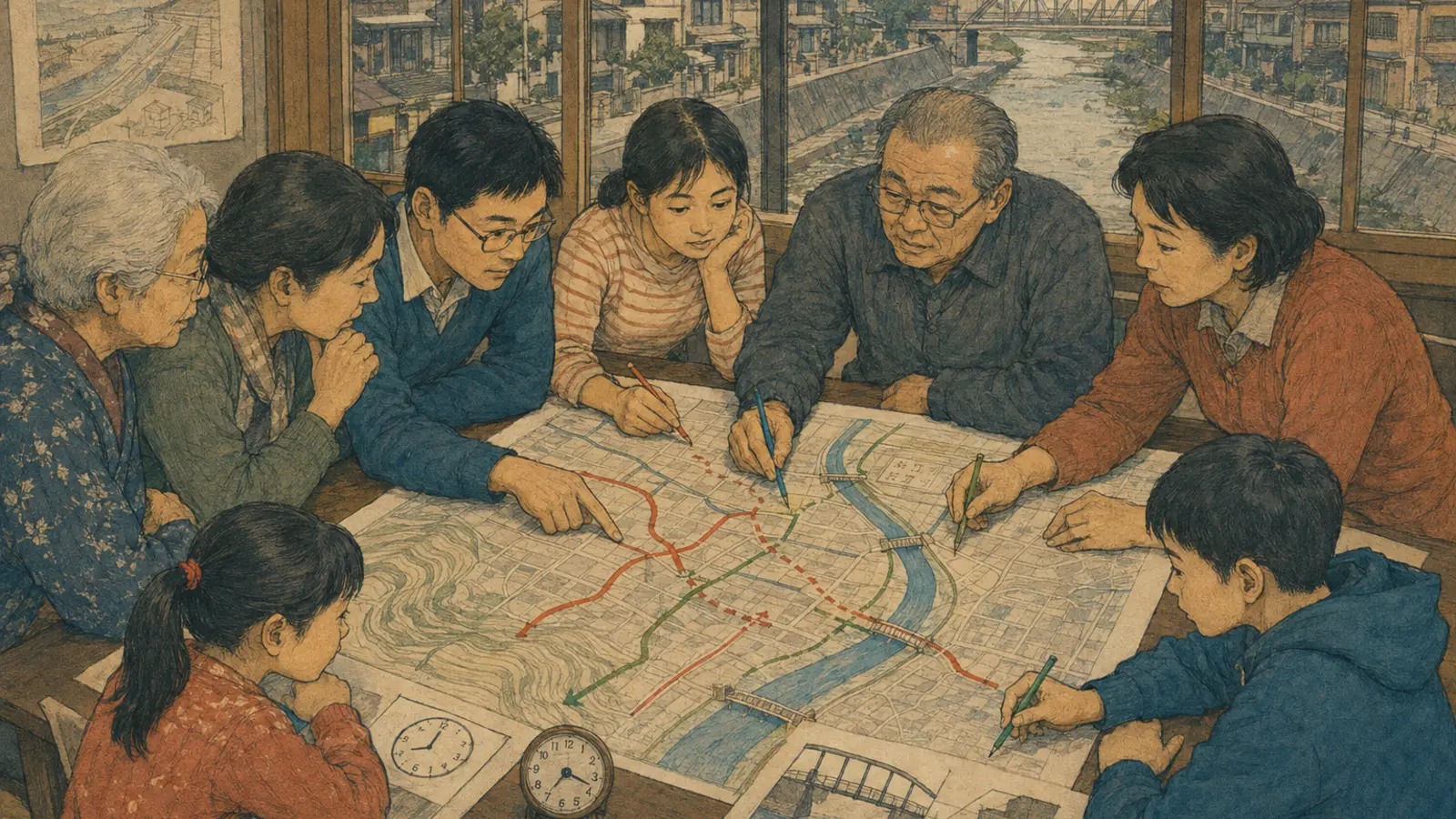
On September 23, 1947, a map was part of a life-or-death operation in the lowlands around Matsudo. Muddy water from the Tone River breach caused by Typhoon Kathleen had spread through eastern Saitama toward Tokyo’s low-lying neighborhoods. A Ministry of Land, Infrastructure, Transport and Tourism chronology records American Army engineers and Japanese workers operating around the clock to direct floodwater into lower land in the Matsudo area. Where was the ground lowest? Which way would water travel? What could still be protected, and in how many hours? Reading terrain was the work of recovery.
Seventy-nine years later, on June 13, 2026, local maps again covered tables in Matsudo. This time the question came before the water: how would people move if a flood threatened? Nineteen members of the Kamiyakiri Third Neighborhood Association divided into three groups at the association hall. With support from Matsudo’s crisis-management office and Sompo Japan Insurance, they spent two hours making flood “escape maps.”
They identified safer destinations, laid measured string along the streets and filled the routes with colored pencils. Would an alley used as a shortcut on an ordinary day remain passable in rising water? How long would the slope feel to an older resident? What if a wall fell, the streetlights went out or someone waited for a neighbor living alone? Details that do not appear in an official hazard layer traveled from memory and conversation onto paper.
Coloring time, not distance
The physical technique is simple enough for a child to grasp. First, select one disaster and identify a destination that provides safety from that particular threat. Use a walking speed of 43 meters per minute—the standard adopted for an older person moving uphill—and cut string to 129 meters, the distance covered in three minutes. Beginning at the safe destination, place the string along the road network. Color the first three minutes one shade, minutes three through six another, then six through nine. Draw arrows toward safety and mark cliffs, narrow roads, bridges, likely inundation points and other obstacles.
An ordinary map contains position and distance. An escape map adds a deadline. Five hundred meters may sound close. At the workshop’s conservative pace, however, it takes nearly 12 minutes in normal conditions. Time spent putting on shoes, finding medicine, calling relatives, helping a neighbor or preparing for rain is absent from that measurement.
The assumptions can be changed. For night, heavy rain or snow, the method suggests reducing walking speed to perhaps 80 percent of the standard. A wheelchair, cane, stroller, visual impairment, cognitive disability or accompanying pet changes the usefulness of the same road. The color is not an absolute property of the terrain. It is a hypothesis: how far can this person travel, under these conditions?
| Stage | What residents do | The question it raises |
|---|---|---|
| Select the hazard | Map flood, inland flooding, landslide, tsunami or fire separately | A destination safe from one hazard may be unsafe in another |
| Set the destination | Confirm a place appropriate to that hazard | Are “emergency evacuation site” and “shelter” being confused? |
| Color the time | Use 129-meter string to divide roads into three-minute bands | Is the shortest route actually passable? |
| Add obstacles | Mark water, cliffs, walls, darkness, stairs and narrow streets | What changes during rain, darkness, blackout or after an earthquake? |
| Add people | Discuss residents needing help, contacts and companions | Does the plan also allow helpers enough time to escape? |
Born in Tohoku after the tsunami
The Japanese term nigechizu, or “escape map,” emerged from a Nikken Sekkei volunteer group after the Great East Japan Earthquake of 2011. In coastal communities where the tsunami had taken roads and evacuation places, residents faced the fear that another wave might arrive before reconstruction. Architects adapted a question familiar from planning large buildings—how many minutes will it take everyone to reach an exit?—to the scale of an entire neighborhood.
They overlaid earlier inundation areas and colored roads to safe high ground in three-minute intervals. Choosing 43 meters a minute rather than the pace of a fit adult was consequential. A map calibrated to an average walker can erase the people who need the most time.
Chiba University, Meiji University, Nikken Sekkei and others subsequently tested workshops and extended the method beyond tsunamis to floods, landslides, major fires and compound disasters. A Japan Science and Technology Agency RISTEX project in 2014–17 standardized practical elements: a 1:2,500 base map, 129-meter strings, colored pencils and facilitation methods usable by children and older adults. In 2018 the Architectural Institute of Japan recognized the project for encouraging risk communication across generations and communities.
1947 · Typhoon Kathleen floods the Kanto lowlands; water-routing work reaches Matsudo.
2011 · Nikken Sekkei volunteers develop escape maps with tsunami-affected communities.
2013 · A revision of the Disaster Countermeasures Basic Act creates district disaster plans and the modern evacuation-site framework.
2014 · The district-plan system takes effect; formal research and standardization of escape maps begins.
2018 · The escape-map initiative receives an Architectural Institute of Japan award.
2022 · Matsudo and Sompo Japan enter a comprehensive cooperation agreement.
June 2026 · Nineteen Kamiyakiri residents hold a flood-focused workshop.
In Matsudo, west and east are different elevations
Matsudo faces Tokyo across the Edo River. Low ground spreads along the river on the city’s western side; a plateau rises to the east. Kamiyakiri lies near the river and the edge of that higher terrain. “Which way?” and “how many minutes?” are therefore not abstract additions to a map. They describe the physical relationship between a neighborhood, the lowland and higher ground.
Matsudo’s official water-hazard map allows residents to examine flooding from the Edo River and smaller rivers, storm surge, tsunami and inland or pluvial flooding. Pluvial flooding differs from a river overflowing or breaching its banks: intense rain exceeds the capacity of drains and channels, leaving water on roads and properties. For its maximum-assumption inland inundation map, Matsudo uses rainfall of 153 millimeters in one hour and shows both likely depth and likely duration.
River flooding and pluvial flooding do not always call for the same escape. A large river can produce deeper, longer-lasting inundation, making early horizontal evacuation beyond the expected flood area crucial. Once roads are already flooded, movement may be more dangerous than remaining in a robust building and moving vertically to an upper floor. During intense local rainfall, an underpass or waterside shortcut may be the first route to reject.
That is why “go to the nearest school” cannot be the entire plan. Matsudo tells households and communities to identify at least two possible places because their availability changes with the type and scale of the disaster. Some facilities inside a flood-assumption area may be listed only for emergency use on the third floor or above.
An evacuation site is not necessarily a shelter
Japanese disaster terminology embodies a distinction that can change route choice. A designated emergency evacuation site is a place to protect life from an imminent, specified hazard such as flood, landslide, earthquake, tsunami, large fire or inland inundation. A designated shelter is where people who cannot safely return home may live temporarily until danger passes or recovery allows them to leave.
A school can serve both roles, but not every school does. A schoolyard suitable after an earthquake may sit inside a flood zone. A gymnasium capable of housing people overnight may not be the nearest high ground during the first moments of escape. The Geospatial Information Authority of Japan began publishing designated shelters on its national web map in March 2026, but users still need to check hazard categories and the newest municipal information.
A neighborhood conversation drawn on paper
The fact that the Kamiyakiri participants worked in three groups matters. One person can produce only a record of what one person knows. A group adds the alley where water collects, the wall that leans, the unlit stairs, the house with a resident who walks slowly and the building whose manager may open an upper floor.
Research into escape-map workshops has found that this act of making changes how official information is received. A hazard map can be technically accurate and still feel like something issued by an authority to an anonymous public. Tracing one’s own route forces a different sentence: this is my street, this is my time and this is the person I may need to call. Researchers describe the completed paper as less important than the risk communication generated while making it.
That logic fits the district disaster plan system introduced after 2011. The Great East Japan Earthquake exposed the limits of public rescue when communications, roads and government itself are struck simultaneously. A 2013 amendment to the Disaster Countermeasures Basic Act allowed residents and businesses to propose a locally tailored plan connected to the municipal disaster plan. The system took effect in April 2014. It does not transfer government responsibility to citizens; it acknowledges that the first useful facts in a narrow street often belong to the people who live there.
Sompo Japan’s work in Matsudo sits within a comprehensive cooperation agreement the insurer and city signed in January 2022 under Matsudo’s SDGs program. The company says it intends to take the workshop to other neighborhood associations. Expansion will matter only if the method remains participatory. A centrally printed map delivered to every household would distribute colors while losing the local knowledge that gives those colors meaning.
What the colors cannot promise
The clarity of three-minute bands is also their danger. A crisp edge can look more precise than the assumptions warrant. Forty-three meters per minute is a planning standard, not a prediction for every older resident. Road width, gradient and surface differ. Water may conceal a ditch or lift a drain cover. Earthquake debris may block a route that was open during the workshop. A destination may be full, locked or inappropriate to the hazard.
Nor does an uncolored area on an official portal prove the absence of danger. Japan’s national hazard-map portal cautions that data may be incomplete, still under review or based on simulations that cannot represent every local phenomenon. An escape map inherits those limits and adds its own. Its safe use requires explicit assumptions, dates and sources.
- Write the disaster type and date directly on every version.
- Confirm emergency evacuation sites, shelters and applicable hazard categories with Matsudo’s latest listings.
- Walk each route in daylight and, where safe, after dark; do not enter floodwater to test it.
- Time the journey at the pace of the slowest household member and include preparation time.
- Mark alternative routes, locked gates, underpasses, steep slopes and likely road closures.
- Decide how warnings, departure decisions and help requests will be communicated if phones fail.
- Repeat the exercise after construction, household changes or updated official inundation assumptions.
The map also cannot settle the hardest ethical question with a symbol: how should a resident help another person without both becoming trapped? That requires consent, realistic assignments, backup helpers and a departure threshold early enough to protect the helper. Community care must be organized before the rain, not improvised when a river warning has already escalated.
The future is a map that can be argued with
Digital tools can accelerate the method. They can calculate travel bands, layer several hazards, model changed walking speeds and preserve updates. Newer projects have explored web-based mapping and facilitator training. Yet paper, string and pencils retain a democratic advantage: everyone at the table can point, object, redraw and tell a story without an account, a battery or specialist software.
The strongest future may combine both. Official geospatial data defines the known hazard. Digital tools test scenarios and distribute revisions. A physical workshop gathers the local knowledge that no remote database can see. A neighborhood then walks the routes, records the times and folds the result into drills, household plans and, where appropriate, a district disaster plan.
After Typhoon Kathleen, crews in Matsudo read the lowland in order to move water. Today residents are learning to read the same relationship between river, road and elevation in order to move themselves before water arrives. The technology has changed from pumps and engineering maps to online hazard layers, but the decisive dimensions remain place and time.
An escape map does not make the future certain. It makes uncertainty discussable. A resident can challenge a route, slow down a calculation, add a missing neighbor or say that the gate is locked. That is the point. In a disaster, the first map is rarely perfect. The useful community is the one that has already practiced correcting it.
- Sompo Japan, Matsudo escape-map workshop announcement — date, venue, attendance, workshop structure and future expansion.
- Nikken Sekkei, “The Benefits of the Escape Map” and project history — origins, 43-meter walking standard and three-minute method.
- Japan Science and Technology Agency RISTEX project record — standardization, workshop purpose and research partners.
- Peer-reviewed evaluation of community flood escape-map workshops — risk perception and communication findings.
- Matsudo water-hazard map, inland-inundation assumptions and evacuation-site listings.
- MLIT Tone River office, Typhoon Kathleen flood chronology — the September 1947 historical frame.
- Cabinet Office, history of Japan’s district disaster plan system.
- Geospatial Information Authority of Japan, evacuation-site and shelter guidance.
Editor’s note: “Nigechizu” is a registered trademark of Nikken Sekkei. The workshop’s color bands are planning assumptions, not forecasts or safety guarantees. In an emergency, follow current instructions and information from Matsudo, Chiba Prefecture and national weather and river authorities.