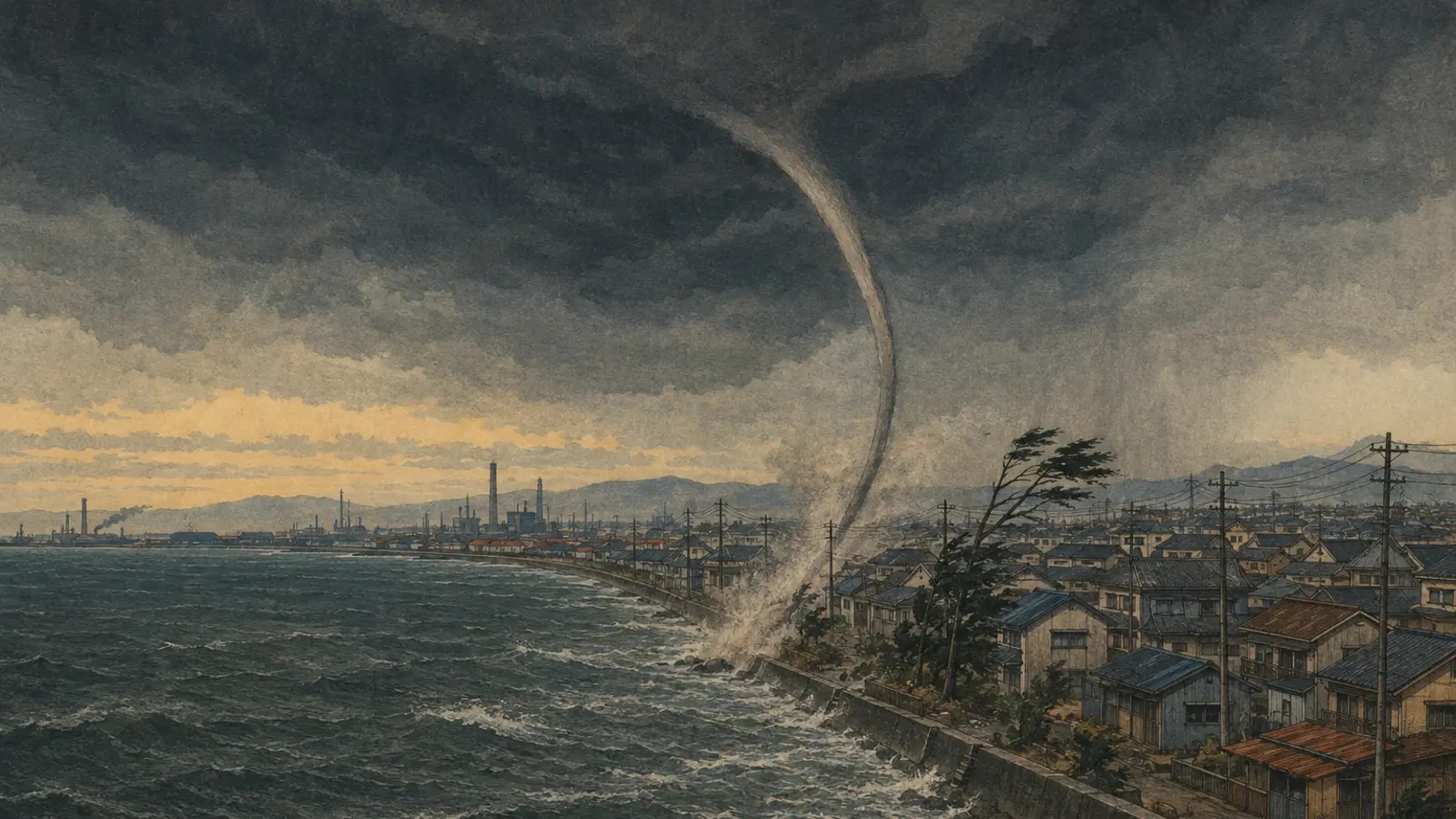
On the afternoon of October 14, 1997, a vortex approached Iki Island from the sea off Nagasaki. Witnesses first heard a hissing sound as it lifted water. After landfall, the sound became a roar. The tornado traveled east at 18 kilometers an hour, cutting a path 100 meters wide and five kilometers long. It damaged four homes and four other buildings and sank three boats.
A waterspout can look almost graceful at a distance: a narrow funnel connecting cloud and sea, its base wrapped in white spray. But the common intuition that a weak marine vortex will collapse as soon as it meets buildings is unsafe. Iki’s official record was one reminder that the shoreline is not necessarily a finish line.
Sato, then a doctoral student at Kyoto University’s Graduate School of Science and now a Nagoya University researcher, and Kyoto University Disaster Prevention Research Institute professor Takemi built that shoreline inside a computer. Their peer-reviewed study appeared online in the American Meteorological Society’s Journal of the Atmospheric Sciences on July 29, 2026.
A column of air, not a column of water
A waterspout is not a tube made of seawater. It is a rotating column of air whose circulation lifts spray from the surface and may connect visually with condensed cloud above. A funnel does not have to appear continuous to the ground for dangerous near-surface rotation to exist.
Meteorologists commonly distinguish tornadic waterspouts, associated with severe thunderstorms or storm-scale rotation, from “fair-weather” waterspouts that develop upward from the water beneath growing cumulus clouds. The latter are generally weaker, but they can overturn boats and damage shore facilities. After landfall, the spray disappears and the vortex may become harder to see; the air circulation does not necessarily disappear with it.
Japan confirms about 50 tornadoes a year when marine waterspouts are included, averaged across 2007–25. Excluding waterspouts that never reached land reduces the figure to about 19. The gap reflects Japan’s long coastline and improved observation. Since 2007, field investigations, mobile phones, social media and active collection of eyewitness reports have sharply increased detections. The historical series cannot by itself establish that tornadoes are becoming more frequent.
A moving wind tunnel inside a computer
The Kyoto team did not reproduce a particular storm or coastline. It generated a tornado-like vortex in the upper portion of an idealized numerical Ward-type chamber. Instead of moving the vortex, it moved the lower computational surface while keeping the upper domain fixed. From the vortex’s frame of reference, smooth “water” passed beneath it and gave way to rough “land.”
Arrays of blocks represented buildings. The researchers systematically changed their pattern, density and height, along with ground speed and external swirl ratio—a measure of rotation relative to radial inflow. A low-swirl case represented a narrower, simpler vortex; a high-swirl case carried a broader and more robust circulation.
That controlled design is the study’s strength. On a real coast, storm strength, rainfall, topography, sea temperature, wind direction and buildings change together. A numerical chamber can hold most variables still and ask one focused question: what do roughness and translation do to the vortex?
| Translation | Low-swirl response | Interpretation |
|---|---|---|
| Low: about 5.8 km/h | Step-like weakening over roughness; temporary intensification in some higher-swirl cases | Obstacles disrupt inflow while the vortex transitions between smooth- and rough-surface equilibria |
| Moderate: about 29 km/h | Intensity maintained over roughness that weakened a slowly moving vortex | Low-level air carrying positive angular momentum is efficiently drawn into the moving vortex |
| High: about 58 km/h | Dense, tall obstacles distort and rapidly weaken the low-level, low-swirl vortex | Strong asymmetry breaks down the near-surface structure |
| High speed, high swirl | No comparable major weakening in some cases | A larger, stronger circulation resists roughness-induced disruption |
Friction can be a brake—and a supplier
For a solid object sliding on a floor, friction removes speed. A tornado is not solid; it is an open circulation continually ingesting surrounding air. Buildings and trees slow and disrupt near-surface wind, but they also create horizontal and vertical vorticity. If air carrying the right sense of rotation flows toward the center, it can support the vortex’s angular momentum.
At the moderate translation speed, the motion of the vortex relative to the near-surface flow favored that ingestion. Air-trajectory analysis showed a supply of positive angular momentum from low levels. Friction did not magically add unlimited energy. It produced rotation that the translating vortex collected efficiently enough to offset weakening.
At high speed, a low-swirl vortex over densely packed tall obstacles became severely asymmetric and lost its low-level structure. Yet the high-swirl vortex did not weaken substantially even at the fastest speed. “Faster means safer” is therefore as wrong as “rougher means stronger.” Speed becomes meaningful only alongside vortex structure and surface roughness.
Three Japanese landfalls, three outcomes
Japan Meteorological Agency damage records show how varied real transitions from water to land can be. They are not validation cases for the Kyoto model—the storms, terrain and old Fujita ratings differ—but they demonstrate why no speed threshold should be treated as a safety line.
| Event | Motion and rating | Recorded effects after landfall |
|---|---|---|
| Kin, Okinawa, April 1990 | 9 km/h, F2, about 10 minutes | 16 injured; eight homes, six vehicles and about 160 street trees damaged |
| Kumejima, Okinawa, April 1991 | 57 km/h, F2, about two minutes | One injured; 19 homes, 10 greenhouses and five vehicles damaged |
| Iki, Nagasaki, October 1997 | 18 km/h, F1, about 14 minutes | Five-kilometer path; eight structures damaged and three boats sunk |
The slow Kin tornado and fast Kumejima tornado both remained destructive over land. That does not prove the model’s mechanisms, but it agrees with its practical implication: translation speed alone cannot clear a coastal community from danger.
From Fujita’s damage maps to a numerical chamber
Tornadoes are narrow, brief and unlikely to pass over an anemometer. In 1971, Japanese-born meteorologist Tetsuya Theodore Fujita devised a scale that inferred wind intensity from damage to structures and vegetation. Japan replaced it in 2016 with the Japanese Enhanced Fujita scale, calibrated to Japanese buildings, vehicles and other damage indicators.
Damage surveys reveal what happened but cannot easily show exactly where friction changed the flow inside a vortex. Wind tunnels offer control but face limitations of scale and instrumentation. High-resolution numerical experiments can track velocity, pressure, vorticity and air-parcel trajectories in three dimensions. Sato described the appeal as creating and operating a virtual experimental apparatus—a bridge between atmospheric science and wind engineering.
1971 · Tetsuya Fujita develops his damage-based tornado-intensity scale.
2008 · JMA begins tornado advisory information.
2010 · Tornado nowcasts begin on a 10-kilometer grid, projecting one hour ahead.
2016 · Japan adopts the Japanese Enhanced Fujita scale.
2021 · Sato presents early work on tornado landfall across nonuniform roughness.
2025 · Sato and Takemi publish obstacle-arrangement and height experiments.
2026 · The new study integrates translation speed and roughness.
What the model does not answer
The numerical chamber contains an idealized tornado-like vortex, not a complete forecast of a living thunderstorm. Ocean heat and moisture, rain and hail, cold outflow, irregular coastal topography, isolated towers and changes in the parent cloud can alter a real tornado. The block arrays isolate urban density; they are not damage maps for Kyoto, Osaka or a coastal power station.
Maintaining simulated vortex intensity also does not directly calculate damage to individual buildings. A real translating tornado has asymmetric winds because rotational and forward motion combine differently on opposite sides. Debris, roof geometry, openings and construction quality then determine loss. Operational use will require comparisons with radar, video and surveyed landfall tracks.
- Establishes: the effect of rough-surface friction changes with translation speed and swirl ratio.
- Establishes: near-average translation can maintain a vortex after it reaches rough land.
- Does not establish: every waterspout moving at 29 km/h will remain strong.
- Does not establish: a fast-moving waterspout will necessarily weaken or become safe.
- Does not establish: a specific landfall path or damage radius for a real community.
What it changes for coastal warning
Japanese cities, ports, petrochemical complexes, power stations and logistics hubs occupy coastal plains. Takemi also points to compound disasters: a tornado after an earthquake could strike buildings with damaged roofs and windows, temporary shelters and disrupted emergency networks. The wind need not be stronger for the consequences to become worse.
JMA’s tornado nowcast analyzes risk in 10-kilometer squares, updates every 10 minutes and projects up to one hour ahead. Its tornado warning or sighting bulletins are valid for roughly one hour. They identify an environment favorable for tornadoes and related violent gusts; they do not draw a precise track for an individual funnel.
The Kyoto result does not immediately rewrite that system. It does provide a physical reason to keep tracking a marine vortex beyond the beach rather than assuming landfall will end it. If a funnel, a rotating debris column or an unusual roar appears, people should enter a sturdy building, move away from windows, use a low interior room and protect their heads. The disappearance of spray is not evidence that the circulation is gone.
The future: following the vortex beyond the beach
The next step is to close the distance between idealized experiment and real coast. Models can add irregular city geometry, hills and terraces, heat and moisture from the parent storm and moving precipitation. Radar, drones, videos and forensic damage tracks can test which simulated mechanisms appear during actual landfalls.
A future nowcast might combine detection with translation speed, vortex structure and the roughness ahead to estimate whether circulation is likely to persist inland. That remains a research direction, not a current operational product.
For now, the study changes the mental map. The coastline is not a vortex’s stop line. It is where the balance of inflow, friction and rotation is rearranged. Buildings are not merely shields; they slow air, disrupt it and can produce vorticity that the storm ingests.
At Iki, the sound changed from a hiss over water to a roar over land. The visible surface changed, but the danger continued. Kyoto’s virtual laboratory explains why that short crossing can contain far more complicated physics than a simple collision with shore.
- Kyoto University, “Waterspouts do not necessarily weaken immediately after landfall” — study summary, speed cases and researcher comments.
- Sato and Takemi, “Numerical Simulations of Tornado-Like Vortices Translating toward Rough Surfaces” — the peer-reviewed study.
- Sato and Takemi (2025), roughness-obstacle arrangement and height experiments.
- JMA annual tornado counts and JMA tornado nowcast and bulletins.
- JMA case records for Kin in 1990, Kumejima in 1991 and Iki in 1997.
- JMA tornado safety guidance.
Editor’s note: The study uses idealized tornado-like vortices and does not reproduce a particular disaster. Historical F-scale events are not directly interchangeable with modern JEF assessments. Changes in observation and reporting affect the confirmed-count series.