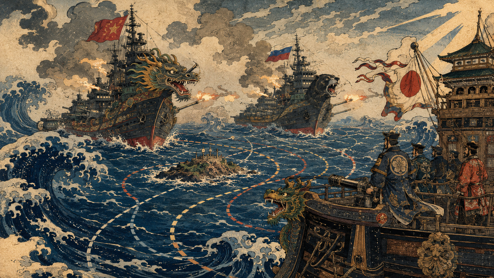
At two in the morning on Sunday, July 19, four grey silhouettes were moving northeast through the Philippine Sea. The Japan Maritime Self-Defense Force found them roughly 330 kilometres southwest of Okinotorishima: China’s Type 055 destroyer Anshan, hull 103; Type 052D destroyer Kaifeng, hull 124; replenishment ship Kekexilihu, hull 903; and the Russian corvette Rezkiy, hull 343. They were far from any city, port or inhabited coast. Yet they had arrived at a crowded intersection of law, strategy and geography.
As the formation closed to about 180 kilometres southwest of the reef, Kaifeng conducted a firing exercise. Japan’s defence minister, Shinjiro Koizumi, later specified that the weapon was a machine gun. Ships nearby received a radio warning immediately before the firing, Chief Cabinet Secretary Minoru Kihara said. The destroyer did not fire a missile at Japan, shell an island or enter Japan’s 12-nautical-mile territorial sea. No injury or damage was reported.
Still, the warning came so late that Tokyo argued the activity could endanger surrounding navigation and made a diplomatic representation to Beijing. The Maritime Self-Defense Force destroyer Samidare watched and collected information. On July 21, the same four ships were seen passing southeast of Minami-Iwo-to and then about 220 kilometres east of Iwo-to, continuing north.
China rejected Japan’s complaint. Foreign Ministry spokesperson Lin Jian said Okinotorishima is a “rock” under the United Nations Convention on the Law of the Sea and therefore cannot generate an exclusive economic zone or continental shelf. In Beijing’s map, the firing took place on the high seas. In Tokyo’s, it took place inside Japan’s EEZ. The argument is not principally over who owns the tiny natural features—China’s statement did not claim them—but over how much sea and seabed they can legally generate.
What happened—and what did not
The ships were not an improvised gathering. China and Russia had held Joint Sea-2026 near Qingdao from July 6 to 13. China’s defence ministry announced in advance that some participating forces would follow the exercise with a Pacific maritime patrol. The Qingdao drills included joint reconnaissance, air and missile defence, maritime strike training and live weapons use. Anshan, Kaifeng, Kekexilihu and Rezkiy then formed the patrol Japan tracked.
On July 16, Japan observed the four ships about 90 kilometres southwest of Kumejima. They sailed south between Okinawa’s main island and Miyakojima into the Pacific. Three days later, the firing occurred near Okinotorishima. This sequence matters. The incident was a Chinese live-fire event during a declared China–Russia patrol that followed a bilateral exercise; the public Japanese evidence does not say the Russian ship fired near the reef.
Japan’s Joint Staff called it “firing training,” not an attack. Koizumi framed the protest around danger to ships, and described the wider voyage as part of strengthening China–Russia military coordination. A Japanese military spokesperson told Reuters this was the first time Tokyo had publicly disclosed Chinese live firing in what Japan claims as its EEZ. That formulation is narrower than “the first foreign drill ever” and should remain so.
- Chinese firing, joint patrol: one Chinese destroyer fired; Russian participation made the voyage bilateral.
- EEZ, not territorial sea: the firing point was about 97 nautical miles from Okinotorishima, far beyond 12 nautical miles.
- Immediate radio warning, not proven advance coordination: nearby shipping was warned just before the event; Japan’s complaint focused on the resulting risk.
- Disputed entitlement, not a reported sovereignty contest: Beijing contests the reef’s capacity to generate an EEZ and continental shelf, not in this statement Japan’s ownership of the exposed features.
An EEZ is powerful—but it is not national water
The phrase “Japan’s waters” can obscure more than it explains. Under UNCLOS, territorial sea may extend 12 nautical miles from a coastal baseline. There the coastal state has sovereignty over the water, seabed and airspace, although foreign vessels retain a right of innocent passage. An EEZ begins beyond the territorial sea and may extend to 200 nautical miles. It is a special-purpose zone, not an enlargement of national territory.
Inside its EEZ, a coastal state has sovereign rights to explore, exploit, conserve and manage living and non-living natural resources. It has specified jurisdiction over artificial islands and installations, marine scientific research and protection of the marine environment. Other states, however, retain freedoms of navigation and overflight, cable and pipeline laying, and other internationally lawful uses related to those freedoms.
Both sides owe “due regard” to the other’s rights and duties. Japan cannot generally close a 200-mile circle to foreign warships merely because it calls the area an EEZ. A foreign navy cannot treat the same water as an empty weapons range without considering shipping, fishing, installations, the environment and coastal-state resource activity.
| Maritime zone | Distance from baseline | Coastal-state authority | Foreign navigation |
|---|---|---|---|
| Internal waters | Landward of the baseline | Full sovereignty, subject to limited exceptions | No general right of passage comparable to the territorial sea |
| Territorial sea | Up to 12 nautical miles | Sovereignty over water, seabed and airspace | Ships have innocent passage; aircraft do not have an equivalent general right |
| Contiguous zone | Up to 24 nautical miles | Limited prevention and enforcement for customs, fiscal, immigration and sanitary laws | Navigation remains free, subject to applicable law |
| Exclusive economic zone | Up to 200 nautical miles | Resource rights plus specified jurisdiction—not general sovereignty | Navigation, overflight and related lawful uses remain |
| Continental shelf | Seabed entitlement, at least to 200 nautical miles and sometimes farther | Exclusive rights over seabed and subsoil resources | Does not by itself convert the water above into territorial sea or EEZ |
| High seas | Beyond national maritime zones | No state sovereignty; flag-state and treaty rules apply | Open to all states, exercised with due regard |
Does international law allow live fire in another state’s EEZ?
UNCLOS does not contain a sentence saying “foreign live-fire exercises are always permitted in an EEZ,” nor one giving the coastal state a blanket veto. It preserves navigation and “other internationally lawful uses of the sea” related to ship and aircraft operations, but does not define every military activity. State practice and legal scholarship remain divided, especially over intelligence collection, weapons tests, hydrographic surveys and large exercises close to a coast.
The position taken by major maritime powers is generally that peacetime military operations, including exercises, may occur in a foreign EEZ without coastal-state permission when compatible with UNCLOS and other international law. A more restrictive group of coastal states argues that some foreign military activity requires consent or must be constrained more tightly. That disagreement has produced confrontations from the South China Sea to the Tasman Sea.
The legal and practical questions therefore turn on conduct. Was the warning timely and sufficiently publicized? Was the danger area proportionate? Did the exercise interfere with fishing or resource activity? Was pollution avoided? Were civilian ships and aircraft given a safe route? Did the operating force act with due regard? A radio call seconds or minutes before gunfire is not equivalent to a published navigational warning that mariners can route around in advance.
On the currently public facts, the strongest conclusion is careful: the mere presence and operation of warships 180 kilometres from a coastal feature is not an invasion of territorial waters. The drill’s legality cannot be decided simply by colouring the area as an EEZ, and the published evidence does not establish a violation of Japan’s resource rights. Tokyo nevertheless had a serious safety basis for demanding earlier, clearer notification. Beijing’s high-seas theory does not erase its duty to navigate and train with due regard for other users.
Two fragments of coral, 1,700 kilometres from Tokyo
Okinotorishima lies at 20°25′ north, 136°04′ east, roughly 1,700 kilometres south of central Tokyo. It is an oval table reef about 4.5 kilometres east to west and 1.7 kilometres north to south. At high tide, Tokyo says two natural islets—Kitakojima and Higashikojima—remain above water. Concrete circular revetments and wave-dissipating blocks protect them from typhoons and erosion.
The reef rises from a steep seamount along the Kyushu–Palau Ridge. Water plunges to thousands of metres around it. Bonito and tuna migrate through the region; the surrounding seabed has drawn interest for manganese and other mineral resources. Its strategic value comes less from dry land than from the huge maritime geometry Tokyo draws from it: approximately 420,000 square kilometres of EEZ, an area larger than Japan’s land territory.
Japanese history records possible Spanish sighting in the sixteenth century. Japan named and placed the feature under Tokyo’s Ogasawara jurisdiction in 1931. Work on a weather station and lighthouse began in 1939 but stopped with the Pacific War. The United States administered the area after the war; it returned to Japan with the Ogasawara Islands in 1968.
Erosion then became law made visible in concrete. Japan designated a coastal conservation area in 1987 and began state-managed protection. In 1996, after ratifying UNCLOS and enacting its EEZ legislation, Japan established an EEZ around the reef. A lighthouse began operating in 2007. A 2010 law designated Okinotorishima as a remote island important to the preservation of EEZ and continental-shelf baselines; port and observation facilities followed.
The decisive words: “of their own”
Article 121 of UNCLOS begins generously: an island is a naturally formed area of land, surrounded by water, above water at high tide. In general, an island generates the same maritime zones as other land territory. Paragraph 3 then removes the richest zones from “rocks which cannot sustain human habitation or economic life of their own.” Such rocks receive a territorial sea but no EEZ or continental shelf of their own.
Japan’s position is that Okinotorishima is an island under the Convention and generates an EEZ. China says the naturally exposed pieces cannot sustain human habitation or an autonomous economic life and are therefore rocks under Article 121(3). Concrete, a lighthouse and a research platform cannot change a feature’s natural legal capacity: UNCLOS treats artificial islands as structures, not islands that create maritime zones.
The 2016 South China Sea arbitration gave Article 121(3) its most detailed judicial interpretation. The tribunal looked at a feature’s natural capacity to sustain a stable human community or non-extractive economic life of its own, not whether outside supplies and government spending could keep personnel there. It found none of the Spratly features capable of generating an EEZ. That award did not adjudicate Okinotorishima, and Japan and China were not opposing parties in an Okinotorishima case. It is influential reasoning—not a judgment on this reef.
The distinction between land and maritime entitlement is essential. Even a “rock” under Article 121(3) is still land above water at high tide and can generate a 12-nautical-mile territorial sea. The dispute is over the much larger 200-nautical-mile EEZ and continental shelf. Calling the issue a territorial dispute falsely imports the logic of the Senkaku/Diaoyu Islands into a legally different argument.
What the UN continental-shelf process did not decide
Japan submitted information on an extended continental shelf to the Commission on the Limits of the Continental Shelf in 2008. China and South Korea sent objections linked to Okinotorishima. In 2012, the commission adopted recommendations on parts of Japan’s submission but deferred action on the Southern Kyushu–Palau Ridge region until the dispute reflected in the diplomatic notes is resolved.
The episode is often recruited to claim that “the UN recognized Okinotorishima as an island” or that it “rejected Japan’s island claim.” Neither slogan is sound. The commission is a technical body of geology, geophysics and hydrography. It recommends outer continental-shelf limits under Article 76; it does not adjudicate sovereignty or finally interpret the island-versus-rock rule in Article 121.
Some shelf recommendations north of Okinotorishima could be supported by submerged prolongations connected to other Japanese land territory. Acceptance of a shelf line therefore need not answer whether the two protected islets independently generate an EEZ. The July 2026 gunfire occurred in the water column inside the 200-mile circle claimed by Japan, not in a deep-seabed licensing dispute. Continental shelf and EEZ overlap geographically but are legally distinct.
From annual exercise to patrol around Japan
China and Russia began the large bilateral naval series known as Joint Sea in 2012. It became geographically ambitious: the 2016 edition reached the South China Sea; the 2017 series included the Baltic and Sea of Okhotsk. The relationship is not a NATO-style mutual-defence alliance, but it has built practical habits—communications, formation sailing, air defence, anti-submarine work, logistics and command coordination.
A new pattern appeared in October 2021. After Joint Sea near Vladivostok, five Chinese and five Russian ships passed through the Tsugaru Strait, travelled down Japan’s Pacific side and crossed the Osumi Strait into the East China Sea. It was the first China–Russia joint naval patrol around Japan of that kind. Japan’s defence ministry says joint navigation connected to bilateral exercises has occurred every year since 2021, expanded in operating area and, in 2024, happened twice in one year.
Naval patrols are only one layer. Chinese H-6 and Russian Tu-95 bombers have conducted joint long-range flights since 2019. Japan’s June 2026 defence overview recorded the tenth such bomber flight in December 2025 and described the geographic reach and operational complexity as growing. On June 27, 2026, weeks before the Okinotorishima incident, Japan again tracked a China–Russia joint flight.
This history explains why Tokyo read a short machine-gun burst as more than gunnery practice. A lone ship can train. A replenishment ship allows endurance. Two modern Chinese destroyers and a Russian corvette moving through Japan’s southwestern gaps, past the country’s remote Pacific outposts and north toward Iwo-to demonstrate that both navies can sustain a politically legible route together.
1931 — Japan names Okinotorishima and places it under Ogasawara jurisdiction.
1968 — U.S. administration ends; the feature returns to Japan with the Ogasawara Islands.
1987 — Japan begins direct erosion-protection work.
1996 — Japan establishes an EEZ around Okinotorishima after implementing UNCLOS.
2007 — The Okinotorishima lighthouse begins operation.
2008–12 — Japan’s extended-shelf submission draws Chinese and South Korean notes; the CLCS defers the Southern Kyushu–Palau Ridge portion.
2012 — China and Russia begin the Joint Sea naval-exercise series.
2016 — The South China Sea tribunal explains Article 121(3), without deciding Okinotorishima.
2021 — China and Russia conduct their first annual-style joint maritime patrol around Japan.
July 6–13, 2026 — Joint Sea-2026 is held near Qingdao.
July 16 — Four patrol ships pass between Okinawa and Miyakojima.
July 19 — Kaifeng fires a machine gun about 180 km southwest of Okinotorishima.
July 21 — Japan publishes the event and ship track; China rejects the protest.
Why this particular route speaks loudly
Okinotorishima sits well beyond the first chain of islands running through Japan, Taiwan and the Philippines. It occupies open water between East Asia and the broader Pacific, along approaches that matter to submarines, surveillance aircraft and surface forces. Farther north, Iwo-to and Minamitorishima extend Japan’s network of remote Pacific positions.
For Japan, the southern reef is simultaneously a baseline, conservation project, observation site, fisheries zone and symbol of an ocean state. For China, denying the 200-mile entitlement preserves a high-seas corridor and resists a legal map that grants a tiny, uninhabitable formation a maritime zone larger than many countries. Russia adds a second nuclear power and advertises that pressure around Japan is not solely a China–Japan affair.
None of this makes every passage hostile. Warships routinely exercise beyond territorial seas, including forces friendly to Japan. The signal lies in the chosen geography, bilateral formation, sequence after Joint Sea-2026 and decision to fire where the two legal maps diverge. It tests whether Tokyo can observe, warn mariners, document its claimed jurisdiction and persuade other governments without pretending it owns the sea as territory.
Japan’s strongest response is precise, not theatrical
Japan has several practical tools. It can maintain continuous surface and air surveillance; compare radio recordings, tracks and imagery; identify weapons and shot direction; and determine whether standard navigational warnings were issued. It can rapidly warn fishermen, research vessels and civil aviation. It can ask China for advance notice and a properly bounded danger area while keeping operational channels open.
Diplomatically, Tokyo can separate its arguments. First: regardless of the island-status dispute, an immediate warning before live fire may be inadequate for safe navigation. Second: Japan maintains its EEZ claim and must record acts that appear designed to deny it. Third: China–Russia interoperability is a strategic development, but lawful passage should not be mislabeled as territorial intrusion. Precision makes the protest harder to dismiss.
Japan also has an interest in reciprocal standards. If it asks other navies for timely notice, safe separation and due regard in Japan’s EEZ, it should support the same rules for its own exercises and those of allies in other states’ EEZs. A safety norm that applies only to competitors is propaganda; a rule applied consistently can become maritime practice.
- Disclosure: whether Japan publishes the radio-warning interval, weapon direction or a navigational notice.
- Route: whether the four ships return through a Japanese strait or continue toward Russia.
- Repetition: whether future patrols again conduct weapons training inside Japan’s claimed Okinotorishima EEZ.
- Coordination: whether Russian ships participate directly in firing or air and anti-submarine drills on later patrols.
- Law: whether either government clarifies its general view of military exercises in a foreign EEZ.
- Safety: whether China provides earlier NAVAREA, NAVTEX or radio warnings in future far-seas drills.
The lesson in the wake
There is a temptation to choose between two easy stories. In one, Chinese and Russian warships “opened fire in Japanese waters,” an image of violated sovereignty. In the other, the exercise happened on the high seas and therefore deserves no concern. Both flatten the law and miss the strategy.
The firing took place far outside territorial sea, amid a genuine dispute about whether two natural fragments of coral can generate a 200-mile economic zone. Even if Japan’s EEZ claim is accepted, foreign navigation and many military uses do not vanish. Even if China’s rock argument is accepted, high-seas freedom is not freedom from safety obligations or political consequence.
The most important event may be the route itself. Four ships assembled after an annual exercise, passed through the gap between Okinawa and Miyakojima, trained at the edge of a contested legal circle, then sailed past Japan’s remote Pacific islands. They transformed an abstract sentence in Article 121 into an operational map. The machine gun was brief. The claim it illustrated will endure.
Reader guide
| Question | Answer |
|---|---|
| Did China and Russia attack Japan? | No. Japan reported a Chinese machine-gun training exercise during a bilateral patrol. No fire at Japanese territory, injury or damage was reported. |
| Was the Russian ship firing? | Not according to Japan’s public release. The identified shooter was Chinese destroyer Kaifeng, hull 124. |
| Did the ships enter Japan’s territorial sea? | The firing position was about 180 km from Okinotorishima, well beyond the 12-nautical-mile territorial sea. |
| Why does Japan call it its EEZ? | Japan treats Okinotorishima as an island capable of generating an EEZ of up to 200 nautical miles. |
| Why does China call it high seas? | China treats the exposed features as Article 121(3) rocks that cannot generate an EEZ or continental shelf. |
| Does an EEZ ban foreign warships? | No. An EEZ is not sovereign territory. Foreign navigation and related lawful uses remain, subject to due regard and other applicable law. |
| Was the drill illegal? | The public facts do not support a simple categorical answer. Military activity in an EEZ is legally contested; notice, navigational risk, interference and due regard are central. Japan’s complaint emphasized safety. |
| What was historically new? | Japan said it was the first time it had publicly disclosed Chinese live firing in its EEZ. That is not necessarily the first foreign naval exercise ever in any Japanese-claimed EEZ. |
Sources and method
This article distinguishes confirmed observation from government position and legal analysis. Distances, hull numbers, the firing ship and track come from Japan’s Joint Staff. The weapon type and Japanese objection come from the defence minister and chief cabinet secretary. China’s view is quoted only as a position, not treated as an adjudicated result. “Japan’s claimed EEZ” is used where the Okinotorishima entitlement is legally material.
- Japan Joint Staff: China and Russia naval-vessel movements, firing position and photographs, July 21, 2026
- Japan Joint Staff: four vessels pass between Okinawa and Miyakojima, July 16, 2026
- Japan Joint Staff: patrol continues past Minami-Iwo-to and Iwo-to, July 21, 2026
- Japan Ministry of Defense: Defence Minister Koizumi’s briefing on the machine-gun firing and protest
- Chinese Ministry of Foreign Affairs: Lin Jian’s July 21 response and Okinotorishima position
- Reuters: Japan protests Chinese live-fire drill, July 21, 2026
- Associated Press: immediate radio notice and Japanese safety concern, July 21, 2026
- Xinhua / Chinese Ministry of National Defense: Joint Sea-2026 and subsequent Pacific patrol announcement
- Xinhua: Joint Sea-2026 concludes, participating ships and training photographs
- United Nations: UNCLOS Part V, Articles 55–60 on the EEZ
- Tokyo Metropolitan Government: Okinotorishima geography, protection and administrative history
- Japan Ministry of Foreign Affairs: Japan’s official island-and-EEZ position, April 28, 2016
- UN Commission on the Limits of the Continental Shelf: 2012 summary of recommendations on Japan’s submission
- Permanent Court of Arbitration: South China Sea Award and Article 121 analysis, July 12, 2016
- Japan Ministry of Defense: overview of China–Russia military coordination and annual joint patrols
- Defense of Japan: Joint Sea history since 2012 and expansion of exercise geography
- U.S. Naval War College: military activities, weapons firing and competing EEZ interpretations