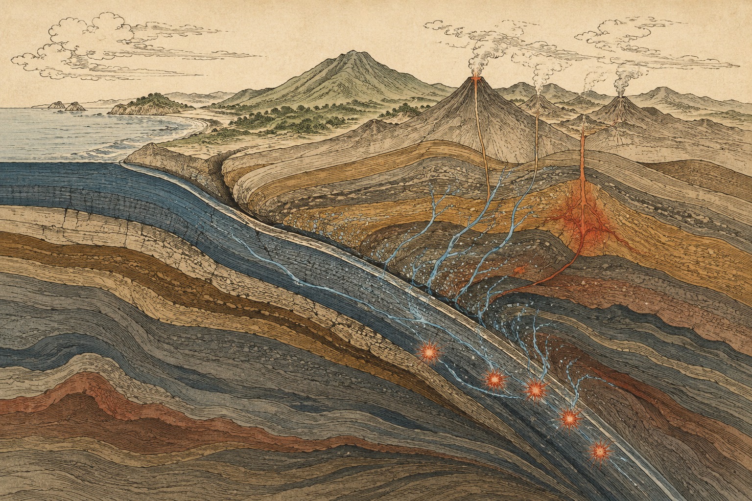
Seven hundred kilometers beneath our feet, there is no ocean. No blue water fills an open crack. There is pressure that would crush a city, heat that transforms stone, and the cold remnant of an oceanic plate still sinking from Earth’s surface. Yet earthquakes happen there.
That fact contains one of seismology’s oldest paradoxes. A shallow earthquake begins when cold, brittle rock overcomes friction and slips, suddenly releasing stored elastic energy. Hundreds of kilometers down, pressure should clamp cracks shut and heat should let rock deform slowly. Ordinary brittle failure ought to be impossible. Seismometers nevertheless record ruptures beginning at a point deep inside a descending plate.
An international team involving Associate Professor Takayuki Ishii of Okayama University’s Institute for Planetary Materials and researchers at Peking University and the Center for High Pressure Science and Technology Advanced Research, or HPSTAR, approached the paradox through the location of water rather than its total abundance. Their Nature Communications paper, published July 3, 2026, reports that mineral-to-mineral water exchange inside a slab may govern both where deep earthquakes cluster and where the plate bends or stalls.
Building the Deep Earth Inside a Tiny Capsule
No drill can reach a deep-focus earthquake. Instead, researchers build its pressure and temperature in a laboratory in Misasa, a hot-spring town in Tottori Prefecture. The central tool is a Kawai-type multi-anvil apparatus. Several extremely hard anvils squeeze a small sample evenly from multiple directions, while a furnace heats it. Such systems can generate hundreds of thousands of atmospheres and temperatures above 1,600 degrees Celsius.
The team worked with simplified mixtures of magnesium, silicon and water containing about two percent H₂O by weight. Under high pressure and temperature, it mapped which minerals remained stable and where the water went. It did not make a large rock rupture or reproduce a whole earthquake. Researchers recovered tiny samples from controlled conditions, identified their phases and compositions, and used those results to reconstruct reactions across a slab.
Simplification is the method’s strength and its limit. A real plate contains iron, aluminum, calcium, basaltic crust, sediments and a disorderly history of fractures and seawater alteration. Put all of that into the first experiment, however, and the variable moving the water becomes hard to isolate. By controlling temperature and the magnesium-to-silicon ratio, the team made the exchange itself measurable.
| What the experiments directly showed | What the authors infer |
|---|---|
| Water partitioning between hydrous phases and major minerals changes with pressure and temperature | A slab can develop a dry core surrounded by regions whose major minerals gain water |
| Hydrous phases progressively dehydrate in the transition zone, transferring water to wadsleyite and ringwoodite | Water-assisted weakening may promote deformation around the slab’s warmer margins |
| Major minerals in the cold core remain nearly dry | Delayed transformations of dry olivine may help trigger most deep-focus earthquakes |
| Hydrous phases break down rapidly near the top of the lower mantle | Released fluid may directly help trigger the deepest events near 700 kilometers |
“Water” Without an Underground Sea
Water in the deep Earth should not be pictured as a lake. Much of it travels as hydrogen bound into crystal structures, commonly in OH groups. Some minerals, including serpentine and dense hydrous magnesium silicates, incorporate water as a defining part of their structure. Others—olivine, wadsleyite and ringwoodite among them—are called nominally anhydrous minerals, or NAMs, yet can hold smaller amounts of hydrogen at crystal defects.
Small does not mean inconsequential. Hydrogen can accelerate atomic diffusion, change the conditions at which deformation begins and reduce a mineral’s strength through hydrolytic weakening. Remove it, and a major mineral may become stronger while its transition to a denser structure slows. For slab mechanics, the decisive quantity is not only how much water descends, but which mineral holds it at a particular moment.
In the cold core described by the new work, specialized hydrous phases sequester water so strongly that surrounding major minerals remain almost dry. A slab can therefore be wet in bulk while the olivine relevant to earthquake physics is dry. The seemingly contradictory idea of “dry metastable olivine in a wet slab,” advanced by Ishii and colleagues in 2021, now becomes part of a continuous exchange model.
Olivine Changes Identity as It Descends
Olivine is a principal mineral in the mantle portion of an oceanic plate. As pressure rises, atoms of the same broad chemical composition adopt more tightly packed arrangements. Near 410 kilometers, olivine changes to wadsleyite; deeper down, wadsleyite changes to ringwoodite. Around 660 kilometers, ringwoodite breaks down principally into bridgmanite and ferropericlase. These solid-to-solid phase transitions are analogous to a change of state, but they reorganize crystal structure and density without producing an ordinary liquid.
In a slab’s cold interior, reactions can lag behind increasing pressure. Olivine may survive below the depth where it should be stable, forming what researchers call a metastable olivine wedge. When transformation finally begins, it creates aggregates of extraordinarily fine new grains. If deformation localizes into those weak bands—and couples to heating and a rapid stress drop—the rock can slip seismically. This family of explanations is known as transformational faulting.
An independent Nature Communications study published in April 2026 provided contemporaneous experimental support. At about 20 gigapascals, thin lamellae of nanopolycrystalline ringwoodite produced during olivine transformation underwent unstable slips and coseismic stress drops at about 760–860°C. At higher temperatures, deformation became stable and superplastic. It was a different experiment, but it helps bridge mineral transformation and sudden failure.
Two Water Stories Inside One Plate
The new study’s most useful move is to stop treating phase transformation and dehydration as mutually exclusive answers. Within the 410–660-kilometer mantle transition zone, the role of water reverses between the cold core and warmer margins.
- Cold core: Hydrous minerals hold the water, leaving major minerals dry. Dryness delays olivine transformation, carrying metastable material deeper. Where transformation begins, grain refinement and weakening may promote earthquakes.
- Warmer margins: Hydrous minerals progressively break down and transfer water to wadsleyite and ringwoodite. Hydrated major minerals weaken, making the outer slab more able to bend and deform.
- Below about 660 kilometers: The same exchange no longer continues. Rapid breakdown of hydrous phases can release fluid, possibly creating a direct instability for the deepest earthquakes.
For many deep events, then, the mechanism is not simply water bursting out and cracking rock. By hiding water in a minor hydrous phase, the slab keeps its earthquake-relevant olivine dry and prepares the conditions for transformational instability. At the very bottom of the seismic zone, actual dehydration may return to center stage. Water can be both a trigger and the custodian that delays a different trigger.
Three Classic Answers to the Deep-Earthquake Paradox
Researchers have long tested three broad mechanisms. Transformational faulting concentrates deformation as metastable olivine changes phase. Dehydration embrittlement releases fluid from hydrous minerals and may raise pore pressure or reduce effective strength. Thermal runaway begins when deformation produces heat, which accelerates still more localized deformation.
No single mechanism necessarily explains every depth and every slab. The depth distribution of hypocenters, rupture speeds inferred from seismic waves, the relative scarcity of aftershocks and the large thermal differences among subduction zones do not fall neatly into one universal model. Zhongwen Zhan’s 2020 Annual Review identified these mechanisms—and possible combinations among them—as the core of the unresolved problem.
The new research does not discard dehydration embrittlement. It redraws its jurisdiction. Dry transformation is favored for much of the transition-zone seismicity; dehydration matters for weakening around the margins and may become a direct trigger at the greatest depths. “Is there water?” is therefore too coarse a question. The better question is: which mineral contains it, at what depth, in what amount, and when is it released?
A Century Since Earthquakes Acquired Depth
Early in the twentieth century, earthquakes were generally assumed to begin near the surface. According to the U.S. Geological Survey’s historical account, Oxford geophysicist H. H. Turner found evidence for deep foci in 1922. By 1931, studies of multiple seismograms had confirmed their existence and enabled travel-time curves for intermediate and deep earthquakes.
In Japan, Kiyoo Wadati’s work in the late 1920s showed earthquake foci descending on an inclined plane beneath the archipelago. Combined with later work by Hugo Benioff and others, these seismic zones became known as Wadati–Benioff zones. Before plate tectonics cohered in the 1960s, earthquake depth had already drawn the outline of a plate sinking into Earth.
Deep does not mean small. On May 24, 2013, a magnitude 8.3 earthquake ruptured roughly 609 kilometers beneath the Sea of Okhotsk, the largest significant deep-focus event in modern records. Its waves traveled over an enormous area. Yet depth also puts distance between rupture and the surface, so a deep earthquake generally causes weaker local surface shaking than a shallow event of the same magnitude. Depth, not magnitude alone, shapes hazard.
1922 H. H. Turner reports evidence for deep earthquake foci.
Late 1920s Kiyoo Wadati systematically maps intermediate and deep earthquakes beneath Japan.
1931 Seismogram studies confirm the existence of deep earthquakes.
1960s Wadati–Benioff zones become understood as the seismic contours of subducting plates.
2013 A magnitude 8.3 earthquake ruptures at about 609 kilometers beneath the Sea of Okhotsk.
2021–2025 Ishii and colleagues develop evidence for dry olivine and limited water in major phases within wet slabs.
July 3, 2026 The integrated water-exchange and composition study is published.
Why Some Slabs Lie Down at 660 Kilometers
A descending plate does not always plunge straight into the lower mantle. Beneath regions including parts of Japan, seismic tomography shows some slabs bending and lying nearly horizontal around 660 kilometers. Density and viscosity contrasts across the mantle boundary, along with the buoyancy effects of phase changes, provide the broad setting. The slab’s own strength helps decide whether it penetrates, folds or stagnates.
In the new model, water added to NAMs weakens the warmer margins while grain refinement during transformation can weaken the dry core. Different processes therefore make the same plate easier to deform and may promote folding near 660 kilometers. The important ambition of the work is to connect local earthquake instability and deformation on the scale of an entire slab through one internal water map.
Composition matters too. The paper reports that the bulk magnesium-to-silicon ratio controls the stability of hydrous phases, and that harzburgite may transport water more efficiently to depth than more typical peridotite. Even at the same temperature, a plate’s rock mixture and history of seawater alteration may change both the journey of its water and the distribution of its earthquakes.
From Hot-Spring Science to 700 Kilometers Down
Okayama University’s Institute for Planetary Materials sits in Misasa, Tottori Prefecture, about 100 kilometers from the university’s main campus. The town is famous for radium hot springs. The institute began as the Institute for Thermal Spring Research in 1951, became a center for studying Earth’s interior in 1985, passed through further reorganizations, and adopted its current name in 2016.
The subject expanded from hot-spring chemistry to Earth’s interior, meteorites, asteroid samples and planetary formation. The thread is an experimental and analytical tradition of extracting histories from matter that cannot be observed in place. Multi-anvil high-pressure research, in particular, lets scientists fold hundreds of kilometers of Earth into a sample measured in millimeters.
In the university’s release, Ishii described the result as the culmination of five years of changing conditions and repeating experiments while trying to prove mineral-to-mineral water exchange. He contrasted the instant answers of the AI era with the distinctive satisfaction of slow research and persistent trial and error. The remark captures the time scale of deep-Earth science: progress comes one pressure and temperature condition at a time.
What the Study Resolves—and What It Does Not
The Nature Communications paper was peer reviewed, accepted June 15 and posted July 3. Its publication page also identifies it as an early, unedited manuscript that will receive further editorial work and may contain errors corrected during production. The conclusions are consequential, but the experiment is not a literal replica of a natural slab.
- Composition: The experiments use simplified MgO–SiO₂–H₂O systems with about two weight percent water, not every component, rock layer and fracture in a natural plate.
- Scale and time: Extrapolating a tiny, short-duration experiment to a plate hundreds of kilometers across and descending over millions of years requires observations and geodynamic models.
- Mechanism: The researchers measured mineral phases and water partitioning; they did not film the nucleation of a natural earthquake. “Control” and “trigger” are physical interpretations.
- Prediction: This is not a method for forecasting the time, place or magnitude of an individual earthquake, and it does not immediately revise public hazard guidance.
Further tests can add iron and aluminum, more realistic rock assemblages, different water budgets and imposed stress. Combining those experiments with seismic images of possible metastable olivine wedges could test why seismicity continues to greater depth in some slabs and disappears earlier in others.
The Water Cycle Does Not End at the Sea
The familiar water cycle runs upward from the ocean into vapor and clouds, then downward as rain and snow. Geology adds another downward arrow. A seawater-altered plate enters a trench, seals hydrogen into minerals and carries it into the mantle. Some water returns through volcanoes. Some reaches the transition zone and perhaps beyond.
The new research portrays that arrow not as a single stream, but as a mineral relay. A hydrous phase holds water and dries the major minerals around it. With rising temperature, it passes water on, weakening the recipient. Deeper still, the remaining hydrous phases may release it abruptly. A small quantity of hydrogen can change crystal strength, phase-transition speed, earthquake location and the posture of a slab.
Earthquakes 700 kilometers down do not supply an immediate new instruction for surface preparedness. They do give a testable map for a century-old question: why does Earth rupture where rock ought to flow? Water carried from an ancient ocean has not vanished merely because it is invisible. It changes owners inside stone—and quietly helps decide how the planet moves.
Reporting note and principal sources
This article uses public information available through August 12, 2026 at 9:18 AM JST. It distinguishes measured mineral phases and water partitioning from the earthquake and slab-dynamics mechanisms inferred by the authors. We describe the researchers as an international Okayama University–Peking University–HPSTAR team rather than simplifying the work as solely Okayama-led. Earthquake-depth terminology varies: the USGS scientific classification calls 300–700 kilometers “deep,” while “deep-focus” can be used broadly for events below 70 kilometers. The 400–700-kilometer range here follows the scope highlighted in Okayama University’s release.
- Zhu et al.: Water exchange process and bulk composition regulate slab dynamics and deep earthquakes (Nature Communications, July 3, 2026)
- Study DOI: 10.1038/s41467-026-74842-y
- Okayama University: Invisible water flow inside plates controls deep earthquakes and large-scale slab deformation (August 3, 2026; Japanese)
- Ohtani and Ishii: Role of water in dynamics of slabs and surrounding mantle (2024 review)
- Honda et al.: Olivine–ringwoodite transformation, deep seismicity and weakening experiments (2026)
- Zhan: Mechanisms and Implications of Deep Earthquakes (Annual Review, 2020)
- USGS: Determining the Depth of an Earthquake and the discovery of deep foci
- USGS: Earthquake depth and its significance for shaking
- USGS: The 2013 magnitude 8.3 Sea of Okhotsk deep earthquake
- Geological Society of Japan: Kiyoo Wadati and the history of deep-earthquake research
- Okayama University Institute for Planetary Materials: Institute history and facilities