In a disaster, the fastest information is not always the safest information
When a major earthquake hits or a typhoon begins to affect Japan, phones fill with alerts, screenshots, social posts, weather maps, train updates, river warnings, family messages and rumors. Speed matters. But in a disaster, speed alone does not keep people safe. Accuracy does. The most useful question is not “What is everyone saying?” It is “Which official source tells me what to do next?”
The June 2026 earthquake off northeastern Japan, combined with two nearby tropical systems, is a reminder that Japan’s disaster-information system is powerful but layered. There is no single magic website for everything. The Japan Meteorological Agency explains the hazard. Local governments issue evacuation information. Safety tips and NHK WORLD-JAPAN help international visitors and foreign residents understand what is happening. MLIT helps with rivers, roads and transport. Telecom companies provide ways to check on family. Hotels, schools and workplaces add local instructions.
This article is meant to be a resource page, not just a news story. Save it. Share it. Use it as a map of where to look before the next alert arrives.
Start with JMA: the national source for hazards
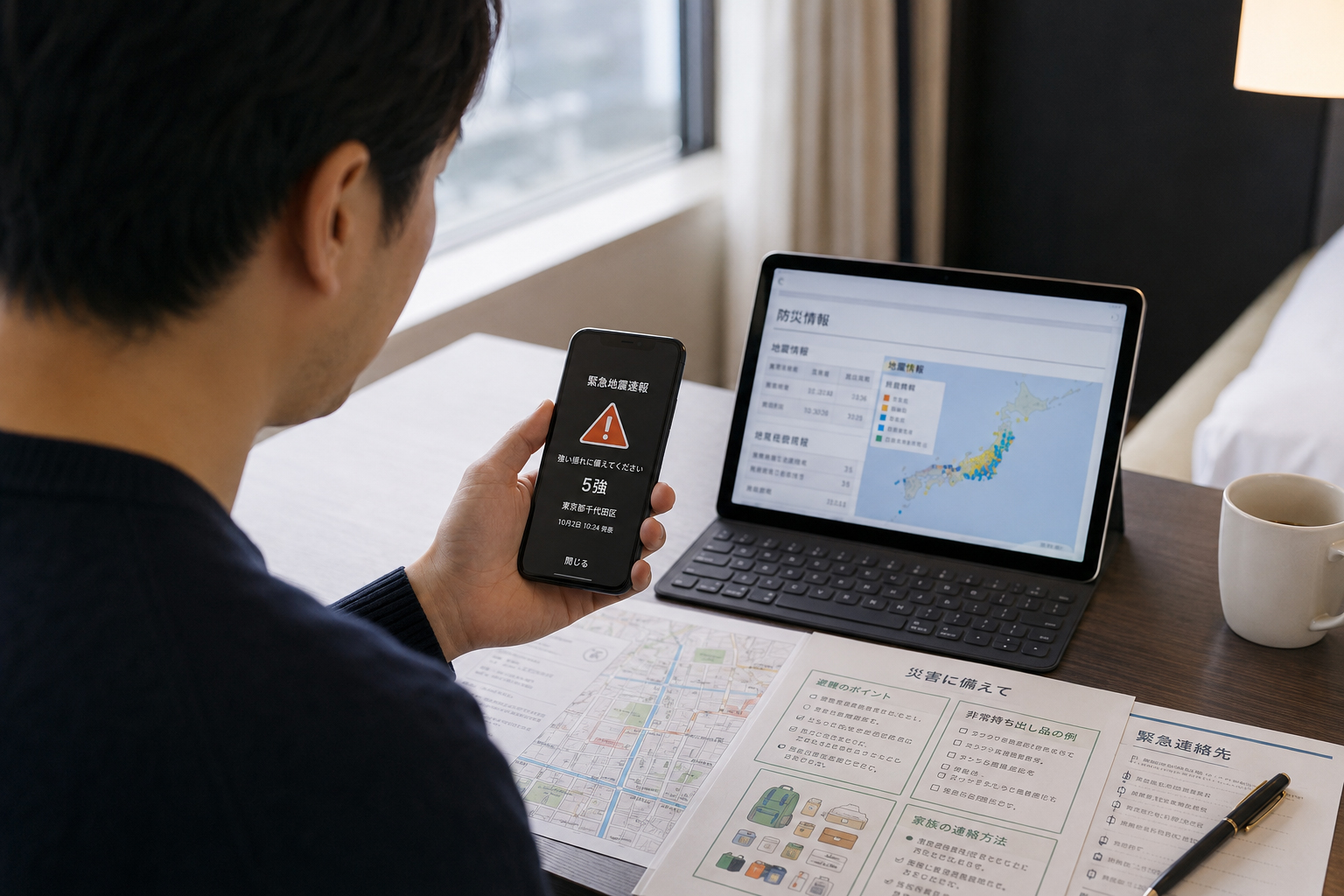
The Japan Meteorological Agency is the primary public source for earthquake, tsunami, typhoon, heavy rain, landslide, flood, snow and volcanic information. JMA monitors Japan through seismic instruments, intensity meters, weather radar, rain gauges, satellite data, tsunami observation systems and typhoon analysis. When an earthquake occurs, JMA reports the hypocenter, magnitude and observed seismic intensity. If a damaging tsunami is expected, JMA issues tsunami warnings or advisories for affected coastal regions.
JMA information is not simply background science. It is meant to support action. Will strong shaking arrive? Should people leave the coast? Is a river basin becoming dangerous? Is the ground saturated enough to create a landslide risk? Are warnings still in effect after rain has stopped? JMA turns observation into warnings so people, local governments, railways, schools, factories and households can act.
For non-Japanese speakers, the English JMA site and the multilingual disaster-information pages are essential bookmarks. Open them once before a disaster. Learn where earthquake information, tsunami warnings, weather warnings, typhoon tracks and risk maps are located. In a real emergency, familiarity saves time.
JMA tells you the hazard. Local governments tell you what to do where you are.
Japan’s national system and local system work together. JMA can say a heavy-rain warning is in effect, or that seismic intensity was recorded in a region. But your city, ward, town or village is usually the source for evacuation instructions, shelter openings, water distribution, local road closures and neighborhood-specific updates. That means disaster information is a two-step process: use JMA to understand the hazard, and use your municipality to decide your action.
For heavy rain, check JMA warnings and risk maps, then check your municipality’s evacuation information: Emergency Safety Measures, Evacuation Instruction, or Evacuation of the Elderly and Others. For earthquakes, check your city or prefecture for shelter openings, water supply points, road damage, school information and local emergency broadcasts. For tsunami risk, local coastal evacuation maps and signs matter because the safest route depends on terrain.
Travelers should ask hotels a simple question before trouble starts: “Where do I evacuate for earthquake, tsunami or heavy rain in this area?” Hotels in Japan often have procedures, but language can still be a barrier. A printed map, saved location, local government link, Safety tips and NHK WORLD-JAPAN together create a much safer information plan.
| Source | What it tells you | How to use it |
|---|---|---|
| JMA | Earthquake, tsunami, typhoon, heavy rain, landslide, flood and volcanic information. | Check the hazard and warning level. |
| Municipal government | Evacuation instructions, shelter openings, local damage, water points and neighborhood updates. | Decide what to do where you actually are. |
| Safety tips | Multilingual push alerts, evacuation flowcharts, helpful phrases and disaster links. | Install before traveling or as soon as possible after arriving in Japan. |
| NHK WORLD-JAPAN | Emergency news and disaster updates in English and other languages. | Use when Japanese television or municipal language is hard to understand. |
| MLIT Disaster Prevention Portal | River, road, transport, logistics and damage-information links. | Check whether movement is safe or whether infrastructure is affected. |
Cabinet Office: the resource hub behind the resource hubs
The Cabinet Office’s disaster-management pages are not always the first place to look for a live warning. Their strength is different: they organize Japan’s disaster system, evacuation guidance, foreign-national support materials, and multilingual apps and websites. For anyone who wants to understand the structure of Japan’s disaster information, the Cabinet Office is the institutional map.
The Cabinet Office’s “Helpful Apps and Websites in the Event of Disaster” guide is especially useful because it groups disasters by type: earthquakes and tsunamis, typhoons and heavy rain, volcanic eruptions, flooding, landslides, heavy snow and transportation trouble. It points users toward Safety tips, JMA, NHK WORLD-JAPAN and the MLIT Disaster Prevention Portal. The guide is written for foreign nationals, but it is useful for everyone because disaster confusion does not respect language ability.
One of the best lessons in the Cabinet Office material is that information is not the final step. The practical sequence is: gather information, then move to safety. An alert that does not change behavior is only noise. A good warning tells people when to leave, when to avoid travel, when to move upstairs, when to stay away from the coast, and when to wait for official instructions.
Safety tips: the app visitors should install before they need it
Safety tips is a disaster-information app supervised by the Japan Tourism Agency. It provides push notifications for earthquake early warnings, tsunami warnings and other weather warnings in Japan. Its language support is broad, including English, Japanese, Korean, Traditional Chinese, Simplified Chinese, Vietnamese, Spanish, Portuguese, Thai, Indonesian, Tagalog, Nepali, Khmer, Burmese and Mongolian.
The app is useful because it does more than send alerts. It includes evacuation flowcharts, helpful phrases for asking people around you for information, and links to disaster websites. That matters because during a disaster, the obstacle is often not only danger. It is language. If trains stop, if a hotel lobby is crowded, if a tsunami advisory is announced, if a typhoon changes travel plans, people need words they can use quickly.
Safety tips is designed for international visitors, but it is also useful for foreign residents, students, business travelers and families visiting relatives in Japan. Japanese residents who work with tourists, hotel guests, overseas students or foreign staff should also know about it.
- Install Safety tips and allow notifications.
- Bookmark JMA’s English or multilingual disaster-information pages.
- Bookmark NHK WORLD-JAPAN or install the app.
- Save your hotel or home address in Japanese and English.
- Ask your hotel, school or workplace where to evacuate locally.
- Keep a charged power bank, small cash and a paper contact list.
NHK WORLD-JAPAN: disaster news when Japanese is not enough
NHK WORLD-JAPAN is a crucial public-media resource for people who need disaster information in English or other languages. Its app and website provide news, live streams and emergency information. Some emergency alerts related to earthquakes and tsunamis are delivered as smartphone notifications. Its multilingual services help people who cannot follow Japanese-language television or local announcements.
Disaster news has two jobs. First, it reports what has happened: the earthquake, the tsunami warning, the storm track, the train disruption, the government statement. Second, it explains what the situation means: why people should evacuate, why river levels can rise after rain, why aftershocks remain possible, why a weakened typhoon can still produce flooding. NHK WORLD-JAPAN helps fill that explanation gap for foreign audiences.
Hotels, schools, companies and tourist facilities should make NHK WORLD-JAPAN part of their emergency information package. A printed card with NHK WORLD, Safety tips, JMA and the local government’s disaster page can be more useful than a complicated binder that nobody opens.
MLIT: roads, rivers, transport and whether movement is safe
After an earthquake, typhoon or heavy rain event, people quickly ask whether they can move. Are roads passable? Are rivers rising? Are flights and trains operating? Are bridges, tunnels and coastal roads safe? The Ministry of Land, Infrastructure, Transport and Tourism’s Disaster Prevention Portal is an important gateway for these infrastructure questions.
Movement after a disaster can be dangerous even when the sky looks calmer. A road that was passable two hours ago may be underwater. A slope may fail after the rain stops. A river may peak later than expected. A bridge may need inspection after strong shaking. A coastal road may be unsafe after a tsunami advisory or high-wave warning. Official infrastructure information helps people avoid becoming part of the next rescue problem.
The rule is simple: do not travel because it “looks okay.” Travel only when official information and local conditions show it is safe.
Local governments: the most important page you may not have bookmarked
Every person in Japan should know the disaster page for the municipality where they sleep. For residents, that means your city, ward, town or village. For travelers, that means your hotel location. For workers, it also means your workplace location. Disasters are local. The national map may show the warning, but the local government tells you which shelters are open and which neighborhoods are under instruction.
Many municipalities publish information through their website, official social-media accounts, disaster email systems, LINE accounts, local radio, public-address speakers and smartphone apps. The best source varies by city. In some areas, the municipal website is clear. In others, official social media updates faster. In rural or coastal areas, local sirens, loudspeakers and community leaders may still be essential.
Do not wait until a warning to find the page. Search your municipality name plus “disaster,” “evacuation,” or “防災” today and save the result.
For international travelers: a practical sequence
Travelers face a special problem: they may not know the geography, the language, the transport system or the evacuation culture. That makes preparation more important, not less. The goal is not to become an expert in Japanese disaster policy. The goal is to have a simple sequence that works under stress.
- Look at Safety tips for the alert and recommended action.
- Check JMA for official hazard information.
- Check NHK WORLD-JAPAN for English or multilingual news context.
- Ask hotel staff or station staff for local evacuation directions.
- Follow municipal evacuation instructions; do not rely on social media alone.
- Stay away from rivers, underpasses, cliffs, beaches and harbors during warnings.
For residents: connect national alerts to your neighborhood
Foreign residents and Japanese residents alike need to connect big national information to small local reality. A typhoon forecast is not enough; you need to know whether your apartment is near a river, in a landslide-prone zone, or on reclaimed land. A tsunami warning is not enough; you need the route uphill. A major earthquake report is not enough; you need to know where to get water, whether schools are open, and how to contact family if mobile networks are congested.
Residents should keep a simple information card: JMA, municipal disaster page, local hazard map, nearest evacuation shelter, family meeting point, workplace emergency contact, school contact, embassy contact if relevant, and 171/web171 disaster message information. The card should exist on the phone and on paper.
Social media can help, but it should not be your final authority
Social media often shows damage before official summaries appear. It can be useful for awareness: flooded underpasses, closed roads, power outages, crowded shelters, train queues, local photos. But social media also spreads old images, wrong locations, mistranslations, speculation and deliberate misinformation. Treat social media as a signal to check official sources, not as the final source itself.
This is especially important for tsunami, river, landslide and evacuation information. Do not go to the coast to verify a photo. Do not go to a river to check the water level. Do not drive into an underpass because one person posted that it was still open. Do not delay evacuation because a stranger says the warning is exaggerated. Verify with JMA, local government and official transport or infrastructure sources.
A short history of Japan’s disaster-information culture
Japan’s disaster-information system grew from hard lessons. The 1995 Great Hanshin-Awaji Earthquake exposed the danger of urban seismic risk and the need for better emergency coordination. The 2011 Great East Japan Earthquake and tsunami transformed thinking about tsunami evacuation, warning communication, nuclear emergencies and wide-area response. Repeated typhoons and heavy-rain disasters have shown that river rise, landslides and urban flooding can be just as deadly as wind.
Today Japan uses multiple channels: JMA warnings, Earthquake Early Warnings, tsunami advisories, municipal evacuation instructions, J-Alert, L-Alert, TV, radio, emergency mobile alerts, apps, websites, public loudspeakers and social media. The system can feel complex because Japan faces many hazards. But the goal is simple: turn information into protective action.
Save the sources before the next alert
The moment after an earthquake or typhoon warning is not the best time to build an information plan. Phones may be busy. Power may be out. Trains may stop. Local pages may load slowly. Stress makes reading harder. Prepare now: bookmark JMA, your local government, Safety tips, NHK WORLD-JAPAN and MLIT. Download apps. Write down addresses. Charge batteries. Ask your hotel or workplace about evacuation.
Disaster readiness is not dramatic. It is practical. The right source, opened at the right moment, can turn confusion into action. In Japan, that action may be as simple as staying away from the coast, moving upstairs, leaving before the rain worsens, waiting for official transport updates, or helping a visitor understand a warning they cannot read.
Good disaster information does not end with knowing more. It ends with being safer.
Sources and references
This article references public and official disaster-information resources from the Cabinet Office, JMA, the Japan Tourism Agency/JNTO, NHK WORLD-JAPAN, MLIT and Tokyo Intercultural Portal.
- Cabinet Office: Disaster Management in Japan
- Cabinet Office: Helpful Apps and Websites in the Event of Disaster
- Japan Meteorological Agency
- JMA: Monitoring of Earthquakes, Tsunamis and Volcanic Activity
- JNTO: Safety tips app
- JNTO: Safety tips for travelers
- NHK WORLD-JAPAN
- MLIT Disaster Prevention Portal
- Tokyo Intercultural Portal: Useful links for disaster information