What happens today—and what does not
The official timetable is compact. Floats run from 4:50 p.m. to 9:30 p.m., following a route from Tsukiji Shrine to the Garden Pier intersection. The mass dance runs from 6:20 to 8 p.m. in the special event space north of that intersection. The event area is on and around the Egawa road, rather than the customary program sites inside Garden Pier.
The Nagoya Port Authority’s July 16 notice calls the float movement a parade by local neighborhood associations. The festival’s official site, however, says “fireworks, parades and other events, and events using Garden Pier” are canceled. The wording is not a contradiction once the scale is made clear: the normal large parade slate is off; the smaller, locally organized float procession survives.
| Program | Time and place | Status for 2026 |
|---|---|---|
| Neighborhood floats | 4:50–9:30 p.m.; Tsukiji Shrine to Garden Pier intersection | Going ahead in rain; canceled in severe weather. |
| Mass dance | 6:20–8:00 p.m.; special space north of Garden Pier intersection | Going ahead in rain; canceled in severe weather. |
| Traffic restrictions | 5:00–9:30 p.m.; around the waterfront event zone | Expect diversions and interruptions while floats move on Egawa road. |
| Fireworks | None | Canceled for the 80th edition. |
| Usual large parade and Garden Pier events | None | Canceled; the neighborhood float procession remains. |
| Roadside stalls | No customary line of road stalls | The official site explicitly asks visitors not to expect the usual street-vendor scene. |
Why the 80th festival is smaller
A May 18 official festival announcement gives the reason. Preparations for the 20th Asian Games and 5th Asian Para Games made it difficult to secure enough viewing and activity space. Organizers chose to cancel the fireworks, standard parade events and programs using Garden Pier “with safety as the first priority.” The float and dance programs were moved to Egawa road between the Minato Bridge and Garden Pier intersections.
That decision makes 2026 an unusual anniversary. The standard festival can include marching bands, stage performances, taiko, the traditional log-rider balancing contest, a mass dance, parades and the night fireworks that most casual visitors associate with the day. Official galleries preserve that wide repertoire. This year, the activities that remain are those most closely attached to the surrounding neighborhoods.
The cancellation also reveals something about a port festival. A waterfront is not an empty backdrop. It is working infrastructure, with roads, passenger spaces, emergency routes, security zones and overlapping public projects. The festival cannot occupy it without limits. In a year when other major events constrain the available land, reducing the program is an act of port management as much as event management.
These floats are neighborhood-built vessels
The word “float” can suggest interchangeable decorated platforms. The Nishitsukiji school district’s current community catalog shows the opposite: nine structures with distinct makers, shapes, music and neighborhood memories. The catalog is not presented as a confirmed 2026 lineup, so it should not be read as a promise that every float below will appear today. It is a record of the local culture from which today’s procession is drawn.
| Neighborhood float in the catalog | Construction and form | Story carried into the festival |
|---|---|---|
| Nigōchi West, Minato Maru | Ship-shaped; built by a shipwright in 1959; 3.0m long | Survived the Ise Bay Typhoon while rising and falling in a flooded warehouse; gong and drum style follows the Kuwana Ishidori tradition. |
| Tak roku | Ship-shaped; designed and built by the association; 7.5m long | Flutes, bells, drums and performance express an explicitly participatory “dance with us” ethos. |
| Lily Heights | Handmade box form; 1.8m long | Built around all-ages participation and the idea that every resident has a role. |
| Minato Honmachi 1 | Two-story, knock-down Japanese structure; made by a shrine carpenter in 1955 | A postwar neighborhood artifact maintained through major repairs. |
| Daini Higashi | Built by a resident ship carpenter in 1987; 3.0m long | Appeared in the 1988 Nagoya Festival and is now cared for as a children’s favorite. |
| Nigōchi East, Irifune Maru | Port-appropriate ship form; 5.3m long; repainted in 2022 | Its restrained structure meets the energy of younger drummers in new purple coats. |
| Jingashira-chō | Box form with a karakuri puppet; 5.4m long | The puppet is by the late eighth Tamaya Shōbei and is operated by local children. |
| Minatomoto, Minatomoto Maru | Large box form; 6.6m long | Three young pines on the roof invite a deity to descend; shamisen, bells and drums accompany the procession. |
| Masago | Lantern-decorated box form; 5.1m long | Women’s dance and a skilled taiko group animate the structure. |
The list is a miniature history of waterfront craft. Shipwrights built several of the structures; a shrine carpenter built another; a famous karakuri lineage supplied a puppet. Some are made to resemble ships, while others are two-story or lantern-covered temporary architectures. They have to be stored, repaired, assembled, decorated, pulled and performed anew. What passes the crowd is not simply an object but a neighborhood organization made visible.
Minato Maru: a float that survived the harbor’s worst disaster
One float compresses port history into three meters. The Nigōchi West association says Minato Maru was made by a shipwright in 1959. Soon afterward, the Ise Bay Typhoon struck. During the storm surge, the ship-shaped float floated up and down inside a warehouse and survived without damage. The community calls it a legendary pleasure-boat float.
The disaster was not picturesque. On September 26, 1959, a maximum storm surge of 5.31 meters was recorded in Nagoya Port. Port Authority teaching material records 3,260 dead or missing in Aichi Prefecture and 5,098 nationwide. Floodwater and timber from waterfront storage areas drove into neighborhoods, demonstrating how cargo itself could become destructive debris.
Recovery changed the bay. A 7.6-kilometer storm-surge barrier from Yatomi to Chita was completed in 1964 at 6.5 meters above the port datum and later strengthened and raised. Minato Maru belongs to that same history at human scale: made in the year of catastrophe, preserved by chance and buoyancy, then maintained by residents for procession rather than sealed away in a museum.
Mass dancing turns a logistics corridor into common ground
A mass dance has a different material. Its structure is time, music and repeated motion. There is no heavy object to preserve, and its meaning depends on residents occupying the road together. At a working port, that matters. Streets normally distribute vehicles and labor; for less than two hours tonight, a designated section becomes civic floor space.
The dance is not an accessory to the floats. The two practices make opposite kinds of participation visible. A float concentrates years of maintenance in a slow-moving form; a mass dance dissolves the boundary between performer and onlooker. Together they show why the port festival lasted after its original reconstruction purpose faded: it gave people living beside large industrial systems a recurring claim on the waterfront.
1946: a reconstruction festival before Marine Day existed
The festival began in 1946 as a postwar reconstruction festival. That origin matters more than the later Marine Day label. Nagoya had been devastated by air raids; the port, factories, transport networks and city neighborhoods all had to resume life amid shortage and loss. A public waterfront festival was therefore not merely entertainment. It was a declaration that port and city could gather again.
The count of eighty editions follows from that 1946 beginning, with disruptions along the way. Port Authority material identifies 2020 as the first year in which all events were canceled. The festival later returned; a Nagoya city publication says about 330,000 people attended in 2025. That figure describes the full previous year, not a forecast for the limited 2026 edition.
The holiday now in the festival’s name came half a century later. Japan first observed Marine Day as a national holiday on July 20, 1996. In 2003 it moved to the third Monday in July. In 2026 that Monday happens to be July 20, returning the movable holiday to its original calendar date. The Nagoya festival did not grow from the holiday; an older local reconstruction festival adopted Marine Day as a national frame.
Before the modern port: Atsuta, the crossing and Horikawa
Nagoya’s relationship with water did not start with concrete quays. Atsuta—known as Miya on the Tōkaidō route—was the embarkation point for the Seven-ri sea crossing to Kuwana. Passengers and goods moved between road and boat at the edge of Ise Bay. Inland, Horikawa served the castle town as a trunk waterway, carrying rice, salt, timber and other necessities past storehouses and working yards.
Those waterways connected a city to a shallow bay, but they did not create a modern ocean port. Larger steamships needed deeper approaches, strong quays and cargo-handling land. The mudflats and shallow water that had supported older coastal movement became the central engineering difficulty of building the new harbor.
1896–1907: building a port where critics saw only shallow water
Major harbor construction began in 1896. Official Port Authority teaching material describes both the technical uncertainty and public opposition: Japan had little precedent for creating a large port in such shallow sea, costs were high, and critics condemned the works as a waste of taxes. Dredging, reclamation and breakwater construction had to turn an unpromising edge of the bay into infrastructure capable of receiving seagoing ships.
Engineer Shichirō Okuda understood that an argument on paper would not be enough. In September 1906, he negotiated to bring the exhibition ship Rosetta Maru into the unfinished harbor and personally piloted it to the iron pier. The vessel’s successful call became public proof that the project could work. Crowds came to see a large ship where opponents had said a port should not be built.
Nagoya Port formally opened on November 10, 1907. Its later growth did not overcome shallowness once and for all; it required continuous dredging, new reclamation and the migration of terminals toward deeper water as ships and cargo volumes grew. The basic geography of today’s port—older public-facing areas inside, large logistics and industrial zones farther out—is the accumulated result.
One port, four cities and a village
Modern port governance also had to cross municipal boundaries. The Nagoya Port Authority was established on September 8, 1951, as a special local public body jointly created by Aichi Prefecture and Nagoya City. Its administrative area now extends across Nagoya, Tokai, Chita and Yatomi cities and Tobishima village.
That structure reflects the port’s scale. Automobile terminals, container berths, energy facilities, manufacturing sites and waterways do not fit neatly inside one city’s edge. Integrated management connects navigation, land use, disaster protection, logistics and public spaces. The festival is staged in Nagoya’s Minato Ward, but the working port it celebrates is a regional system.
How a cargo pier became Garden Pier
Garden Pier was once part of the inner port’s logistics core. As freight functions shifted outward from the late 1960s and 1970s, the Port Authority reconsidered the older No. 2 pier. A 1978 redevelopment plan set out to make it a waterfront “familiar and accessible” to people rather than leave a superseded cargo zone behind fences.
The result accumulated over decades: the Port Building and maritime museum, open plazas, the Antarctic museum ship Fuji in 1985, and the Port of Nagoya Public Aquarium beginning with its south building in 1992 and north building in 2001. Garden Pier became an interface, not an alternative to the working port. Visitors could see ships, learn how trade functions and reach the water while industrial terminals continued farther around the harbor.
The 2026 festival’s relocation is therefore especially telling. The usual public waterfront cannot host the normal program this year, so the surviving floats and dance are concentrated on the northern approach. The civic port has not disappeared, but its available geometry has narrowed.
The working port behind the dance floor
Official finalized data for 2024 put Nagoya Port’s total cargo at 156.71 million tonnes, the largest volume in Japan. Foreign trade accounted for roughly 70 percent. The value of exports was ¥16.1659 trillion and imports ¥7.5693 trillion; the resulting trade surplus was ¥8.5966 trillion. About 1.46 million completed vehicles were exported, preserving a 46-year run at the top of Japan’s vehicle-export ranking.
The direction of cargo explains the port’s relationship with central Japan’s manufacturing economy. Completed automobiles, automotive parts and industrial machinery dominate exports. LNG, iron ore, crude oil and coal are major imports, feeding energy and material systems on which production depends. This is a two-way industrial metabolism: raw materials and fuel arrive; high-value manufactured goods depart.
Provisional 2025 data show 159.35 million tonnes of total cargo and 27,769 ship calls, with 112.55 million tonnes in foreign trade. Those figures are newer but preliminary; the national rankings above rest on finalized 2024 data. The port trades with about 160 countries and regions. Much of that enormous geography is invisible from the festival road, compressed into manifests, containers, vehicle yards and ship schedules.
| Working-port measure | Official figure | What it means |
|---|---|---|
| Total cargo, 2024 final | 156.71 million tonnes | Japan’s largest total cargo volume. |
| Foreign-trade share | About 70% | Nagoya is both a regional industrial port and a global gateway. |
| Exports / imports, value | ¥16.1659tn / ¥7.5693tn | Manufactured exports generate an unusually large trade surplus. |
| Completed vehicles exported | About 1.46 million | The port ranked first in Japan for the 46th consecutive year. |
| 2025 provisional cargo | 159.35 million tonnes | A newer operational indicator, not yet the basis for final rankings. |
| Trading reach | About 160 countries and regions | The local waterfront is connected to an almost global network. |
Automation, carbon and the port’s next argument
The engineering problem of 1907 was how to make shallow water receive large ships. The present problem is how to keep a huge industrial gateway productive while reducing labor strain, emissions and climate risk. Port Authority material describes Tobishima South as Japan’s only operating automated container terminal, using centralized gates and automated or remote cargo-handling systems. Other terminal programs extend remote-operated equipment and data coordination.
Nagoya’s carbon-neutral port plan sets a 2050 objective and treats manufacturing growth and decarbonization as a single regional problem. Measures under study or development include cleaner cargo-handling equipment, shore-side electricity for some vessels, incentives for lower-emission ships, and supply systems involving hydrogen and ammonia. These are plans and transitions, not evidence that the port is already carbon neutral.
The distinction is relevant on Marine Day. A festival can celebrate the port’s economic output without treating its current form as permanent. The harbor has always been reconstructed—through dredging, postwar rebuilding, storm-surge defenses, offshore terminals and public waterfronts. Decarbonization is the next test of whether port, industry and city can change together.
Practical guide for July 20
The closest rail stop is Nagoyako Station on the Meiko subway line. From Nagoya Station, the official access guidance suggests the Higashiyama line to Sakae and a transfer to a Meijo/Meiko-line train for Nagoyako. JR and Meitetsu passengers can transfer at Kanayama. The Aonami line’s Inae Station is another option, but the published walking route is about 30 minutes.
There is no visitor parking around the venue, and the surrounding streets are a no-parking zone. Traffic restrictions run from 5 p.m. to 9:30 p.m. Organizers prohibit drones and warn visitors to hydrate against the heat. The floats and dance proceed in ordinary rain but are canceled in severe weather. Check the official site before departure for operational changes.
| Visitor question | Answer for July 20, 2026 |
|---|---|
| Best public transport? | Subway Meiko line to Nagoyako Station. |
| Can I drive and park? | No venue parking; the surrounding area is entirely no-parking. Use public transport. |
| When are roads restricted? | 5:00–9:30 p.m. |
| Are there fireworks? | No. The official 80th-edition program explicitly cancels them. |
| Are the floats and dance weatherproof? | They proceed in rain but are canceled in severe weather. |
| Can I fly a drone? | No. Organizers prohibit drone flights at and around the venue. |
| What should I bring? | Water, heat protection and a plan for a smaller event without the usual roadside stalls. |
Eighty festivals, one recurring question
The first festival asked whether a war-damaged port city could gather and rebuild. The modern festival asks a related question: how can residents inhabit a waterfront whose economic scale has grown far beyond ordinary sight? Floats and mass dancing answer at street level. They turn shipbuilding knowledge, carpentry, music, children’s work and neighborhood maintenance into public form.
The limited 2026 edition does not provide the usual panoramic answer. It removes the fireworks, large parade slate and Garden Pier attractions that pull a mass audience. Yet that absence puts the most persistent layer in focus. Before the port becomes tonnage, trade value or an automated terminal, it is a place that communities name, repair, pull through the streets and dance beside.
At 9:30 p.m., the floats are scheduled to finish and the road begins returning to traffic. Beyond it, ships and terminals continue on industrial time. The 80th festival’s achievement is not to stop that working port. It is to make visible, for a few hours, the people who have lived beside its risks, rebuilt after its disasters and given its waterfront a civic memory.
| Year | Port or festival milestone | Meaning in 2026 |
|---|---|---|
| Early modern era | Atsuta/Miya crossing and Horikawa link road, bay and castle town. | Nagoya’s water history predates the ocean port. |
| 1896 | Major modern harbor works begin in shallow Ise Bay. | The port starts as a contested engineering project. |
| 1906 | Rosetta Maru calls at the unfinished harbor. | A ship visit becomes proof that the port can work. |
| 1907 | Nagoya Port opens on November 10. | Modern international-port history formally begins. |
| 1946 | First Nagoya Port Festival, for postwar reconstruction. | The festival is 50 years older than the Marine Day holiday. |
| 1951 | Nagoya Port Authority is established. | Integrated regional governance follows the port’s expanding footprint. |
| 1959 | Ise Bay Typhoon devastates the port region; Minato Maru survives. | Disaster protection and neighborhood memory meet in one float. |
| 1978 onward | Garden Pier is redeveloped as a public waterfront. | The former cargo core becomes the civic face of a working port. |
| 1996 | Marine Day becomes a national holiday. | An older local festival gains the national holiday’s name and date. |
| 2020 | All festival events are canceled for the first time. | The anniversary count includes interruption and return. |
| 2026 | 80th festival proceeds partially with floats and mass dance. | Local participation survives a major reduction in scale. |
Principal sources and further reading
- Nagoya Port Authority, 80th festival event page: July 20 schedule, route, mass-dance site, parking, stalls, drones and heat advice.
- Official Nagoya Port Festival site and May 18 program announcement: partial-edition status, cancellations, relocation, Asian Games/Asian Para Games space constraint and traffic restrictions.
- Nishitsukiji School District Council, neighborhood float catalog: makers, dimensions, music, symbols and the Ise Bay Typhoon story of Minato Maru.
- Nagoya Port statistics and history material: the festival’s 1946 reconstruction origin and the first complete cancellation in 2020.
- Japan Maritime Public Relations Center, Marine Day history: national-holiday start in 1996 and move to the third Monday in 2003.
- Nagoya City, history of Horikawa: the waterway’s transport and castle-town functions.
- Nagoya Port Authority educational guide, 2026: 1896 works, shallow-water opposition, Shichirō Okuda, Rosetta Maru, 1907 opening and port expansion.
- Nagoya Port Authority 70-year history: September 8, 1951 establishment and integrated jurisdiction.
- Nagoya Port Authority disaster-prevention history: the 1959 storm surge, casualty figures and storm-surge barrier.
- Garden Pier redevelopment outline and detailed public-waterfront history: transition from logistics pier to civic waterfront, museum ship and aquarium.
- Nagoya Port Authority, “The Strength of Nagoya Port”: finalized 2024 cargo, trade, surplus and motor-vehicle figures.
- 2025 provisional port results: ship calls and cargo totals; marked preliminary in this article.
- Nagoya Port logistics DX material and carbon-neutral port plan: automation, remote operations and the 2050 transition.
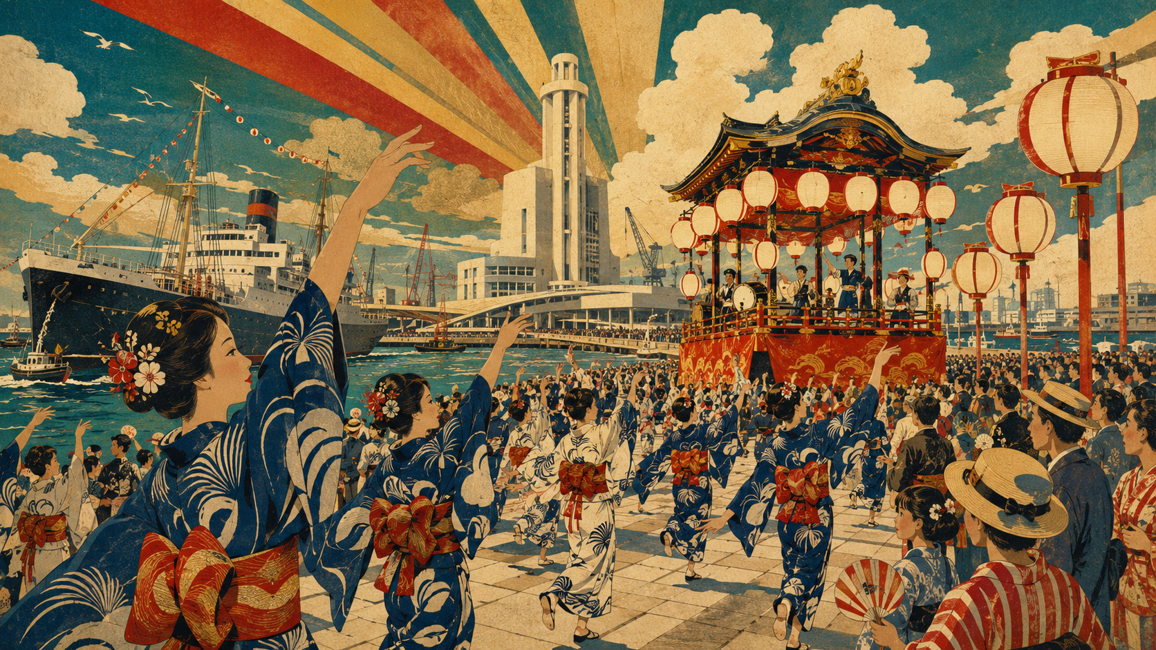
Editor’s note: Research closed on July 18, 2026, Japan time. The 2026 float catalog is used as a cultural inventory, not a confirmed promise that all nine structures will appear. Final 2024 statistics and provisional 2025 statistics are labeled separately. Schedules, routes and weather operations can change; check the official festival site before travel. The hero image is an editorial illustration, not a record photograph.