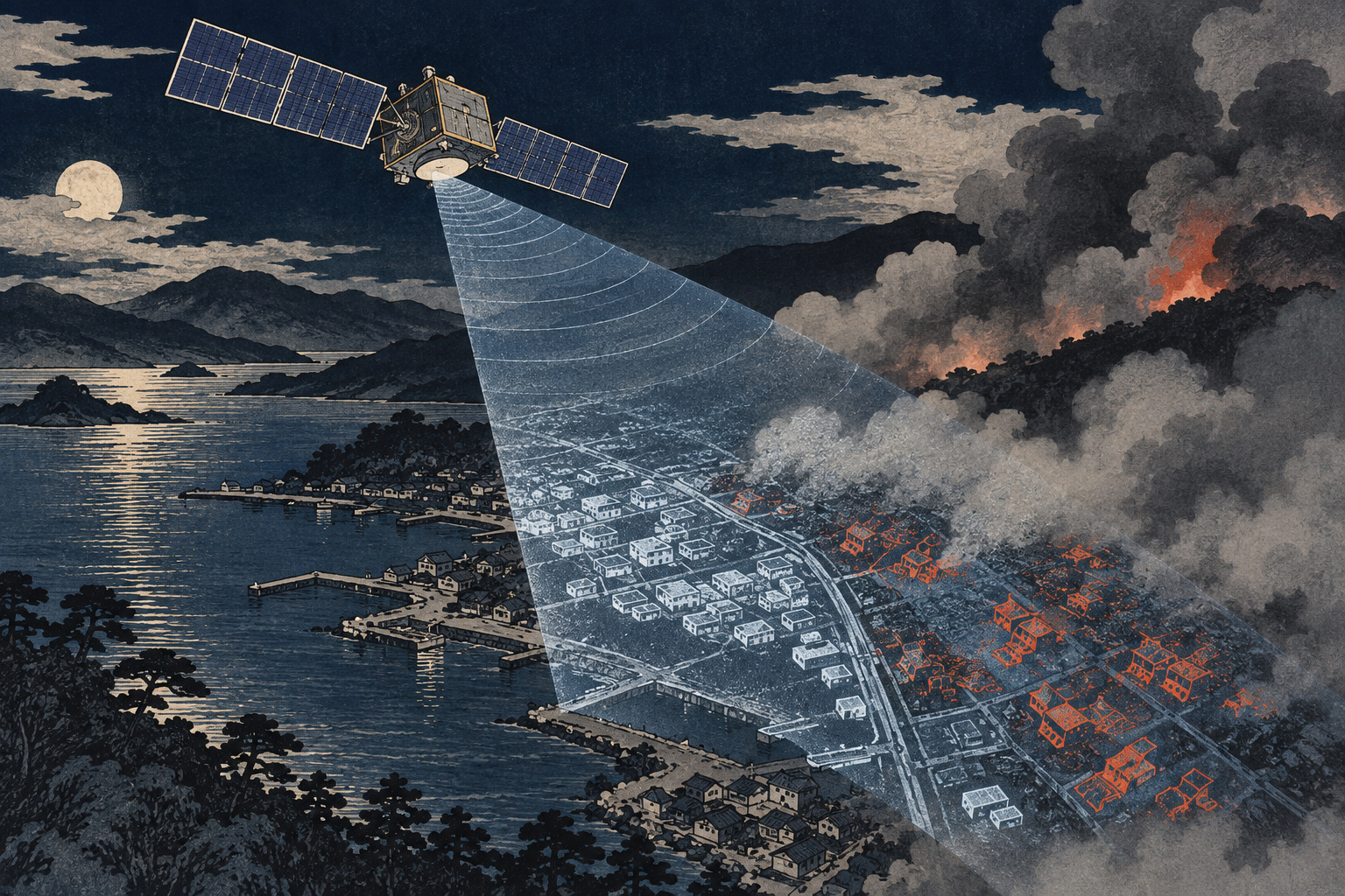
A major fire creates its own information blackout. Smoke obscures streets. Clouds can seal off a mountain. Darkness removes the reflected sunlight on which ordinary Earth-observation cameras depend. Aircraft may be constrained by weather, terrain or the danger below just when a command center needs a map of what has burned and what remains accessible.
Japan’s new research effort starts in that blind interval. NILIM’s Urban Disaster Mitigation Division wants to establish how high-frequency, high-resolution observations from small synthetic-aperture-radar satellites can reveal fire spread and building damage. The satellites are important. The real research problem lies downstream: which imaging mode to request, how to compare scenes, how to validate the output, and how quickly the result can become usable information.
A research program—not a product announcement
NILIM divided the work into five parts: select analysis methods for different small-SAR imaging modes; build validation datasets from documented fires; test detection on Japanese and overseas cases; optimize satellite tasking for different disaster conditions; and assess usefulness against both building-damage characteristics and radar-observation characteristics.
An appendix names Synspective Inc. and iQPS, Inc. as two designated institutions. NILIM says it began agreements with them early because the work is urgent. The public call seeks one additional university, company or eligible organization by September 30, with a new agreement expected in October.
Participants bear their own costs. The selected organization must be able to make high-resolution SAR data from archived and newly occurring major fires available for the research without charging NILIM, under terms to be set in the agreement. No operational accuracy, delivery time or service territory has yet been published.
What radar sees when optical imagery goes dark
A SAR instrument illuminates the ground with microwave pulses and measures the returning signal. It does not need sunlight. The relevant wavelengths pass through cloud and rain far more effectively than visible light, allowing observation at night and in poor weather. Smoke that defeats an optical camera need not defeat the radar.
But “seeing through smoke” is an easy phrase to misunderstand. SAR does not produce a familiar color photograph of flames and ruins. Its image records how strongly surfaces scatter the transmitted energy, and—in some applications—the phase of the return. Building geometry, roughness, moisture, vegetation, wavelength, viewing direction and incidence angle all affect the signal.
Fire-damage analysis therefore looks for patterns and changes. A dense block can generate strong returns where walls and ground form reflective corners; collapse or removal may weaken or rearrange that signature. Comparing a post-fire acquisition with a compatible pre-event scene can identify candidate damage. The radar observation is evidence, not a building-by-building fire certificate.
Wajima supplied a proof of possibility
After the January 2024 Noto Peninsula earthquake, fire devastated part of Wajima’s Kawai-machi district. NILIM later tested whether deep learning could identify the burned area in ALOS-2 SAR data. A false-color composite used observations from January 9, 2024, and October 19, 2021. The institute reported that its best-performing model produced an inferred area that nearly matched the validation boundary.
NILIM also stated the limitation plainly: this was a trial with restricted data, and the model could not simply be deployed to detect post-earthquake fires. Only the January 1 training example had a reference fire perimeter close to the observation time; other labels relied on the final burned area. A map of where fire ultimately reached is not necessarily the correct answer for what a satellite saw hours earlier.
The value of the Wajima test was narrower and scientifically useful. It suggested that fire-damaged urban fabric leaves SAR features distinguishable by a model. The 2026–28 program must discover how well that finding travels across sensors, acquisition modes, city forms and fire types.
Ofunato moved small SAR closer to operations
Japan’s next major case was different: a vast wildland fire that began in Ofunato, Iwate Prefecture, on February 26, 2025. Fire and Disaster Management Agency material puts the affected area at about 3,370 hectares. iQPS announced on March 6 that it would make QPS-SAR observations available without charge to government, municipal and disaster-management organizations, emphasizing the system’s ability to observe at night, in poor weather and through smoke.
The Cabinet Office’s revised Basic Plan on Space policy schedule later said intelligence, infrared and small SAR satellites had been used to help determine the fire’s spread. That is evidence that small-satellite observations had entered Japan’s disaster-information mix. It does not establish the accuracy standards, automation or end-to-end delivery process sought in NILIM’s new program.
January 2024 Wajima fire becomes a test case for ALOS-2 imagery and deep learning
February–March 2025 Small SAR contributes observations during the Ofunato wildfire
September 1, 2026 NILIM announces its call for a third joint-research participant
September 30, 2026 Application deadline
March 31, 2028 Scheduled completion
Revisit time can matter more than a sharper picture
Disaster observation has several kinds of resolution. Spatial resolution determines the size of detail in an image. Temporal resolution determines how often a useful observation can occur. Interpretation and delivery determine how long officials wait after the data reach the ground. Improving only one leaves the emergency chain incomplete.
Japan’s large ALOS-2 and ALOS-4 radar satellites provide wide-area L-band coverage. JAXA says ALOS-4 can maintain three-meter resolution while greatly increasing observation width and frequency; its 200-kilometer standard observation width can cover Japan in a 14-day orbital cycle. Small commercial satellites typically observe narrower swaths, but a growing constellation can create more opportunities to revisit a target.
The Ministry of Land, Infrastructure, Transport and Tourism now explicitly describes these capabilities as complementary: government satellites for broad coverage, private small SAR systems for narrower, higher-frequency and higher-resolution observation. The best spacecraft is the one that can obtain the right scene in the available window.
Tasking is the hidden emergency technology
Satellites do not hover above a fire. Their orbits, viewing geometry, power budgets, downlink schedules and competing requests constrain what can be collected. Someone—or a decision system—must define the area of interest, select an imaging mode, assign priority and determine when a second pass is more valuable than expanding coverage.
That is why NILIM treats “tasking optimization” as a research subject in its own right. A wide fire moving under strong wind may demand different priorities from a compact urban fire after an earthquake. An algorithm that maps damage perfectly after receiving a scene may still be operationally useless if the acquisition arrives after critical decisions have been made.
The application rules also require experience sharing high-resolution SAR observations in the Japan Disaster Charter demonstration. The Charter is a separate National Research Institute for Earth Science and Disaster Resilience initiative, designed to coordinate multiple public and private satellites and route observations through a common system. The requirement links scientific detection work to evidence that a participant can operate inside an emergency data chain.
The errors a disaster map cannot hide
SAR imagery contains granular speckle and geometric effects unfamiliar to readers of ordinary photographs. Terrain can create shadow. Buildings aligned differently to the radar can return different signals despite similar damage. Rain changes moisture; vegetation changes between acquisitions; debris clearance can make a later scene unlike the immediate aftermath. Pre- and post-event images acquired with different modes or angles may be difficult to compare.
A detection system must also balance false negatives—burned areas it misses—against false positives, where ordinary change is labeled as damage. The acceptable balance depends on the decision. A map used to prioritize reconnaissance may tolerate more candidates than one used to support damage certification. Aggregate burned-area accuracy can conceal serious building-level errors.
| SAR advantage | Operational qualification |
|---|---|
| Active sensing works at night | The orbital pass and tasking request still determine timing |
| Microwaves can observe through cloud and smoke | The return signal still requires specialist interpretation |
| Large areas can be observed without entering the hazard | Resolution and viewing geometry constrain building-level conclusions |
| A constellation increases acquisition opportunities | Downlink, processing, validation and distribution add latency |
A credible 2028 result will need more than one headline accuracy rate. It should disclose performance by fire type, building pattern, sensor and mode; state the age and quality of the reference data; and report how long the entire chain took.
A map becomes useful only when someone can act on it
The satellite industry often measures success at image acquisition. Emergency managers measure it at decision time. A useful product must show when the scene was collected, what geographic area was analyzed, how confidence varies, which places could not be assessed and when the next update is expected. It must align with roads, shelters, building data and field reports in systems agencies already use.
Aircraft, drones, thermal sensors, optical satellites and ground teams remain essential. SAR’s strongest role is complementary: narrow the search when visibility is poor, provide a wide-area hypothesis without exposing crews, and support repeated comparison as other evidence arrives. No primary source for this project says it will replace those tools.
That distinction also defines public accountability. If an automated layer affects access, evacuation, reconstruction or certification, agencies need a record of model version, source imagery, human review and correction. Speed without traceability can move an error faster.
Japan is building an observation system, not merely satellites.
Japan has decades of radar heritage, from JERS-1 through the ALOS series, and two domestic companies now building small-SAR constellations. The 2026 Space Technology Strategy calls for automated selection of disaster areas of interest, fusion with aircraft and three-dimensional data, machine-learning analysis and interfaces that deliver numerical information—not just imagery. The NILIM project is a specific fire-focused piece of that broader shift.
Japan.co.jp’s analysis is that the program should ultimately be judged on four clocks: time from ignition or request to acquisition, acquisition to analysis, analysis to delivery, and delivery to a documented decision. It should also be judged on what it admits it cannot see. A system that marks uncertainty honestly may save more time than one that presents every pixel with false confidence.
In the hours after the next major fire, smoke may still close the sky to human sight. Radar can reduce that blindness. Whether it reduces uncertainty will depend on the less dramatic work now beginning: assembling truthful reference data, testing failures across many fires, scheduling scarce observations and delivering a map whose limits travel with it.
- Synthetic-aperture radar: An active sensor that transmits microwaves and constructs high-resolution images from the returned signal.
- Constellation: Multiple coordinated satellites used to increase coverage or observation frequency.
- Tasking: Assigning an area, time, geometry and imaging mode to a satellite observation.
- Fire-damage detection: In this project, extracting and validating indications of burned areas and building damage from SAR data—not directly seeing flames.
- NILIM’s September 1 announcement and full call for participants—scope, assignments, designated institutions, schedule and conditions.
- NILIM’s Noto Peninsula Earthquake building-damage report, Chapter 6—the Wajima SAR/deep-learning trial and its limitations.
- iQPS on its Ofunato observation—the company’s Japanese statement describing collection and data availability.
- Cabinet Office Basic Plan on Space schedule—government account of satellite use at Ofunato.
- JAXA’s ALOS-4 mission page—SAR principles, L-band characteristics and disaster uses.
- MLIT policy for satellite data in infrastructure—public/private combination and implementation constraints.
- NIED’s Japan Disaster Charter—the related multi-satellite operational framework.
Editorial method: This edition separates the announced research plan, earlier experimental results, company claims and Japan.co.jp analysis. It does not infer an accuracy rate, delivery time or operational capability that NILIM has not published.