Reopening access does not mean the risk has disappeared.
A reopening that met its first stress test
Three days after Kusatsu Town began allowing visitors back into limited sections of the Kusatsu-Shirane volcanic landscape, its first experiment in renewed access ran into a different kind of pressure: cars. On October 15 the municipality warned that queues for parking were creating severe congestion on National Route 292, particularly in the morning. It also reported people entering areas beyond the authorized boundaries and operating drones.
The reopening, which began October 13, is neither a declaration that the volcano is safe nor a general reopening of the famous Yugama crater. It is a controlled trial of access to specified sections of a western mountain path and the Yumiike area. The distinction matters to hikers, drivers, tour operators and residents who depend on the same road. The question now is whether the return of visitors can be managed without compromising the precautions that made this limited experiment possible.
Precisely what has reopened
The town scheduled its pilot from 10 a.m. on October 13 through 3 p.m. on November 8. Entry to the trail is permitted between 10 a.m. and 3 p.m.; visitors must leave both the designated area and the parking facility by 4 p.m. The period can be cut short because of snow, ice, bad weather, a change in volcanic conditions or other local safety concerns.
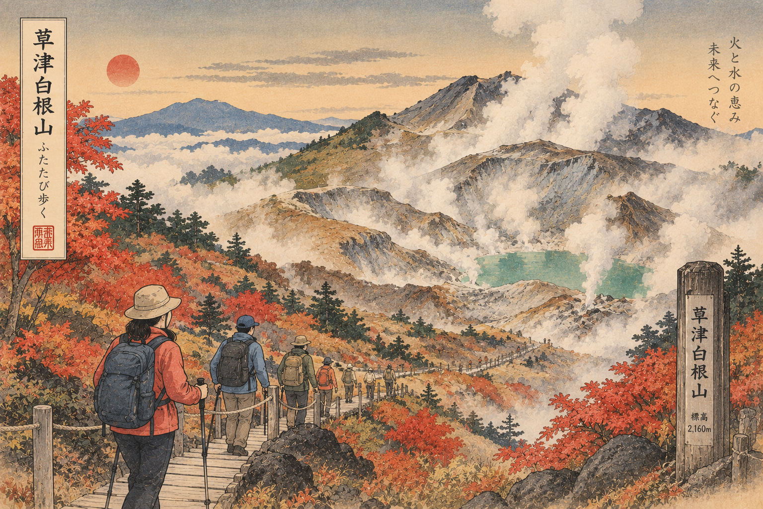
Only clearly marked sections of the western trail and the Yumiike surroundings outside the 500-meter crater exclusion zone are included. The designated path is approximately 610 meters long. Its stone-paved surface has uneven sections and slopes, and the elevation is approximately 2,160 meters. Distance alone is a poor indicator of difficulty. The town advises suitable footwear, warm clothing, rain protection and drinking water. Neither the broader mountain nor the Yugama crater rim is freely accessible under this arrangement.
Why alert level one does not mean zero risk
On May 15, 2026, the Japan Meteorological Agency lowered the alert level for the Shirane/Yugama sector from two to one. The decision followed a period of declining seismic activity from March onward and stabilization of other indicators, after increased activity had prompted a level-two warning in August 2025.
Level one nonetheless means that visitors should remain mindful of an active volcano. The JMA still warns that small emissions of volcanic ash or other material are possible within roughly 500 meters of the Yugama crater. Volcanic gas can accumulate in depressions and valleys near the crater. The town therefore maintains the 500-meter entry restriction under Article 63 of Japan's Disaster Countermeasures Basic Act. An alert-level change issued by scientists and a legally maintained local boundary are related decisions, but they are not interchangeable.
The landscape behind the turquoise crater
Kusatsu-Shirane is a volcanic complex rather than one simple mountain cone. Its terrain includes Shirane, Ainomine and Motoshirane, with multiple craters formed across a long eruptive history. The lakes Mizugama, Yugama and Karegama occupy summit craters near Shirane; Yumiike is another familiar feature in the surrounding landscape. The mixture of crater lakes, exposed earth and high mountain vegetation helps explain the area's appeal to visitors.
It also creates the temptation to treat a scenic photograph as a practical route map. A recognizable view of Yugama does not mean an unrestricted path to its shore or crater rim exists. For this pilot the legally accessible area is defined by current signs, barriers and instructions on site, not by the proximity of a famous viewpoint shown in older travel imagery.
The 2018 eruption that changed the calculation
Kusatsu-Shirane carries recent lessons about the limits of volcanic forecasts. On January 23, 2018, Motoshirane erupted at approximately 10:02 a.m. The JMA and Fire and Disaster Management Agency recorded one death and 11 injuries. Ejected rocks traveled substantial distances, some beyond a kilometer, and the disaster affected people in the nearby ski area.
That eruption occurred at Motoshirane, not at the Yugama crater whose current warning level is central to the trial reopening. It occurred in an area with a very different recent pattern of observed activity. The distinction matters: a volcano can have multiple hazardous sectors, and monitoring one crater is not a guarantee against sudden activity elsewhere. The historical record also includes eruptions around the Shirane summit and Yumiike area. Such history does not by itself establish that the current pilot is unsafe. It establishes why the boundaries and response plans should be taken seriously.
A road becomes the bottleneck
The town lists approximately 240 standard-vehicle spaces and about 20 large-vehicle spaces in the partially opened parking facility. Parking is free, but capacity is finite. Motorists are told not to line up or stop on Route 292 when the parking area is full; they must continue past the site as instructed. Having a parking space also does not automatically guarantee immediate access to the path if admission is being controlled.
According to the October 15 municipal notice, queues have already interfered with ordinary through traffic. In a mountain corridor, inconvenience can quickly become a wider governance problem. Residents, commercial vehicles and potentially emergency transport all need access to a road serving more than sightseers. The municipality has not published verified counts of delayed vehicles or quantified emergency impacts. These should not be invented to dramatize the story. The documented congestion alone raises a serious question about matching promotion of a reopened destination to actual road and parking capacity.
The meaning of a barrier
The town also reported repeated instances of visitors leaving the authorized zone and drone filming, describing these as safety-management issues. Its notices require visitors to remain within marked limits and follow staff instructions. Entering a prohibited section can prompt police notification.
There are important gaps in the public account. The municipality has not specified the number of incidents, the identities or nationalities of those involved, whether fines were issued or whether any injury occurred. It would be irresponsible to imply that international visitors, or visitors generally, are disregarding the rules. The issue is narrower and more practical: a safety system must work even when a small number of people misunderstand, overlook or ignore it. Where gases or sudden ejecta can be hazardous, a rope is not merely a suggestion about preferred walking routes.
What a successful tourism reopening would require
Kusatsu's reputation rests heavily on its hot springs and mountain setting. Limited access to another remarkable landscape could strengthen the area's appeal, but successful tourism cannot be measured solely by the number of arriving vehicles. Traffic effects, staffing costs, environmental pressures and weather-related closure procedures are part of the balance sheet.
The town planned approximately three to four safety guides, with two additional security personnel on weekends and public holidays. Only designated toilets in Shirane Rest House are available; its shops and dining facilities remain closed. Visitors must carry their own supplies and take their rubbish away. The reopening is therefore not yet a return to normal commercial operations at the mountaintop. Claims of major local economic gains would require visitor counts, public expenditure and business data that are not established by the current notices.
Nature conservation and volcanic protection overlap
Trail boundaries can have several purposes at once: keeping people away from potential volcanic hazards, preserving manageable escape and supervision routes, and reducing pressure on fragile mountain terrain. Even when eruptions do not occur, crowds, litter and off-trail movement can strain a high-altitude environment.
The town's guidelines call for staying on permitted routes, carrying out rubbish and accepting abrupt suspension of access if thunderstorms, heavy rain, fog, strong winds, snow, freezing conditions or bear sightings make continuation unsafe. These contingencies underscore a basic reality of mountain travel: a day's plan remains subject to local conditions. A visitor's personal expectation, or a prebooked excursion, cannot override a closure announced by site managers.
A pilot program, not a final settlement
Kusatsu officials say the trial is intended to collect evidence about visitor behavior, congestion and operational safety before deciding how access should work in future seasons. In that sense its early problems are part of the policy test, not merely embarrassing incidents. An honest evaluation would look at arrivals by time of day, route compliance, staff workload, incident handling, budget and the ability to clear the area quickly when needed.
For anyone considering a visit, this report is not a live access advisory. Conditions and permission can change without warning. Check Kusatsu Town's official notices and the JMA's most recent volcanic information immediately before departure, and follow the signs and personnel at the site. There is a larger lesson here for destinations built around active geological forces: reopening is not the moment when danger has been abolished. It is the beginning of a more demanding agreement between public access and public restraint.
Sources and primary records
- Kusatsu Town, October 15: safety warning after the reopening began
- Kusatsu Town, October 8: trial access boundaries, hours and restrictions
- Japan Meteorological Agency, May 15: lowering of the Yugama volcanic alert
- JMA: Yugama activity and ongoing hazards
- JMA: Kusatsu-Shirane geology and volcanic history
- JMA: analysis of the January 2018 Motoshirane eruption
- Fire and Disaster Management Agency: 2018 eruption casualties