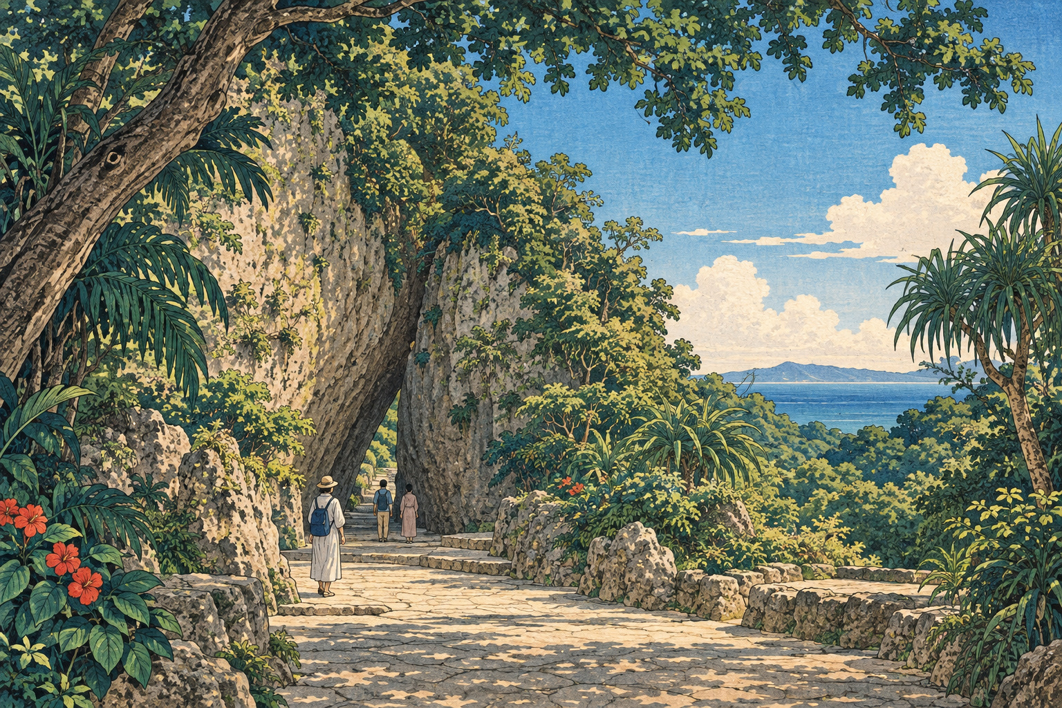
On the southeast coast of Okinawa Island, the change is defined by an absence. Above National Route 331 at Kudeken, the familiar procession of concrete poles, power lines and communications cables no longer cuts across the crown of subtropical trees. The road now meets sky before it reaches Sefa Utaki.
That uncluttered view is real. The date often implied by descriptions of it is not. The Okinawa General Bureau’s Nanbu National Highway Office announced completion of underground utility works on the national-road section in April 2025, not September 2026. The project sheet gives a total length of 0.7 kilometres across the two directions of travel. It uses a common utility duct—an underground system designed to carry electricity and telecommunications infrastructure—so the change was broader than burying “power lines” alone.
The distinction matters for another reason. In its completion notice, the bureau said the Nanjo City road leading from Route 331 toward Sefa Utaki was then being prepared for completion that summer. Japan.co.jp did not locate a later primary municipal notice confirming its final status as of September 2026. This report therefore does not present the national and city sections as a single completed project. Nor did the verified national-road work place cables beneath the sacred grove itself.
project length
announcement
inscription
within the utaki
A sacred place before a scenic place
Sefa Utaki—written 斎場御嶽 and presented by the official site as sēfa utaki—is not a built shrine in the mainland Japanese sense. Utaki is a Ryukyuan term for a sacred place, often identified through forest, rock and terrain rather than monumental architecture. Nanjo City describes Sefa Utaki as the highest sacred site of the Ryukyu Kingdom. Tradition says that the creation deity Amamikiyo made it; that is a transmitted creation account, not a historically verified construction date.
The documentary record is nevertheless deep. Japan’s Agency for Cultural Affairs says royal visits appear in records by the early fifteenth century. Sefa Utaki became a place of state ritual, including the installation ceremony of the Kikoe-ogimi, the kingdom’s highest-ranking priestess. Prayers were offered for political peace, harvests and safe voyages. White sand was carried from Kudaka Island for royal rites.
Six sacred areas known as ibi lie within the precinct. Among them are Ufugui, Yu-inchi and Sangui; the first three names also occur within Shuri Castle, a correspondence that the Agency for Cultural Affairs connects to the site’s relationship with royal authority. Men were once barred from the place. Visitors may now arrive for the dramatic cleft in the limestone or a glimpse toward Kudaka, but scenery alone does not explain why the forest matters.
Nine properties, one Ryukyuan history
The Japanese government designated Sefa Utaki a historic site on May 15, 1972, the day Okinawa reverted to Japanese administration. In 2000 it became one of nine component properties in the UNESCO inscription “Gusuku Sites and Related Properties of the Kingdom of Ryukyu.” The group also includes Shuri Castle Site, Tamaudun, Shikina-en, Sonohyan-utaki Ishimon and four gusuku ruins.
Read together, the properties describe more than castle building. They connect government, diplomacy, burial, garden design and indigenous religious practice. Sefa Utaki gives the serial property its clearest sacred landscape: the authority of the former kingdom expressed through natural formations and ritual movement rather than a palace facade.
World Heritage status also brought physical pressure. In a review published for the twentieth anniversary of inscription, Nanjo City identified congestion, poor visitor conduct and erosion of stone paths among the problems accompanying larger crowds. Recognition can finance and legitimise protection; it can also accelerate the wear that protection is meant to prevent.
Heritage begins before the gate
Nanjo City’s landscape plan for the area emerged from workshops with local stakeholders in fiscal 2019. Its goal is a sustainable visitor economy in which residents, businesses and travellers recognise the area’s sacred character. Road surfacing, utility-pole removal, greenery, outdoor advertising and land use appear within one planning frame.
The logic is spatial. A visitor encounters Sefa Utaki before crossing its entrance. Parking, information facilities, the walk toward the precinct, signs, storefronts and traffic establish a tempo. Utility poles were part of that sequence. Clearing them allows the contours of the coast, tree canopy and sky to read as a continuous setting rather than a backdrop divided by infrastructure.
Yet a polished approach can fail if it converts reverence into spectacle. The purpose is not to manufacture a cleaner social-media frame. In Japan.co.jp’s assessment, the best heritage infrastructure recedes: it signals that the traveller is leaving an ordinary transport corridor and approaching a community landscape that still carries religious meaning.
What a common utility duct changes
A common utility duct is coordination cast in concrete. Road authorities allocate underground space; electricity and telecommunications operators install conduits and cables; connections to buildings must be redesigned; above-ground equipment remains where necessary. Existing water, sewer and other buried assets constrain every alignment. Residents and roadside businesses live with the construction period.
Okinawa Electric Power identifies three public aims for such work: improved disaster preparedness, safer and more comfortable pedestrian space, and better urban scenery. The company says agreed projects under Okinawa’s eighth utility-pole-removal plan, covering fiscal 2021 through 2025, totalled about 120 kilometres, the largest planning-period figure to date. It also names long construction schedules and high costs as persistent obstacles.
| Public objective | Potential value near Sefa Utaki | What it does not solve |
|---|---|---|
| Disaster preparedness | Reduces the chance that collapsed poles or hanging wires block the road after a typhoon | Does not guarantee power continuity; surface equipment, connections and adjoining overhead networks remain exposed |
| Pedestrian access | Removes obstacles from limited roadside space used by residents and visitors | Traffic speed, heat, gradients and pavement safety still require separate management |
| Landscape quality | Reveals the sky, canopy and topography along the approach to a sacred landscape | Cannot manage advertising, buildings, visitor conduct or crowding by itself |
Typhoon resilience, without a promise of invulnerability
Okinawa has seen the road-blocking consequences of pole failure. An official Okinawa City plan cites Typhoon Maemi in 2003: Miyako Island recorded a maximum gust of 74.1 metres per second, and roughly 800 utility poles fell. The damage disrupted lifelines and obstructed the movement of emergency and recovery vehicles.
That history clarifies the resilience case at Kudeken. Route 331 is not only the visual threshold to a World Heritage property. It is a working road for residents, deliveries, evacuation and restoration crews. With fewer poles at risk of toppling, one category of debris and obstruction is removed from the emergency equation.
Underground infrastructure is not invulnerable, however. Local distribution can still fail at transformers, service connections, neighbouring overhead sections or inundated equipment. Finding and repairing underground faults may require specialised diagnosis and excavation. Japan.co.jp found no published post-completion data measuring outage duration or road access on the Kudeken section. The project has a credible risk-reduction purpose; its measured performance should not be invented.
The price of making infrastructure disappear
Visitors see the gain immediately and pay little attention to the system that produced it. Operators face the reverse. Shared ducts demand reliable maps, access points, spare capacity and rules for every future connection. A cable fault cannot always be reached from a bucket truck. Road excavation may compete with heritage-season traffic and with the needs of shops and homes.
This is why pole removal advances slowly even where the public case is strong. High initial cost is part of the explanation; fragmented responsibility is another. National, prefectural and municipal road owners, power and communications companies, landowners and community organisations must agree on design and timing. At Sefa Utaki, that institutional seam is visible in the separate national-road and city-road sections.
Good stewardship therefore includes maintenance after the celebratory photograph. Asset records must remain current. Access chambers must be inspected. Emergency excavation protocols must be understood before a storm. The open sky is the surface expression of a permanent obligation below ground.
In 2026, the work inside the site is drainage
Construction is taking place within Sefa Utaki in 2026, but it must not be confused with utility undergrounding. Nanjo City says drainage repairs are proceeding between the junction and Yu-inchi from July 1 through November 1, with normal admission continuing. From November 2 to January 5, 2027, work is scheduled to shift to the stretch from Ujo-guchi to the junction and around Ufugui. Access is then expected to be limited to the Ujo-guchi area.
Water management is a different conservation problem: directing heavy rainfall without eroding paths, damaging cultural layers or destabilising visitor routes. Its presence explains why the site may look like an active work zone in September 2026. It does not turn the 2025 road project into a current undergrounding event.
The two projects nevertheless reveal a common truth. Sacred landscapes are not preserved by freezing them in time. Their caretakers must decide where modern systems can prevent damage, how construction can avoid creating new harm, and when access must yield to repair. The systems should serve the place without becoming the story of the place.
A quieter threshold, not a finished task
Sefa Utaki asks restraint of engineering and visitors alike. Do not mistake rock for a prop. Do not confuse access with entitlement. Do not let the mechanism of preservation overwhelm the sacred landscape it is meant to support.
The 0.7-kilometre Route 331 project is modest at the scale of Okinawa’s road network. Its significance lies in how several public purposes meet: a clearer approach to a World Heritage property, more usable roadside space and one less kind of obstacle after a violent storm. Those are benefits, not proof that the site is now protected from every risk.
Under the reclaimed sky, the essential work continues underground, underfoot and in public conduct. The cables have disappeared from view. Responsibility has not.
- July 1–November 1: drainage repairs between the junction and Yu-inchi; Nanjo City says normal admission continues.
- November 2–January 5, 2027: work shifts toward Ujo-guchi and Ufugui; access is scheduled to be limited to the Ujo-guchi area.
- Construction and severe weather can change arrangements. Check the official Sefa Utaki and Nanjo City notices before travelling.
- The drainage repairs inside the site are separate from the Route 331 utility project discussed in this report.
Sources and editorial distinctions
Dates, project length, method, visitor restrictions, official names, historic-site designation, World Heritage components and ritual history are drawn from the public bodies and site authorities below. The Amamikiyo creation account is identified as tradition, not established fact. Interpretations about visitor tempo, visual restraint and infrastructure that recedes are Japan.co.jp analysis. Undergrounding reduces particular hazards; it does not guarantee uninterrupted service or eliminate disaster risk.
- Okinawa General Bureau: completion of undergrounding around Sefa Utaki on Route 331 (Japanese)
- Okinawa General Bureau: Route 331 Kudeken common utility duct (Japanese)
- Okinawa Electric Power: utility-pole-removal programme (Japanese)
- Nanjo City: Sefa Utaki area landscape formation plan (Japanese)
- Nanjo City: “Sefa Utaki and Us” (Japanese)
- Nanjo City: 2026 conservation works and access restrictions (Japanese)
- Agency for Cultural Affairs: Sefa Utaki (Japanese)
- Agency for Cultural Affairs: Gusuku Sites and Related Properties (Japanese)
- Official Sefa Utaki website (Japanese)
- Okinawa City utility-pole-removal plan (Japanese)