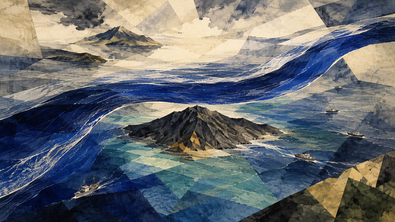
Hachijojima does not move. The great river around it does.
On August 12, the Japan Agency for Marine-Earth Science and Technology published two views of the Kuroshio’s immediate future. Its detailed JCOPE-T DA run, looking 20 days ahead to September 1, forecast that the current would approach Hachijojima but continue to pass north of it. Its lower-resolution JCOPE3M outlook extended the same non-large-meander nearshore route through October 9.
The long-range result was not a lonely line from one computer run. JAMSTEC also perturbed the forecast’s initial conditions and calculated 24 ensemble members for October 9. A large majority kept the current north of Hachijojima. None showed an unmistakable offshore route clearly south of the island, although several brought the axis close. South of Japan, a strong warm-core eddy was expected to resist a large bend. A small meander was forecast to form southeast of Kyushu, but not to grow dramatically.
Near the other landmarks, the forecast was deliberately uneven. On August 12 the Kuroshio was somewhat offshore from both Boso and Izu, close to the three capes farther west, and shedding a branch toward the Tokai coast. Through September 1, it was forecast to stay near the coast from Cape Shionomisaki to Cape Ashizuri, approach Boso and widen its separation from Izu. A route label summarizes a system; it does not erase the bends, branches and eddies inside it.
A current measured in cities and millions of tonnes
The Kuroshio is the western boundary current of the North Pacific subtropical circulation, the Pacific counterpart in broad physical role to the Atlantic Gulf Stream. Water travels north through the East China Sea, enters the Pacific through the Tokara Strait between Kyushu and Amami Oshima, follows southern Japan and turns east beyond Boso as the Kuroshio Extension.
At its fastest, according to the Japan Meteorological Agency, it exceeds two meters per second—faster than a brisk walking pace. The strong flow can span 100 kilometers and transport as much as 50 million tonnes of water each second. That is not one fixed pipe of tropical water. It is a jet with a core, margins, vertical structure, recirculation, branches and eddies, all interacting with wind, seabed topography and surrounding water.
Its Japanese name is usually connected to the deep indigo or almost black appearance of clear, plankton-poor water. Early Japanese observers called it Kurose-gawa, the “black-rapid river.” An Edo-period map, the Nihon Yochi Rotei Zenzu, already depicted that offshore river. Fishers and mariners knew the force before oceanography could calculate it: a sailing vessel gained or lost miles according to where it met the stream.
The apparent paradox is that the blue-black core itself can be relatively poor in surface nutrients while the wider Kuroshio system supports extraordinary biological production. Its margins, fronts, seamounts, islands and eddies stir water vertically and bring different water masses together. The river is not a conveyor belt carrying a guaranteed catch. It is an architect of boundaries where food, larvae and predators concentrate.
Three paths through the same sea
South of Honshu, the Kuroshio has three familiar large-scale configurations. In the non-large-meander nearshore route, sometimes called the N path, it crosses the Tokai sector relatively directly and passes north of Hachijojima. In the non-large-meander offshore route, or C path, it makes a smaller southward loop around the Izu Islands and passes south of Hachijojima. In the large-meander route, or A path, it separates from Cape Shionomisaki and dives south of latitude 32 degrees north between 136 and 140 degrees east before returning toward the Izu chain.
| Route | Defining geography | Hachijojima signal | Typical consequence to watch |
|---|---|---|---|
| Non-large nearshore · N | Relatively direct Tokai passage; north of Hachijojima | Higher island sea level | Warm current and front shift north; current close to some coasts, not all |
| Non-large offshore · C | Smaller southward loop near the Izu Islands; south of Hachijojima | Lower island sea level | Fishing access, water temperature and vessel routing reorganize around the island |
| Large meander · A | Stable separation at Shionomisaki and south of 32°N in the Tokai sector | Often part of a much broader offshore pattern | Cold-water dome inside the loop; altered fisheries, shipping and coastal sea level |
The last category dominated recent memory. A large meander began in August 2017 and ended in April 2025 after seven years and nine months—the longest episode in the official record beginning in 1965. The previous record, from August 1975 to March 1980, lasted four years and eight months. Other official episodes began in 1981, 1986, 1989 and 2004.
Ending the great loop did not instantly place the current north of Hachijojima. In late August 2025, when the Meteorological Agency and Japan Coast Guard formally confirmed the meander’s end, the Kuroshio still passed south of the island. A current can be non-large-meander and still take the C path. During early 2026, it shifted toward the northern side. The August forecast is therefore a story of two sequential changes: the historic large meander collapsed, and the succeeding non-large route eventually settled into its more direct northern configuration.
Edo period Japanese maps depict the Kurose-gawa, the powerful “black rapid” offshore.
1918 Japanese fisheries authorities begin extensive systematic ocean observations.
1965 The modern official sequence used to compare large-meander duration begins.
October 1997 The Japan Coastal Ocean Predictability Experiment, JCOPE, begins.
December 2001 JCOPE starts an experimental “ocean weather” forecast.
August 2017 The latest large meander begins.
April 2025 It ends after a record seven years and nine months.
August 2025 The current is non-large-meander but still south of Hachijojima.
August 2026 JAMSTEC forecasts the northern nearshore route through October 9.
How to forecast a river hidden below the surface
The Kuroshio can sometimes be seen from space as a temperature boundary, but cloud, summer warmth and the three-dimensional ocean complicate the picture. Satellite altimeters measure small variations in sea-surface height from which large-scale currents and eddies can be inferred. Infrared and microwave instruments estimate surface temperature. Argo floats and ships measure temperature and salinity below the surface. Tide gauges silently record the current’s pressure field at fixed coasts and islands.
JCOPE does not merely draw a curve through those observations. Data assimilation combines measurements with a numerical ocean-circulation model, seeking a physically consistent estimate of the sea at the forecast’s starting time. The model then advances temperature, salinity, sea level and current under atmospheric forcing, tides, river discharge and boundary conditions.
The short-range JCOPE-T DA system has a horizontal grid of about three kilometers, 46 vertical levels and hourly output. It assimilates satellite sea-surface height, satellite temperature and in-situ temperature and salinity each day. It calculates 11 tidal constituents, which is why JAMSTEC can animate the August 12–September 1 run hour by hour. This higher detail is used to discuss effects near particular coasts.
The JCOPE3M system trades some resolution for time, running at one-twelfth of a degree—roughly nine kilometers at these latitudes—out to two months and updating daily. Its task in the August 12 article is not to predict the temperature beside one harbor at one hour. It is to test whether the current’s basin-scale path and meanders persist.
Every model starts from an imperfect estimate. That is the purpose of the 24-member ensemble: make small changes to the initial ocean, run the futures and see whether they diverge. Agreement does not make the majority infallible, but it tells the reader the north-of-island result is structurally more robust than one deterministic line. The outlying members near Hachijojima show where uncertainty remains.
- JAMSTEC’s Kuroshio Watch presents research-based forecast experiments and weekly interpretation.
- JMA and Japan Coast Guard observations provide operational analyses of temperature, currents, sea level and route.
- Marine warnings, wave forecasts and navigation publications remain the appropriate safety information for a voyage.
- A two-month route outlook cannot replace local observations, a vessel’s weather routing or a fisheries agency’s species forecast.
The island’s tide gauge sees the invisible slope
There is a slope across the Kuroshio even when the eye sees only open water. In the Northern Hemisphere, the balance between the pressure gradient and Earth’s rotation leaves sea level higher on the current’s southern side. Across the broad current, the difference can approach a meter.
When the Kuroshio passes north of Hachijojima, the island lies on that higher, southern side and its observed sea level rises. When the current moves south of the island, Hachijojima lies north of the axis and its level falls. That relationship has made the island’s tide gauge a remarkably economical path detector. JAMSTEC reports that the recent level rose and remained high, consistent with a route north of the island; if the forecast verifies, the high state should continue.
Farther west, another quiet diagnostic spans the tip of the Kii Peninsula. When the current is close to Cape Shionomisaki, sea level at Kushimoto on the west side responds more strongly than Uragami on the east side, and the difference becomes large and variable. When a large meander pulls the current away, the difference becomes small and stable. The current’s geometry is written at two small ports before it appears as a label on a national map.
This does not mean a high Hachijojima tide gauge is itself a coastal-flood warning. Astronomical tide, atmospheric pressure, wind, waves and shorter ocean fluctuations remain essential. Current-driven background sea level can, however, change the baseline on which a typhoon or low-pressure surge acts. The route forecast is one component of coastal awareness, not a substitute for official tide and storm-surge warnings.
For fishers, the boundary can matter more than the current
Hachijojima lies about 287 kilometers south of central Tokyo, a volcanic island whose fishing identity was built in moving water. Alfonsino, skipjack tuna, flying fish and mackerel scad are among its important species. Tokyo’s fisheries research vessel Takunan repeatedly measures temperature, salinity and current, conducts test fishing and shares ocean-condition reports with island fishers because yesterday’s productive ground can be on the wrong side of a front today.
The new northern route can move warm water and the Kuroshio front relative to the island, change the speed fishers must cross, and rearrange eddies where prey gathers. Warm-water species may follow temperature corridors. Eggs and larvae can be transported downstream. A cold eddy can lift nutrient-rich water and support food production, while a fast jet can make bottom fishing physically difficult even when fish remain present.
Past experience shows why “the Kuroshio is near, therefore catches rise” is unreliable. Tokyo research found that after the 2017 large meander began, alfonsino catches in bottom-line fisheries around Hachijojima fell sharply while catches of blue fusilier increased. Another island study found larger mackerel scad tended to dominate under the offshore C route and smaller fish under the nearshore N route. During earlier large-meander periods, skipjack grounds sometimes spread across the northern Izu Islands rather than simply vanishing.
Those relationships are clues, not a 2026 catch prediction. Stock abundance, recruitment, fishing effort, regulations, prey, seasonal migration, wind and local eddies all matter. Even fish with the same preference for warm water use the current differently at different life stages. The rigorous consequence of JAMSTEC’s outlook is that fishers can plan around a more probable physical setting through early October—not that a named species is guaranteed to prosper.
| Physical change | Possible fishery mechanism | Why the result is not automatic |
|---|---|---|
| Warm axis shifts north | Changes migration corridor and distance from port to temperature front | Fish respond to prey, age and season, not temperature alone |
| Front becomes sharper | Can concentrate plankton, forage fish and predators | A front may move quickly or be unsafe to work |
| Eddy forms inside route | Can retain larvae or lift cooler, nutrient-rich water | Clockwise and counterclockwise eddies have different vertical structures |
| Current strengthens near ground | Transports organisms and changes gear behavior | Fast water can make bottom lines and small-vessel operations harder |
Warm water is transported, not evenly painted
Because the Kuroshio moves heat northward, a route change can alter coastal sea-surface temperatures. Yet the effect is not a uniform warming stripe. Direct contact with the axis, branches peeling toward shore, warm-core eddies, cold-core eddies, upwelling and mixing with coastal water determine what one bay or fishing ground experiences.
In the August 12 short forecast, a branch separated from the Kuroshio toward the Tokai coast even while the main axis lay away from the Izu Peninsula. Near Boso, the axis was forecast to approach. Those two facts could create local warming without requiring every stretch of shore between them to warm by the same amount.
JAMSTEC’s weekly highlight also noted satellite-observed warm water extending north in the Kuroshio Extension to roughly the latitude of Iwate. The Extension is the eastward continuation after the current leaves Japan near Boso. Its northern reach matters for the mixing zone between warm subtropical and cool subarctic waters, but the August image alone does not assign a single cause to high temperatures across northern Japan. JAMSTEC separately noted warm water in the Sea of Japan, which belongs to a different circulation setting.
Weather can overturn the surface signal quickly. A typhoon’s wind mixes warm surface water with cooler layers below, while sunlight and weak winds rebuild a warm skin. Rain and rivers change salinity nearshore. The current controls an important background and supplies warm water; the atmosphere and local ocean decide what a swimmer, coral, aquaculture pen or thermometer encounters on a particular day.
The ocean’s moving road for ships
For a ship, the Kuroshio is both road and resistance. A vessel moving with a two-meter-per-second current gains speed over the ground without the same increase in engine power. A vessel fighting it pays in time and fuel. Route planners therefore balance current assistance against distance, weather, traffic, safety margins and the vessel’s schedule. When the axis moves, the most economical route moves with it.
The sea state can also change. Waves traveling against a strong current become shorter and steeper; Japan’s meteorological wave service now marks areas where opposing flow is calculated to increase wave height and make waves more abrupt. During past route changes, the Meteorological Agency has warned that the areas prone to sudden large waves can migrate along with the current.
For the overnight ferry and cargo routes connecting the Izu Islands, and for small fishing boats crossing the front, the current is not an abstract arrow. It affects arrival time, fuel reserve, drift during gear deployment and the distance a disabled vessel may travel. But the August 12 JAMSTEC map is not a navigation chart. A captain must use current operational analyses, wave and weather forecasts, notices and direct observation.
Uncertainty has an economic value. If 24 ensemble runs agree that the axis remains north, a planner has more confidence in a seasonal assumption than if half go south. As departure approaches, that broad assumption must yield to the latest hourly and daily products. Ocean forecasting works as a ladder: climate context, two-month route, 20-day coastal pattern, near-term sea state, then the water actually under the hull.
What would prove this forecast right—or wrong?
A forecast should end with observations, not applause. Through September and early October, at least five signals can test JAMSTEC’s account.
- Hachijojima sea level: remaining elevated would support a current axis north of the island; a sustained fall would signal southward movement.
- Kushimoto–Uragami difference: a comparatively large value would support continued contact near Cape Shionomisaki.
- Satellite height and temperature: these should show the axis, warm eddy south of Japan and any growing small meander southeast of Kyushu.
- Ships, floats and coastal observations: subsurface temperature, salinity and velocity should agree with the model’s three-dimensional structure.
- The ensemble spread: later forecasts should reveal whether the minority cases near Hachijojima disappear, persist or become the new majority.
The most consequential challenge in the August outlook sits upstream. A small meander is expected southeast of Kyushu. Many large-meander events begin with a disturbance there, which then travels east and interacts with warm and cold eddies. JAMSTEC’s present model says this one will not develop greatly, while the strong warm eddy south of Japan makes the main path resistant to bending. That is a forecast of competing structures, not a declaration that the Kuroshio has become permanently straight.
The current has crossed the north and south sides of Hachijojima many times. In 2016, the island’s tide record moved rapidly between high and low states as the route switched. Even a confident two-month ensemble should be read within that history of reversals.
A line that carries the memory of the Pacific
The ancient name “black rapid” captured what could be seen from a wooden deck: color, speed, danger. Modern oceanography adds satellites measuring centimeters of sea-surface height, floats descending through kilometers of water and computers dividing the coast into millions of cells. Yet the central fact remains bodily. Japan stands beside a moving mass of water powerful enough to change the practical shape of its shoreline.
For Hachijojima, north and south are different oceans without the island traveling a meter. One side brings the high surface of the Kuroshio, the other the lower water across its front. Fishers find the boundary in the pull on a line and the species in a hold. A ship finds it in fuel burned and minutes gained. A tide gauge finds it in centimeters.
JAMSTEC’s August 12 forecast says the northern world will persist to October 9. The result is supported by a strong warm eddy, a small meander expected not to grow, high island sea level and a 24-member ensemble dominated by the same route. That is meaningful confidence, carefully earned.
It is not certainty. The ocean contains motions smaller than the grid, observations arrive unevenly, weather changes the surface and eddies carry surprises downstream. The most honest forecast does not hide those limits. It converts them into alternatives that can be watched.
The Kuroshio will never be fixed like a road on land. Its value lies precisely in learning how a moving road can be observed, anticipated and lived beside. For the next two months, the best evidence says that road runs north of Hachijojima. The island will keep the record.
Reporting Notes and Principal Sources
This article cross-checked ocean-model, meteorological, hydrographic and fisheries sources published by August 13 at 9:52 AM Japan Standard Time. JAMSTEC describes JCOPE outputs as forecast experiments. Conditions at sea can change, and readers should use current official marine information for operations and safety.
- JAMSTEC Kuroshio Watch: Short-range forecast through September 1, announced August 12
- JAMSTEC Kuroshio Watch: Long-range forecast and 24-member ensemble through October 9
- Japan Meteorological Agency: Kuroshio dimensions, route classes, sea-level evidence and effects
- Japan Meteorological Agency: End of the record 2017–2025 large meander
- Japan Coast Guard: Observation record and confirmation of the large-meander ending
- JAMSTEC: Explanation of the nearshore, offshore and large-meander paths
- JAMSTEC: History and design of the Japan Coastal Ocean Predictability Experiment
- JAXA: JCOPE-T DA resolution, observations, tides, forcing and data assimilation
- JAMSTEC: Hachijojima sea level as an indicator of north and south routes
- Japan Meteorological Agency: Waves made steeper by opposing currents
- Tokyo Islands fisheries center: Kuroshio large meander and changing Izu Islands catches
- Tokyo Islands fisheries center: Route type and mackerel-scad fishery around Hachijojima
- Tokyo Islands fisheries center: Research vessel observations and fishery support at Hachijojima
- Japan Fisheries Research and Education Agency: Kuroshio position, coastal warming and fishing-ground formation
- JAMSTEC: The “Kuroshio paradox,” fronts, mixing and biological productivity
- JAMSTEC: Edo-period depiction of the Kurose-gawa