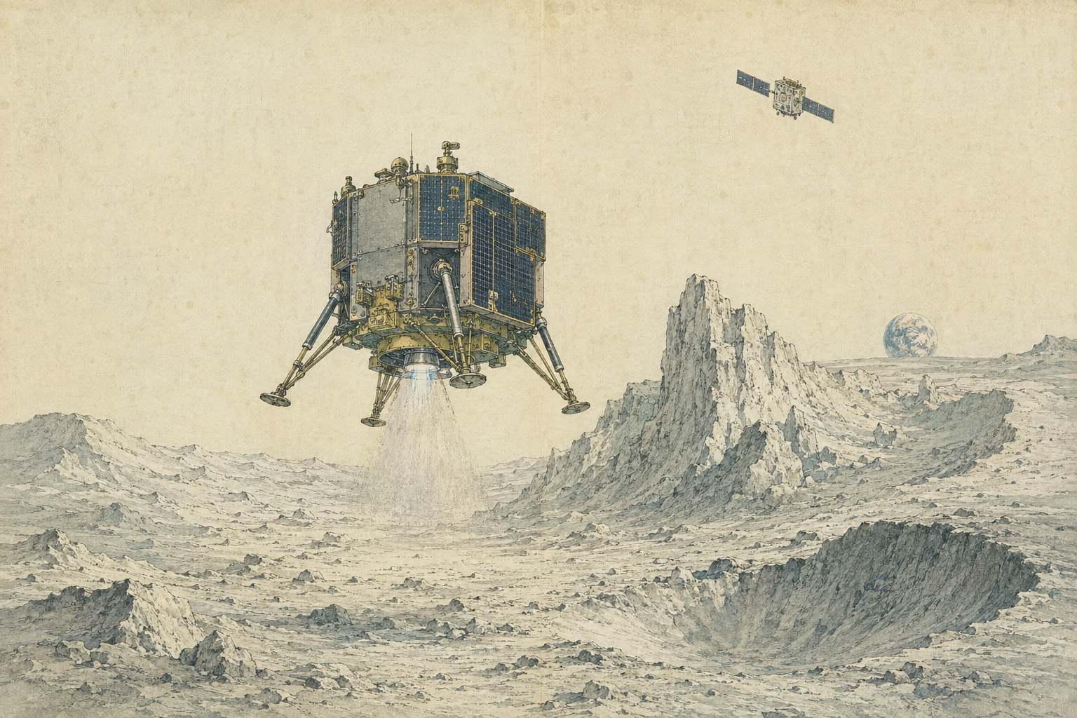
On the Moon, being close is not the same as arriving. A lander can cross nearly 400,000 kilometers of space, brake into lunar orbit and calculate its way toward a chosen plain, then lose the mission in the distance between a high-rise roof and the street. The surface has no forgiving atmosphere, no GPS constellation and no crew in a control tower. By the time a radar or laser sees the ground clearly, velocity, fuel and uncertainty are all running down together.
That is the distance the Japanese government has decided to invest in. On August 7, Tokyo-based ispace said JAXA had set a grant amount of ¥11.6 billion for its project to develop high-precision landing technology in the lunar polar region. The project is part of the second phase of the Space Strategy Fund, a national program designed to turn space research and industrial capacity into businesses that can compete beyond one government mission.
The destination is not an arbitrary patch of gray. The south-polar region contains permanently shadowed craters cold enough to preserve water ice, while nearby high ground can offer longer periods of sunlight and a line of sight toward Earth. Those features make it one of the solar system’s most scientifically valuable—and increasingly strategic—landscapes. They also make it extraordinarily difficult. The useful landing zones are an intersection of safe slopes, manageable rocks, adequate light, communication geometry, thermal limits and access to shadowed terrain. Miss the intersection by a kilometer and a rover may face a journey it cannot survive.
A grant decision, not a blank check
The distinction between ¥11.6 billion and ¥20 billion is important. When JAXA selected the project in January, it identified a maximum support amount of ¥20 billion over a period of up to five years, including launch and in-space demonstration. The August announcement fixes the initial grant decision at ¥11.6 billion. ispace expressly says receiving the remaining amount is not guaranteed.
JAXA’s public-call rules build two moments of judgment into the program. Around the second year, reviewers are to examine private financing, the company’s own funding, payload commitments and progress in the lander’s technology and system development. Around the third, they are to ask whether key components have been validated on the ground, whether the lander design is mature enough for a demonstration and whether there is a credible business plan after the publicly supported flight.
That architecture tries to solve a difficult public-policy problem. A lunar lander cannot be developed by reimbursing a company only after a flawless touchdown; the capital must arrive before the hardware exists. Yet releasing the entire ceiling at selection would place taxpayers behind every subsequent design decision and schedule slip. Stage gates move the argument from a hopeful promise to evidence that can be inspected.
- Capital: Has ispace secured private financing and committed sufficient resources of its own?
- Customers: Are credible payloads booked, including projects Japan may need the lander to carry?
- Engineering: Have navigation, propulsion, landing and communications moved from design claims into tested hardware and integrated systems?
- Mission readiness: Is the full lander design mature enough for a space demonstration?
- After the grant: Can the technology support a repeatable delivery business instead of ending as a one-off subsidized flight?
The fund’s larger ambition is correspondingly broad. The Cabinet Office’s basic policy describes roughly ¥1 trillion in support over ten years through JAXA, across launch, satellites, exploration and other strategic fields. The lunar-polar theme seeks not only a national capability but a Japanese company able to win a share of a future delivery market. That makes technical disclosure and commercial discipline part of the same test.
The mission number changed because the road map changed
Readers following ispace may remember the south-pole flight as Mission 6. That was correct when the company announced its selection in January 2026. It is now Mission 4. The spacecraft has not moved backward in time; ispace reorganized its mission sequence and publicly mapped the old numbers to the new ones in July.
| Current plan | Earlier name | Purpose and timing |
|---|---|---|
| Mission 2.5 | New intermediate designation | An orbiter mission targeted for no earlier than 2027. |
| Mission 3 | Former Mission 4 | The first ULTRA lander, planned for 2028 on Japan’s H3 rocket under a separate METI SBIR program. The launch schedule remains under coordination. |
| Mission 4 | Former Mission 6 | The 2029 lunar south-pole flight supported by the Space Strategy Fund: high-precision landing, payload delivery, extended surface work and relay communications. |
The renumbering matters because a schedule is part of the engineering story. Mission 3 is intended to fly the larger ULTRA lander before the polar demonstration. A successful 2028 mission could provide flight data about structures, propulsion, navigation, software and operations that no vacuum-chamber test can fully reproduce. A delay would compress the learning interval before 2029. A failure would make the stage-gate question much sharper.
ULTRA is the platform around which ispace is building its next era. The company’s current plan has Mitsubishi Heavy Industries’ H3 launch Mission 3 from the Tanegashima Space Center. A domestic launch is not incidental: JAXA’s call makes launch on a Japanese rocket the principle for the funded demonstration, aligning the lander, launcher and payload ecosystem.
What “high precision” actually means
Old lunar missions could aim for broad plains. Polar exploration needs the landing ellipse to shrink. JAXA defines the objective as a touchdown error of 100 meters or less—equivalent to or better than its Smart Lander for Investigating Moon, known as SLIM. The technology must also be adapted to the polar region, where illumination and terrain make the navigation problem less forgiving.
A lander first estimates where it is and how fast it is moving. In vision-based navigation, a camera photographs the surface and a computer compares features such as crater patterns with a map stored onboard. Terrain-relative navigation updates the spacecraft’s position without waiting for Earth. Radar or laser instruments measure range and velocity. Guidance selects a path, navigation estimates the state, and control commands the engines. Near the ground, hazard detection must distinguish a safe patch from rocks, craters and slopes.
These are connected tasks, but they are not one task. A spacecraft can know its horizontal position with exquisite accuracy and still hit too hard because its altitude estimate is late. It can reach the chosen coordinates but tip over on a slope. It can land upright and lose power because the Sun arrives from an unexpected angle. “Within 100 meters” therefore describes only one essential dimension of success.
Japan’s small lander changed the meaning of accuracy
SLIM gave Japan a technical reference. On January 20, 2024, it became the country’s first spacecraft to make a soft lunar landing. JAXA declared that the mission had achieved its goal of landing within 100 meters of the target. Analysis placed the touchdown about 55 meters away, despite the loss of thrust from one main engine during the final descent.
The deeper result came from separating the navigation performance from the emergency that followed. Before SLIM began its obstacle-avoidance maneuver at roughly 50 meters altitude, JAXA estimated its position error at ten meters or less—probably three to four meters. The spacecraft used image matching to recognize its location and then selected safer terrain near the target. It landed in an abnormal attitude, which limited initial solar generation, but later revived and unexpectedly operated through three lunar nights.
SLIM did not make polar landing routine. It showed that a compact Japanese spacecraft could recognize lunar terrain and steer toward a precise point. The Space Strategy Fund’s question is whether that public-sector achievement can be transferred, hardened and integrated into a commercial machine carrying customer payloads. ispace has said it will leverage SLIM-related knowledge, including terrain-relative navigation, in its redesign.
Technology transfer is often described as if a finished invention were handed across a counter. Spaceflight is less tidy. Algorithms must run on different computers and cameras. Sensors have different noise. A larger lander bends, vibrates and burns fuel differently. Software has to survive new failure modes and vendors’ interfaces. The useful inheritance from SLIM is therefore not a magic package but methods, data, people and a demonstrated standard against which ispace can be measured.
Two descents, two different failures
ispace arrives at this grant with unusual experience: it has twice reached lunar orbit and twice failed in the final descent. The company grew from HAKUTO, a Japanese finalist in the Google Lunar XPRIZE, and began selling a vision of frequent, privately operated lunar transport. Its first two missions proved that a startup could build, launch and operate landers around the Moon. They also showed how completely the final minutes can erase the distinction between “almost” and “landed.”
On April 26, 2023, Mission 1 crossed the rim of a crater during descent. The sensed altitude changed abruptly by roughly three kilometers. Because that measurement differed too far from the altitude predicted in software, the system treated valid sensor information as abnormal and rejected it. The onboard estimate eventually reached zero while the spacecraft was still about five kilometers above the surface. The lander continued until its propellant was exhausted and fell.
Mission 2’s RESILIENCE lander reached the final approach on June 6, 2025. This time, ispace’s investigation found that valid measurements from the laser range finder arrived later than expected because the unit performed below requirements or suffered a hardware anomaly. The lander did not reduce its velocity sufficiently and made a hard landing. The company said it found no anomaly in the guidance, navigation and control software or in the propulsion and power systems.
The failures should not be blurred into a vague statement that “landing is hard.” The first involved software rejecting a physically real terrain-induced change. The second centered on degraded or late altitude sensing. Different causes point toward a common discipline: the navigation chain has to tolerate a world that does not behave exactly like its preflight model, and the organization has to find weak links before a one-shot mission reveals them.
| Descent | Immediate lesson | Design question for the polar mission |
|---|---|---|
| Mission 1, 2023 | A valid altitude jump was rejected because it looked inconsistent with the software’s expected terrain. | Can the estimator recognize difficult topography without discarding the measurement needed to land? |
| Mission 2, 2025 | Laser range data became valid too late for sufficient deceleration. | Are sensors, vendors, redundancy and fault responses validated across realistic worst cases? |
| Mission 4, planned 2029 | The challenge adds low-angle light, extreme terrain and a narrow useful destination. | Can position accuracy, hazard avoidance, soft touchdown and post-landing survival all succeed together? |
An external review task force delivered its report in March 2026. Its seven recommendations included adopting terrain-relative navigation, using remaining fuel more aggressively to reduce risk, strengthening vendor selection and testing, improving fault detection and recovery, clarifying interaction between ispace and its U.S. subsidiary Draper, and reinforcing management’s approach to technical risk. ispace responded with plans for a Test and Flight Operations unit and a Technical Risk Assessment Committee.
Public support after two failures is therefore neither an absolution nor an irrational refusal to learn. Flight data are valuable, and new industries are not built only by organizations that have never failed. But public money changes the burden of proof. The company must show not simply that it understands the last anomaly, but that its design and institution can discover the next one before launch.
Why the south pole became a destination
For most of human history the Moon looked dry because its sunlit surface is exposed to vacuum and harsh radiation. Scientists nevertheless proposed in the 1960s that water delivered by comets or created by other processes might survive in “cold traps”—places near the poles where the Sun never rises high enough to touch the ground.
Evidence accumulated by layers. The Clementine mission in 1994 produced radar observations consistent with ice. Lunar Prospector in 1998 detected concentrations of hydrogen near the poles. On October 9, 2009, NASA’s LCROSS mission sent a spent rocket stage into Cabeus crater and flew through the plume, confirming water in material from a permanently shadowed region. In 2018, scientists using data from the Moon Mineralogy Mapper aboard India’s Chandrayaan-1 reported direct evidence of exposed surface ice at the poles.
1960s Scientists develop the cold-trap hypothesis for polar volatiles.
1994 Clementine radar observations add evidence consistent with lunar ice.
1998 Lunar Prospector maps elevated hydrogen near the poles.
2009 LCROSS strikes the south-polar Cabeus region and confirms water in the plume.
2018 Chandrayaan-1 instrument data provide direct evidence of exposed polar surface ice.
2023 India’s Chandrayaan-3 achieves the first soft landing in the southern polar region.
2024 Japan’s SLIM demonstrates pinpoint lunar landing.
2029 ispace plans its funded high-precision south-pole demonstration.
The attraction is easy to state. Water can support people, yield oxygen and—if split into hydrogen and oxygen—provide ingredients for rocket propellant. It may help shield habitats or supply industrial processes. Scientifically, ice preserved in ancient shadow may carry a record of water delivered to the inner solar system.
The caveat is just as important. “Water on the Moon” does not mean an accessible underground lake. Deposits appear patchy; some water is bound in grains or mixed with regolith; concentration, depth and chemistry vary. Permanently shadowed regions can be colder than minus 200 degrees Celsius. Machines must work without ordinary solar power and then transport material to somewhere it can be processed. Extraction energy, equipment life, ownership rules and demand have not been proved at commercial scale.
The ice is therefore a scientific fact, not yet a mine. The business case depends on measurements: how much is present, in what form, at which accessible sites and at what cost. That is why precise delivery matters before extraction. A payload that lands far from the terrain it was designed to sample may return little more than a lesson in geography.
A tiny intersection of light, land and radio
Near the south pole, the Sun skims rather than climbs. Small ridges cast enormous shadows; craters hide their floors. Visual navigation must contend with high contrast and fewer familiar lighting cues. Surface temperature depends brutally on illumination. A place with favorable sunlight can be tens or hundreds of meters from darkness cold enough to preserve volatiles.
Earth hangs low near the horizon. Terrain can block a direct radio link, and a lander entering a crater or sending a rover downslope may lose sight of home. A safe site also needs slopes the landing legs can accept, rocks the hazard system can see, enough room for dispersions and a practical route for the payload. No single map layer answers all of those questions.
- Navigation: Distinct terrain features and maps accurate enough for onboard matching.
- Safety: A reachable patch with tolerable slope, rocks, craters and dust risk.
- Energy and heat: Illumination suited to solar power and temperatures the hardware can survive.
- Communications: Direct Earth visibility or reliable access to a relay satellite and ground network.
- Science: A route to the shadowed or volatile-bearing terrain the payload was sent to study.
ispace’s funded concept addresses communications as part of the landing architecture. The company says Mission 4 will use lunar communication relay satellites and demonstrate its planned Lunar Connect service. The mission also aims to operate on the surface for longer than roughly fourteen Earth days—beyond one normal lunar daylight period. A relay intended to persist after the landing demonstration could support later customers, turning communications from a bespoke mission expense into shared infrastructure.
That is potentially as important as touchdown accuracy. Roads, ports and cellular towers made terrestrial delivery scalable because each truck did not have to build its own route and network. A lunar economy will likewise need navigation references, communications, power and standardized interfaces. The first business may be carrying instruments; the enduring business may depend on the invisible services that let many instruments work.
The payload gives the landing a purpose
A landing demonstration can become circular if success is defined only as proving the lander. Mission 4 already has a strong candidate for why the location matters. In July, the European Space Agency awarded ispace’s European subsidiary a €65 million contract for MAGPIE, ESA’s first lunar rover intended to explore polar ice. ispace says the rover is scheduled to travel on Mission 4 in 2029.
That pairing joins European science to Japanese-funded transport and communications. It also raises the stakes. A rover designed to investigate polar volatiles needs an accessible traverse, enough power and thermal survival, commands and data, and a landing that does not consume the margin intended for exploration. Delivery is not complete when a payload crosses an imaginary surface plane; it is complete when the customer’s instrument can do the work it was sent to do.
JAXA’s rules anticipate that public purpose. If requested, the selected lander may have to prioritize relevant payloads from other Space Strategy Fund themes, while commercial payloads can fill remaining capacity. That creates a hybrid manifest: government-supported technologies and science can buy down market risk, while private customers test whether the service has demand outside the subsidy.
A race, but not a single finish line
The south pole is already a field of national and commercial competition. India’s Chandrayaan-3 made the first soft landing in the southern polar region in August 2023. The United States’ Artemis architecture treats polar water, illumination and access as central to returning people to the Moon. China is pursuing its own robotic and crewed lunar plans. Commercial operators are learning quickly: Firefly Aerospace’s Blue Ghost made a successful lunar landing in March 2025 carrying NASA instruments.
There is no one finish line. A state can claim a first landing; a company can still win business by carrying more mass, landing closer to a target, communicating behind terrain, surviving longer or flying more often. Conversely, a dramatic touchdown does not create a market if each mission remains too expensive or too unreliable for customers to insure and schedule.
Japan’s strategic interest is therefore wider than national prestige. It wants domestic control over a supply chain that could deliver instruments, rovers and infrastructure to specific places. It wants knowledge of polar operations, a role in setting technical norms and a company able to sell that service abroad. Using H3, SLIM-derived knowledge, JAXA oversight and ispace’s customer network binds those interests into one program—but also creates dependencies whose delays can propagate.
The business reality behind the spacecraft
The grant does not erase ispace’s financial risk. In results released the same day as the award announcement, the company said existing contracts and grants represented at least ¥46 billion in project revenue over four years. It reported first-quarter project revenue of ¥168 million, a gross loss of ¥4.627 billion and a net loss of ¥6.336 billion. Cash and deposits stood at ¥25.703 billion, while interest-bearing debt was ¥29.758 billion.
Those figures are a snapshot, not a verdict. Space companies spend years before recognizing launch and milestone revenue, and grant accounting does not move in a simple line with engineering progress. They do show why stage gates matter. Government support is central to the present road map, but it cannot substitute indefinitely for booked payloads, private capital, reliable flights and positive mission economics.
Schedule deserves the same restraint. The first ULTRA mission is shown for 2028, but ispace says timing with the responsible ministry is still being coordinated because an earlier agreement contemplated 2027. The south-pole flight is planned for 2029. “Planned” is the accurate word: launch availability, development tests, mission results, regulatory work and customer hardware can all move a date.
How to judge Mission 4
The cleanest headline in 2029 will be “landed” or “did not land.” The public investment deserves a more demanding scorecard. Did the spacecraft reach the advertised coordinates, and how was that error independently reconstructed? Did hazard avoidance select safe terrain? Was the touchdown velocity within design limits and the final attitude stable? Were payloads deployed without damage?
Then the clock should keep running. Did the rover communicate and move? Did the relay satellite carry useful traffic, and did it remain available after the lander’s demonstration? Did surface operations continue beyond roughly fourteen days? Were navigation performance, anomalies and lessons reported in enough detail to improve later Japanese missions? Did the cost and schedule suggest the architecture could fly again?
| Measure | What evidence should show |
|---|---|
| Precision | Target coordinates, reconstructed touchdown point and the resulting horizontal error—not merely “near the target.” |
| Safety | Hazard-detection performance, vertical and lateral velocity, attitude and landing-leg condition. |
| Delivery | Payload release, power, communications and the customer’s ability to begin its mission. |
| Endurance | Continuous operating days, thermal and power margins, and recovery from interruptions. |
| Infrastructure | Relay availability, data carried and usefulness to missions beyond the first lander. |
| Repeatability | Cost, manufacturing cadence, launch integration, customer backlog and a funded next flight. |
The same discipline applies before launch. At each stage gate, JAXA can ask whether private money and payload demand are arriving, whether tests cover the failure modes exposed in 2023 and 2025, and whether the system is becoming safer rather than merely more complicated. A transparent decision to narrow, delay or stop a project can be evidence that the fund is working as designed, not necessarily that it failed.
From “somewhere on the Moon” to a lunar address
The first era of lunar exploration proved that nations could reach the Moon. The emerging era asks whether machines can return to a particular ridge, deliver a particular instrument and connect it to a network that will still be there for the next visitor. That is a change from expedition to geography.
ispace’s assignment occupies that boundary. The company must turn two crash investigations into engineering practice, a public research achievement into commercial hardware, a rocket booking into a schedule and a shadowed scientific promise into a reachable address. The grant gives it money and time, but also milestones against which all of those translations can be judged.
If Mission 4 succeeds, the decisive image will be a lander standing under a low Sun. The deeper achievement will be less photogenic: coordinates held to tens of meters, a rover alive at the edge of darkness, bits passing through a relay, and a customer able to plan the next delivery with something better than hope.
Reporting notes and principal sources
This article is based on information published through August 8, 2026, 6:00 a.m. Japan Standard Time. The ¥11.6 billion figure is the announced grant decision, not confirmation that the ¥20 billion ceiling will be paid. Mission dates remain plans. Descriptions of lunar resources distinguish confirmed water or ice signatures from an unproved commercial reserve.
- ispace: August 7 grant decision, amount and Mission 4 objectives
- ispace: January selection and original Mission 6 designation
- ispace and Mitsubishi Heavy Industries: H3 launch contract and revised mission numbering
- JAXA Space Strategy Fund: high-precision lunar-polar landing theme
- JAXA: public-call rules, ¥20 billion ceiling, stage gates and domestic-launch principle
- JAXA: Phase 2 selection results and 100-meter-or-better goal
- Cabinet Office: basic policy for the Space Strategy Fund
- JAXA: SLIM landing accuracy and January 2024 results
- JAXA: conclusion of SLIM operations and three lunar-night survivals
- ispace: Mission 1 status after loss of contact
- ispace: Mission 1 completion report and altitude-estimation cause
- ispace: Mission 2 technical cause analysis
- ispace: external review task force recommendations
- NASA Science: history and evidence for lunar water and ice
- NASA Science: LCROSS and the confirmation of water in a south-polar crater
- NASA JPL: direct evidence of exposed polar surface ice from Chandrayaan-1 data
- NASA: illumination and temperature conditions near the lunar poles
- Indian Space Research Organisation: Chandrayaan-3 south-polar-region landing
- NASA: Firefly Blue Ghost commercial lunar landing
- ispace: ESA MAGPIE rover contract and Mission 4 plan
- ispace and SKY Perfect JSAT: lunar communications infrastructure study
- ispace: fiscal 2027 first-quarter results and project-revenue outlook