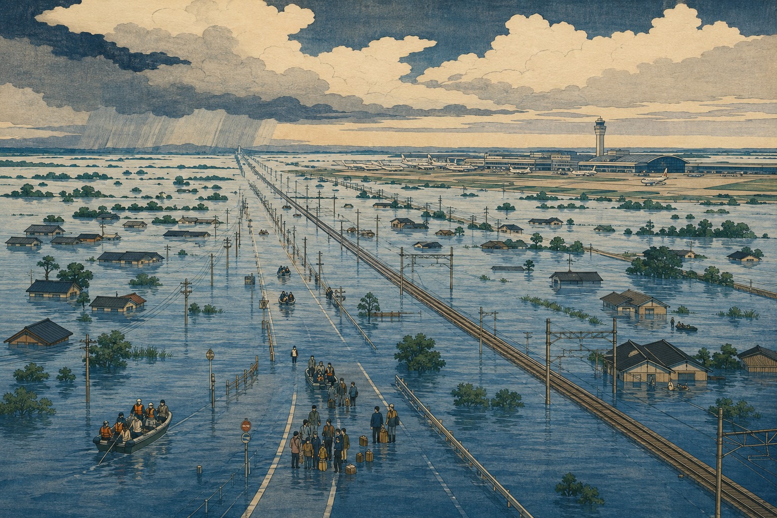
At 3 in the morning, Narita Airport still had the light of an international gateway. Flight boards glowed. Arriving passengers pulled suitcases through the terminals. Aircraft were visible beyond the glass. But the railways toward Tokyo had been severed and roads outside were flooded or closed. The airport company counted 6,680 people unable to continue their journeys. Sleeping bags covered the floor. Water and snacks were handed out.
This was not a total shutdown of the airport itself. In the Ministry of Land, Infrastructure, Transport and Tourism’s 5 p.m. assessment, no airport-facility damage preventing operations had been identified. Six flights were canceled on August 13 and 25 on August 14, though not every cancellation was necessarily rain-related, and much of the flight schedule continued. What stopped was the system outside the terminal. Planes could arrive, but passengers could not flow onward. The night exposed how a vast aviation hub depends on relatively narrow arteries of rail and road.
Rain that outran the record
The ministry’s meteorological summary described strong cold air aloft meeting warm, moist air flowing around the edge of a high-pressure system. The resulting storm clouds organized over southern Kanto. A linear precipitation band repeatedly sent heavy cells across the same ground, pushing 24-hour rainfall above 200 millimeters across broad parts of the prefecture.
In Chiba City, 115 millimeters fell in the hour to about 6:48 p.m. on August 13. The city’s three-hour total reached 188.5 millimeters and its six-hour total 293 millimeters, all new local records in observations dating to 1966. The 12-hour total reached 348 millimeters; the eventual 24-hour figure was 367 millimeters. In less than a day, more than three times Chiba City’s normal rainfall for the entire month of August had fallen.
The intensity was not confined to one gauge. By 4 a.m., totals included 254.5 millimeters in Sakura, 211 in Tateyama, 206.5 in Abiko and 203 in Funabashi. The meaning of those numbers became visible in the failures that followed: water gathering faster than streets, drains and rivers could move it away.
August 13, about 6:48 p.m. Chiba City records 115 millimeters in one hour, a local record.
7:30 p.m. The Japan Meteorological Agency issues its highest-level special heavy-rain warning for 14 municipalities, urging immediate action to protect life.
Overnight Roads flood, slopes collapse, power fails and railway equipment is inundated. Land access to Narita narrows.
August 14, 3 a.m. Narita Airport counts 6,680 stranded people.
5:15 a.m. The final special warning is downgraded, though dangerous conditions remain locally.
About 6:40 a.m. Chiba City’s 24-hour rainfall reaches 367 millimeters.
9 a.m. The overnight backlog at the airport has cleared. Transport restoration and damage surveys continue.
2 p.m. JMA formally names the disaster the “August 2026 Chiba Torrential Rain,” preserving it in the national record.
The runways worked. The airport did not connect.
The distinction between airport capacity and airport-access capacity explains the Narita paradox. A functioning terminal and runway cannot carry passengers onward when JR, Keisei, expressways and buses are weakened together. That the 6,680-person backlog at 3 a.m. was cleared by 9 a.m. reflected two systems reconnecting: the airport’s sheltering and supply operation, and a gradual restoration of transport.
The vulnerability was not new. In September 2019, Typhoon Faxai—later formally named the Reiwa 1 Bōsō Peninsula Typhoon—struck Chiba. At the peak, 934,900 customers in the Tokyo Electric Power service area lost electricity, and outages endured in parts of the prefecture. Narita remained capable of handling aircraft while rail and road access failed. A government review recorded 6,800 people still at the airport at 3 p.m., with the number later growing as arrivals continued.
That event became a national lesson in interdependence. Power restoration depended on road access and communications; water and mobile networks depended on electricity; airports depended on rail and expressways that they did not control. Seven years later, rain rather than wind reproduced the same basic image: an airport operational in isolation.
Narita’s airport continuity plan, known as an A2-BCP, includes a severe-weather scenario of at least 80 millimeters in one hour or 300 millimeters in 24 hours. It explicitly anticipates all rail services stopping, road restrictions, expressway closures and the accumulation of stranded passengers. Chiba City’s observed 115 millimeters in an hour and 367 millimeters in 24 hours exceeded both thresholds. The gauges are not at the same location, so the comparison is not a direct measurement of rainfall at the airport. It is nonetheless a revealing comparison between the intensity experienced in the prefecture and the plan’s deliberately severe scenario.
Every part of the network failed differently
“Suspended” is too simple a word for what happened across the transport map. A flooded railway switch requires different inspection and repair from a track buried by soil or a roadbed washed away. A flooded road is not the same engineering problem as a cut slope that has collapsed onto an expressway. And when buses and taxis are exposed to the same water, the backup system also disappears.
| System | Verified failure | Result |
|---|---|---|
| Expressways and main roads | Cut-slope failures on the Chiba-Tōgane Road and Ken-Ō Expressway; flooding on Route 16 and prefectural roads | Twelve sections closed because of slope failures; diversions also congested |
| JR lines | A switch flooded at Soga; soil entered the Sotobō Line; roadbeds washed out on the Tōgane and Sōbu lines | Three operators had nine conventional lines suspended at 3:30 p.m. |
| Keisei Main Line | The Ōwada substation flooded | A principal Tokyo–Narita corridor was weakened |
| Buses and taxis | Twenty-one highway-bus and 27 local-bus routes suspended; vehicles entered floodwater | Rail replacement capacity shrank; one taxi passenger died after a cab was submerged |
| Power and gas | Flooded electrical equipment and widespread outages; gas service interrupted | Chiba reported 19,600 customers without power at 5 p.m.; gas to nearly 13,000 homes was temporarily cut |
| Drainage and sewerage | Pumping and wastewater facilities were damaged or stopped | The ability to remove water from low ground diminished |
Figures are from the national ministry and Chiba Prefecture’s reports with a 5 p.m. cutoff on August 14. Several sites remained under investigation.
Water remembers the old landscape
Chiba’s flood risk cannot be read from a modern street map alone. Lowlands follow the Tone and Edo rivers in the north. Along Tokyo Bay, parts of today’s city stand on reclaimed tidal flats and wetlands. Rivers crossing the Kujūkuri Plain move slowly across gentle gradients, and some channels are difficult to widen. On the Shimōsa Plateau, branching narrow valleys called yatsu cut into higher ground. Their wet floors were historically used as rice paddies. Today, homes, roads and railways often occupy the same low corridors.
Urban development shortens and accelerates the journey of a raindrop. Water that once soaked into forest or farmland runs rapidly from roofs, asphalt and parking lots into gutters. In March 2026, Chiba City designated inland-flood assumption zones for conditions in which rain exceeds the capacity of sewers and channels—or river levels rise so high that urban drainage can no longer discharge. The city’s planning for central Chiba has long identified expanded paved surfaces, low ground, land subsidence and rapid short-duration runoff as overlapping problems.
That is why asking only whether a river overtopped its banks misses part of the disaster. Flooding was confirmed along five prefecture-managed rivers, but water also rose within the urban fabric when rainfall had nowhere to go. The record storm moved across a modern, sealed surface and revealed the outlines of old valleys and wetlands beneath it.
The 2013 record and the 2019 warning
Before this week, Chiba City’s 24-hour rainfall record was 309 millimeters, set in October 2013. The new total did not edge past it; it exceeded it by 58 millimeters. That difference is not merely a line in a weather almanac. It pushes drainage, road-control rules, evacuation decisions, communications and emergency supplies into conditions outside recent experience.
The 2019 Bōsō Peninsula Typhoon is remembered for wind damage and a long, cascading blackout. Power poles, transmission lines, mobile base stations, water supplies and rail restoration depended on one another; municipal officials struggled even to assemble a timely picture of damage. The 2026 rain broke different components, but the dependency problem remained. Pumps, traffic signals and rail substations need electricity. Repair crews and buses need passable roads. When trains stop, an airport floor becomes a bedroom.
A car is not a shelter
Some of the dead and injured were in vehicles caught by floodwater. Depth is difficult to judge in darkness, and conditions at underpasses, road dips and river crossings can change in minutes. Once an engine stalls and water pressure builds against the doors, escape becomes much harder. Chiba’s disaster guidance urges drivers to move vehicles out of low ground early, never enter a flooded road, and abandon the vehicle for higher ground if danger develops.
- Do not wait for the highest-level special warning. Combine municipal evacuation notices with radar and river information.
- Leave lowlands, yatsu valleys and underpasses before darkness makes movement more dangerous.
- Never estimate flood depth from inside a car. Stop and turn around.
- At airports and stations, do not attempt an improvised walk through flooded areas; follow facility and official transport guidance.
- Keep a power bank, water, essential medicine, cash and walking shoes together for outages and transport stoppages.
Climate change is the background—not a shortcut
It is not scientifically sound to attribute this single storm to climate change without a dedicated event-attribution study using observations and climate models. No such analysis of the August 2026 Chiba event had been published by this article’s cutoff. The immediate meteorology—cold air aloft, abundant moisture and a persistent linear band—still matters.
But the background is changing. JMA’s long-term monitoring finds that, in Japan, the frequency of extremely heavy events—at least 80 millimeters in one hour, 150 millimeters in three hours or 300 millimeters in a day—is roughly twice what it was around 1980. The government’s Climate Change in Japan 2025 says the increase in extreme rainfall is already observed and is projected to continue as warming advances, with high confidence.
The policy question is therefore not whether a single phrase can explain a disaster. It is how quickly drainage, slopes, substations and transport plans designed around past records can be updated for a world in which those records are challenged more often.
Five questions that remain after reopening
When trains return and the terminal floor empties, a disaster recedes from the screen. The most important investigation begins afterward. The Chiba rain cannot be answered by a single levee or one replacement rail line.
- Redundant airport access: If rail and road are exposed to the same rain field, how much replacement transport, shelter space and multilingual information must be ready?
- Flood-proof critical equipment: Can substations, switches, pumps and communications equipment be moved above projected flood levels, sealed or isolated when one unit fails?
- A complete low-ground map: Can river flooding, inland drainage, yatsu valleys, underpasses, embankments and cut slopes be combined into a single operational picture?
- Time from warning to action: Can driving and evacuation end before a nighttime Level 5 warning becomes the last possible signal?
- Practice for compound failure: Can power, communications, railways, roads, airports and sewerage test their mutual dependencies together rather than in separate exercises?
Narita did not become an island because the sea reached it. It became an island because its land connections narrowed at once. The hardest lesson of the August 2026 Chiba Torrential Rain is that a major facility can be resilient on its own and still cease to function as part of a city when the surrounding network fails together.
By 9 a.m., the airport backlog had cleared. But the sleeping bags on the floor were not merely symbols of an inconvenient night. The 367 millimeters of rain illuminated the memory of Chiba’s landscape and the hidden connections that make metropolitan life possible. The meaning of giving a disaster a permanent name is to strengthen those connections before the next record arrives.
Sources and reporting notes
- Japan Meteorological Agency, special heavy-rain warning for Chiba (August 13, 2026)
- Japan Meteorological Agency, naming of the August 2026 Chiba Torrential Rain (August 14, 2026)
- Ministry of Land, Infrastructure, Transport and Tourism, third damage report (5 p.m., August 14, 2026)
- Chiba Prefecture, disaster damage and response report (5 p.m., August 14, 2026)
- Chiba Prefecture, August 13 heavy-rain information portal
- Reuters, “Thousands stranded at Japan’s Narita airport after record rain” (August 14, 2026)
- The Mainichi, report on about 7,000 people stranded at Narita (August 14, 2026)
- Japan Weather Association, Chiba rainfall totals (August 14, 2026)
- Weathernews, short-duration rainfall records in Chiba (August 14, 2026)
- Cabinet Office, review of the 2019 Bōsō Peninsula Typhoon
- Cabinet Secretariat, review of stranded passengers at Narita in 2019
- Tokyo Civil Aviation Bureau, airport continuity planning (A2-BCP)
- Narita International Airport, A2-BCP severe-weather scenario
- Chiba Prefecture Regional Disaster Prevention Plan, flood and storm volume
- Chiba City, inland-flood assumption zones
- Japan Meteorological Agency, climate change monitoring in Japan
- MEXT and JMA, Climate Change in Japan 2025: Heavy Rain
Editor’s note: Preliminary figures may be revised. This article reflects public information available by 3:14 a.m. Japan Standard Time on August 15, 2026.