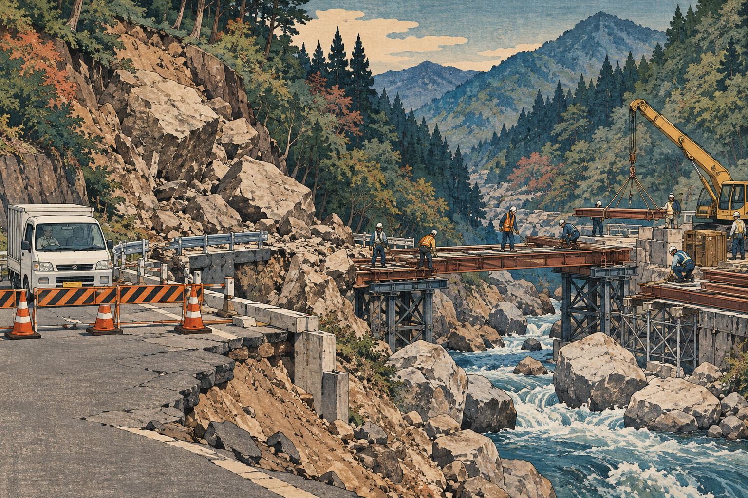
A damaged stretch of road only about 30 meters long has kept a vehicle connection closed for more than three months in Shiiba, a mountain village in Miyazaki Prefecture. The hoped-for end-of-September reopening has now moved to an estimated mid-October.[1],[2]
The obstacle is underground. Miyazaki Prefecture said on September 25 that unexpectedly large boulders were present in quantity where crews are installing the H-section steel piles supporting a temporary bridge. Dealing with them is taking additional time. Weather and other conditions could still alter the revised outlook.[1]
For residents and businesses arranging journeys around the closure, the announcement extends a period of uncertainty. The immediate issue is how to restore passage. The broader issue is how a dispersed mountain community maintains dependable access when a small break interrupts a much larger road network.
Three different stages of recovery
The road shoulder failed during heavy rain associated with the seasonal rain front on June 24, closing Route 265 at Imamura in the village’s Okawauchi (大河内) district. The prefecture’s July account records investigations beginning the following day, then surveying, geological work and tree clearing on June 26. A pedestrian passage opened July 10.[2]
That pedestrian connection is distinct from vehicle access. A walking route cannot perform every function of a road carrying people, equipment and deliveries. Nor is the planned temporary bridge the same as permanent restoration. The July plan explicitly placed the main restoration work after installation of the bridge.[2]
These distinctions matter when interpreting a reopening announcement. Restoring a way through, allowing specified vehicles to use it and finishing the permanent road are separate milestones. A mid-October estimate for the temporary crossing should not be read as a promise that all restoration activity will end then.
Why a temporary bridge can still be difficult
The prefecture identifies the difficulty at the pile-installation locations. H-section describes the shape of the steel members. The boulders in this account are within the ground; the notice is not announcing a fresh episode of falling rocks at the site.[1]
The word “temporary” describes the crossing’s role in recovery, not an exemption from the need to support traffic. Installing the bridge depends on completing its supporting structure. The latest explanation shows why the visible gap in a road is not, by itself, a measure of how quickly a crossing can be provided.
It does not, however, establish that the original investigation was negligent or the design defective. Those conclusions would require evidence beyond a short progress notice. This report does not infer a contractor’s method, a redesign or a construction-cost increase from the presence of unexpected boulders.
A useful next update would explain the remaining work as well as the opening estimate. Households and businesses cannot plan around a date with the same confidence when its dependencies are unclear. The prefecture says it will provide another announcement once the reopening outlook is established.[1]
A working landscape, not simply a remote destination
Shiiba occupies 537.29 square kilometers in the central Kyushu mountains, in northwestern Miyazaki. Its official profile describes settlements scattered across steep terrain. Agriculture and forestry are principal industries, including cedar and cypress timber production and flowers and vegetables suited to cooler highland conditions.[4]
That geography makes access an economic service as well as a personal convenience. Roads link work sites, suppliers, customers and essential errands. A detour can require a different vehicle or a different sequence of stops, not merely more fuel. Those are practical implications of disrupted access, rather than measured losses established for this particular closure.
The village’s April 2025 forestry vision identifies labor shortages and an increase in forests receiving insufficient care. It proposes balancing commercially managed forest with areas managed more strongly for environmental purposes. The document is not an assessment of the current road failure. It nevertheless places the access question within a larger effort to sustain work and stewardship in the mountains.[7]
For a business serving a rural area, predictability has value. Delivery windows, staff assignments and visits can be organized around a known restriction. Repeatedly changing expectations require those arrangements to be revisited. Establishing the actual burden in Imamura would require records from users; the construction announcement alone cannot supply a yen total or an average delay.
A history of opening routes—and keeping them open
Shiiba’s official chronology records completion in 1933 of the road connecting Tomitaka, now part of Hyuga City, with Kamishiiba. It also records completion of the Route 265 Kamishiiba bypass in October 1993. Neither event concerns the present bridge site, but both illustrate the village’s long effort to improve connections.[5]
A completed road remains a continuing obligation. Improvements at one location do not remove the importance of another vulnerable section. In a network, the usefulness of a route depends on being able to complete the journey, not simply on the quality of its best segment.
Recent history makes that point more directly. A June 2025 prefectural announcement described damage from the late-August 2024 typhoon to roads linking the Okawauchi district and Shiiba’s center. Users had been diverting onto mountain roads with poor surfaces. Improvement work ran from October 2024 to June 2025.[3]
The work covered 7.6 kilometers of a three-meter-wide detour, including paving previously unpaved stretches and adding guardrails and curve mirrors at hazardous locations. Even after completion, the prefecture warned about the narrow width. An available alternative did not mean an equivalent road.[3]
That is historical context, not a present-day routing recommendation. The 2024 damage and 2025 works must not be conflated with the June 2026 collapse at Imamura. An old completion notice cannot establish that a particular detour is currently open or suitable for a particular vehicle.
The cost of maintaining connections
The village’s sixth comprehensive plan treats road maintenance, preventive repairs to structures and access to different forms of transport as linked responsibilities. It also recognizes the need to understand road conditions and use limited budgets efficiently. Recovery from one failure takes place within that wider maintenance task.[6]
Japan.co.jp’s assessment is that the useful measure of recovery should include the conditions under which movement resumes. Which journeys become possible again? Are there vehicle restrictions or controlled passage? How does subsequent permanent work affect access? These questions describe what users need to know; they are not assertions that specific restrictions have already been decided for the temporary bridge.
A reopening at one point also does not establish unrestricted travel along the whole route. Shiiba has separately announced timed closures for disaster-recovery work in Route 265’s 下水流 area, in 大字下福良, from September 3 through September 30. That is a different location and a different restriction from Imamura’s full closure.[9]
What travelers can rely on now
The mid-October timing remains an estimate. Readers planning a journey should consult Miyazaki Prefecture’s current road-restriction service and Shiiba’s road notices, checking the relevant locations and the conditions for their vehicle. The source links below distinguish the latest reopening announcement from historical material.[1],[8]
The distinction is especially important for businesses: an opening estimate is not a confirmed dispatch instruction, and a road number is not a guarantee of a clear route from end to end. The usable information is the current status of each relevant section.
For Shiiba, the temporary bridge will mark an important stage in recovering a connection interrupted in June. Permanent restoration follows. The significance of that sequence is best understood from the users’ side: first a way to pass, then a road restored for the longer term—and throughout, enough reliable information to keep everyday life and work moving.
