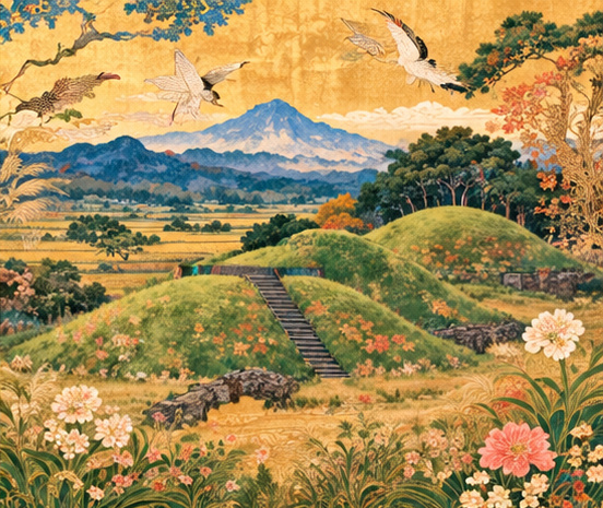
A landscape that remembers
On a plateau in southern Japan, grassy rises are more than scenic interruptions. They are the surviving outlines of tombs built by communities some 1,700 years ago. Across the Saitobaru landscape in Miyazaki Prefecture, the arrangement of those earthworks records an ancient political and social world that written sources describe only imperfectly.
A special exhibition, “The Afterglow of Hyūga: The Kofun Landscapes of Southern Miyazaki,” opened at the Saitobaru Archaeological Museum on October 10 and runs through December 13. Its subject is not simply the artifacts retrieved from graves. It is the unusual survival of a landscape in which the tombs can still be seen in relation to one another.
One plateau, hundreds of monuments
The Saitobaru group extends roughly 4.2 kilometers from north to south and 2.6 kilometers east to west. Official prefectural archaeological records count 319 surviving above-ground mounds: 31 keyhole-shaped, two square, one scallop-shaped and 285 round. That total does not count every underground burial structure or earthwork destroyed in earlier centuries.
The numbers matter because “ancient Japan” was never a single, uniform burial culture. Monumental tombs provide evidence of concentrated labor and status, while smaller mounds, tunnel tombs and regional burial practices reveal more complicated communities. The surviving topography makes these differences visible in a way that detached museum objects cannot.
What the great tombs can and cannot tell us
The complex appears to have developed from the late third or early fourth century. By the first half of the fifth century, exceptionally large tombs were being built, including Osahozuka and Mesahozuka, each approximately 176 meters long. The former is a celebrated scallop-shaped mound; the latter is described in regional documentation as Kyushu’s largest keyhole-shaped tomb.
They testify to the ability of elites to organize enormous building projects and suggest connections with political trends elsewhere in the Japanese islands. They do not, by their shape alone, reveal the name of the deceased or establish a complete map of allegiance to the Yamato court. Archaeologists must work from burial forms, stratigraphy, associated objects and chronology rather than treating later legend as proof.
How the site became an archaeological landmark
Saitobaru is also a chapter in the history of archaeology itself. Excavations conducted between 1912 and 1917 investigated 30 mounds with specialists from Tokyo and Kyoto imperial universities and other institutions. Saito City’s historical account notes both the scholarly importance of the excavations and the contemporary political desire to connect the region to narratives of imperial origins. That dual history deserves to be acknowledged, not polished away.
National historic-site designation followed in 1934, and special historic-site status in 1952. Development as an early fudoki-no-oka archaeological landscape began in the 1960s, while the present museum opened in 2004. Modern custodians therefore inherit more than ancient tombs: they inherit a century of decisions about digging, reconstruction, interpretation and preservation.
Four municipalities, one heritage story
Miyazaki’s heritage designation has an unusually regional structure. The Japan Heritage story “Monuments of the Ancients — Kofun Landscapes in Southern Miyazaki” received recognition in fiscal 2018 and now encompasses Saito City, Miyazaki City, Takanabe Town and Shintomi Town. The exhibition brings together landscape photographs and archaeological finds associated with Saitobaru, Ikime, Hasugaike, Mochida and Nyutabaru.
That is a different designation from UNESCO World Heritage inscription. Japan Heritage is a national storytelling and regional heritage initiative, not a declaration that each site is internationally inscribed. The practical test is whether it strengthens conservation, public understanding and responsible local tourism rather than producing only a promotional logo.
Why scenery is evidence
A museum can protect excavated pottery behind glass. It cannot place an entire plateau in a display case. Kofun are built from earth, and the spaces around them—their placement along ridges, distances from other mounds and relationship to routes and settlements—are part of the archaeological record. Miyazaki’s relatively open mound landscapes are valuable precisely because visitors can still perceive these relationships.
But the countryside today is not a perfect reconstruction of the fifth century. Modern flowers, managed lawns, paths and farms belong to later histories. Preserving the legibility of the tombs is not the same as recovering every plant, settlement and belief that surrounded their original construction. A sophisticated exhibition can help visitors understand both the evidence and its limits.
The cost of being discovered
There is a productive tension between promoting an archaeological attraction and safeguarding it. Better access can support local guides, schools and museums; more footsteps, vehicles and infrastructure can also complicate preservation. For residents, the plateau is part of daily geography. For visitors, it may be a single spectacular excursion. Heritage policy has to reconcile those viewpoints.
The exhibition’s decision to pair archaeological material with landscape imagery provides a particularly useful bridge. Visitors can learn what a mound is before walking to it, and return to the museum with questions about size, construction and neighboring sites. It treats the site as both a source of knowledge and a responsibility held in common.
How to visit—and a date worth checking
The exhibition occupies the museum’s basement-level exhibition room, and admission is free. The museum ordinarily operates from 9:30 a.m. to 5:30 p.m., with last exhibition-room entry at 5 p.m. A related symposium is scheduled for October 25, including representatives of the four participating municipalities and cultural heritage specialists; advance telephone registration is required. The broader Japan Heritage Festival in southern Miyazaki is scheduled for November 7–8.
For anyone reading on the October 13 publication date, one detail is essential: the museum’s published calendar specifically lists Tuesday, October 13 as a closed day. Visitors should check the current calendar rather than assuming an exhibition remains open every day of its run. The lasting reason to make the journey is not simply to see an ancient monument. It is to see how a landscape can carry the memory of a society, and how today’s communities decide what of that memory will survive.
Sources and further reading
- Miyazaki Prefecture: exhibition announcement
- Miyazaki archaeological archive: exhibition and municipalities
- Miyazaki Prefecture: Saitobaru mound inventory
- Saito City: history of archaeological investigation
- Museum: closure calendar
- Museum: 2026 event calendar
- Agency for Cultural Affairs: Japan Heritage recognition
- Miyazaki archives: Ikime
- Miyazaki archives: Nyutabaru
- Japan Heritage: conservation landscape
Sources reviewed October 10, 2026. This feature relies on official program announcements and published archaeological sources; it does not claim onsite reporting or firsthand examination of exhibits.