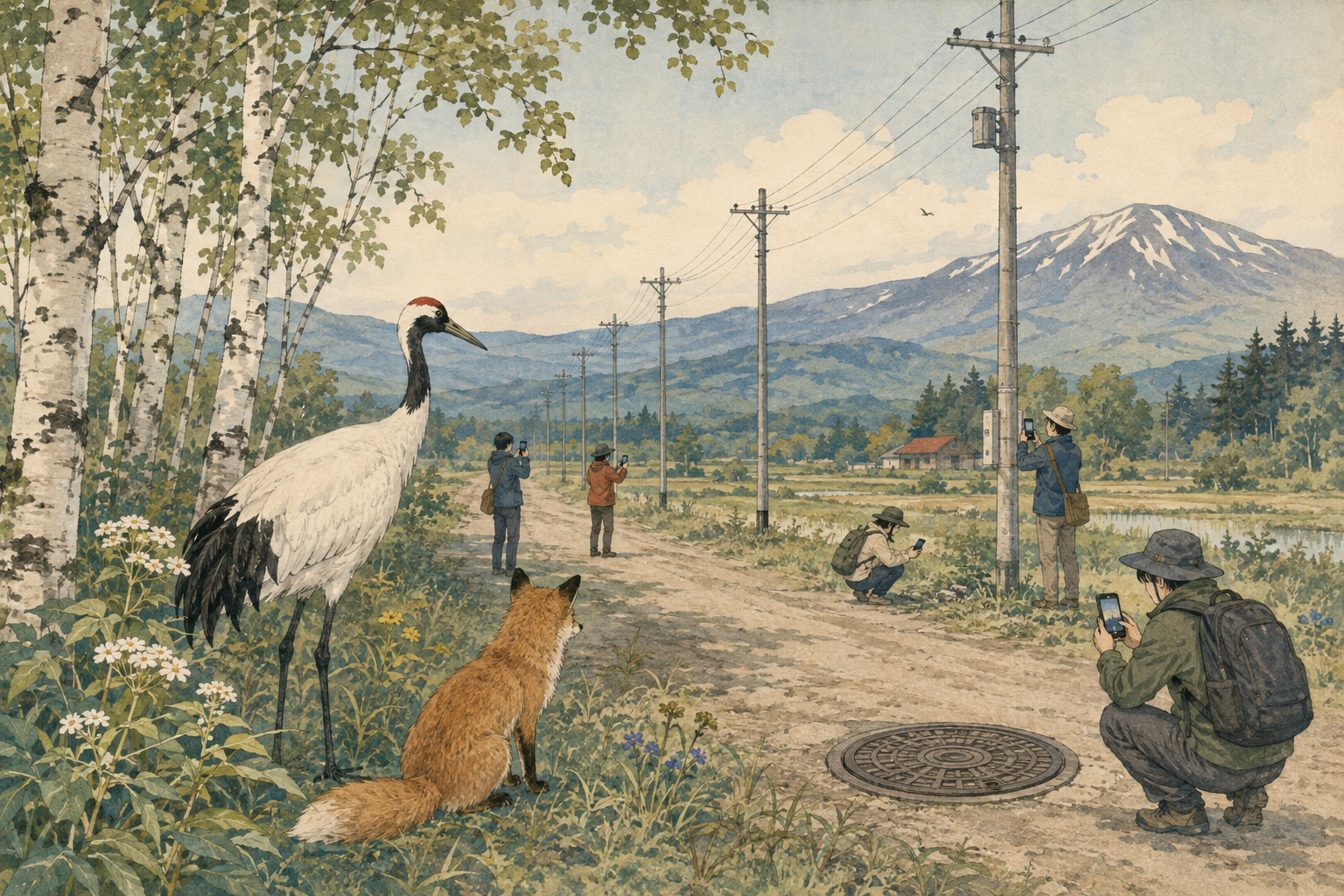
A utility pole is designed to disappear into ordinary life. It holds up conductors, transformers and communications lines, absorbs wind and ice, and stands through decades of road work, salt, snowplows and passing traffic. A manhole cover is even easier to ignore: a patterned circle in the road, noticed chiefly when it rattles or floods.
Beginning Saturday, those overlooked objects become game pieces across Hokkaido. Players using the free PicTrée smartphone app will choose one of three locally themed teams—red fox, long-tailed tit or brown bear—then check in, photograph designated assets and connect poles on a map. First photographs earn coins; rankings bring additional rewards; coins can be exchanged for benefits including Amazon gift cards.
The 2026 season is organized by Digital Entertainment Asset, Growth Ring Grid, Hokkaido Electric Power Network and NTT ME. It covers all of Hokkaido from August 8 to November 3, although organizers may alter or end the campaign as photography progresses. Shooting is limited to daylight windows: 5 a.m. to 7 p.m. in August, 5 a.m. to 6 p.m. in September, and 6 a.m. to 5 p.m. in October and November.
Why Hokkaido Is the Hard Case
Hokkaido is not merely another service territory enlarged on a map. The prefecture accounts for about 22 percent of Japan’s land area and contains 179 municipalities. Its population is dispersed among Sapporo, regional cities, fishing ports, farming towns, mountain settlements and islands. A network crew can spend much of a day driving between small clusters of equipment.
The climate writes its own maintenance schedule. Freeze-thaw cycles open pavement and disturb foundations. Snow hides covers and roadside damage. Plows and heavy vehicles strike or stress equipment; coastal salt and airborne spray promote corrosion; wet snow, wind and ice load overhead lines. Spring reveals defects that winter concealed, while summer offers the safest broad window for collecting consistent photographs.
That geography makes a current visual inventory unusually valuable. A phone image with time and location can answer basic but important questions: Is the asset still where the database says it is? Is its identifying plate readable? Has vegetation crowded it? Is a cover buried, tilted or surrounded by failing pavement? Has construction changed the scene?
These are screening questions, not structural diagnoses. A photograph cannot measure concrete strength inside a pole, test an underground chamber, confirm electrical clearance or determine whether corrosion is superficial. Its power lies in coverage: millions of ordinary observations can tell specialists where to look first.
From 730,000 Poles to a Broader Network
The project is not beginning from zero. PicTrée held its first Hokkaido-wide season from July 12 to October 12, 2025. The organizers later reported that participants photographed about 730,000 poles in three months. Governor Naomichi Suzuki called the result symbolic for a prefecture whose scale and dispersed settlement make network management exceptionally laborious.
That first season supplied proof of participation as much as equipment imagery. Some players traveled from Tokyo and Tohoku specifically to photograph poles, according to the organizers, turning maintenance data collection into an unusual form of tourism. Local businesses joined promotions. What had been a repetitive field task acquired teams, scores, routes and a finish line.
The 2026 design narrows the Hokkaido Electric target from the roughly 1.5 million poles described in the earlier campaign to about 900,000 designated poles, while adding approximately 35,000 NTT ME manholes and handholes. The addition matters. It tests whether a game built around visible vertical landmarks can also gather useful, correctly framed records of less conspicuous ground-level communications assets.
Groups of up to five people can compete as school classes, company departments, community organizations or families. A parallel Hokkaido Electric Power Network and NTT ME group cup promises the winning group reward coins worth ¥1 million, while the general season offers per-asset first-photo coins and ranking rewards.
| Feature | 2025 inaugural season | 2026 season |
|---|---|---|
| Coverage | All Hokkaido | All Hokkaido |
| Period | July 12–October 12 | August 8–November 3 |
| Reported result / target | About 730,000 poles photographed | About 900,000 poles plus 35,000 manholes and handholes targeted |
| Network partners | Hokkaido Electric Power Network; NTT ME poles were later added | Hokkaido Electric poles and NTT ME underground-access assets from launch |
The Long Maintenance Reckoning
Japan’s infrastructure problem was built into its success. During the high-growth decades after World War II, the country laid roads, bridges, tunnels, water systems, power distribution and telephone networks at extraordinary speed. The assets enabled industrialization and raised living standards; they also created a large cohort that would age together.
The 2012 Sasago Tunnel ceiling collapse made deferred and inadequate inspection a national trauma. Concrete ceiling panels fell on vehicles in Yamanashi Prefecture, killing nine people. The disaster concerned a highway tunnel, not utility poles, but its lesson traveled across infrastructure sectors: maintenance is not the quiet residue after construction. It is a permanent public-safety system.
Japan responded with infrastructure longevity plans, recurring close visual inspection requirements for road bridges and tunnels, asset-management programs and greater support for sensors, robotics and digital records. Yet technology does not erase the arithmetic. The number of aging objects rises while many municipalities, contractors and utilities face retirements, recruitment shortages and constrained budgets.
Hokkaido adds depopulation to distance. Fewer residents do not necessarily mean proportionally less network. Long lines still connect small settlements, farms, ports and public facilities. The fixed geography of service can remain even as the pool of workers and ratepayers shrinks.
Postwar decades Rapid electrification, road building and communications expansion create the modern network.
December 2012 The Sasago Tunnel ceiling collapse kills nine and intensifies national scrutiny of maintenance.
2013–2014 Japan establishes longevity planning and tighter recurring road-structure inspections.
April 2024 PicTrée launches as a citizen-participation infrastructure game.
July–October 2025 The first Hokkaido season records about 730,000 pole photographs.
August 8, 2026 The second season begins with underground communications access points added.
What a Photograph Can Do
Traditional inspection and a crowd image occupy different layers. A qualified inspector follows a standard, views prescribed components, may touch, sound or measure them, classifies defects and accepts professional responsibility. A participant produces a visible record from a safe public position. Conflating the two would be dangerous; combining them can be useful.
At minimum, photographs can refresh an asset register. Location, timestamp, direction and equipment identifiers help reconcile the map with reality. Repeated images can support change detection. Machine-learning systems may flag leaning poles, damaged labels, vegetation, surface cracking or abnormal surroundings, but any automated finding still needs validation and an escalation rule.
The greatest gain may be prioritization. Sending a trained crew to every object merely to learn that most look unchanged is expensive. A broad image layer can help owners direct scarce expertise toward anomalies, uncertain records and areas affected by storms or construction.
There is also civic value. Infrastructure normally becomes visible only when it fails. A game asks residents to notice the system before an outage, and to understand that the pole on a rural bend and the cover outside a shop belong to interconnected networks requiring constant care.
The Game Mechanics—and Their Biases
Gamification solves a motivation problem by attaching immediate feedback to a diffuse public good. Players receive points and coins, see progress on a map, compete in rankings and coordinate routes. The three animal teams give a vast technical inventory a simple social identity.
But incentives shape data. Players naturally prefer dense, accessible neighborhoods where many assets can be collected quickly. Remote poles—the very ones costly for owners to visit—may be least attractive. Ranking pressure can encourage rushed framing, duplication or unsafe stopping. Valuable datasets therefore require rules, quality checks and reward structures that favor coverage and accuracy, not just volume.
There is a second bias in timing. The official daylight windows improve safety and image quality, but snow, fog, rain and summer vegetation can conceal the condition that matters. A single season is a snapshot. Maintenance intelligence becomes stronger when images are comparable across years, weather events and repair cycles.
- Clear instructions to photograph only from safe, lawful public locations.
- Automated and human checks for duplicates, wrong assets and unusable images.
- Protection of precise location data and incidental faces, homes and license plates.
- A documented path from a flagged image to expert review, work order and closure.
- Public reporting that distinguishes assets photographed from defects verified or repaired.
Safety Cannot Be a Side Quest
Poles stand beside roads and carry energized equipment. Manholes sit in carriageways, intersections and sidewalks. The correct photograph is never worth stepping into traffic, touching equipment, entering private property, climbing, opening a cover or approaching storm-damaged lines.
Operators must design out risky behavior: daylight-only collection, geofenced targets, warnings before capture, rejection of images taken too close to dangerous locations and no rewards that make speed more valuable than judgment. Participants should obey road rules, avoid photographing while driving and leave emergency hazards to police, fire services and the utility’s official reporting channels.
Privacy is less dramatic but equally structural. Geotagged street photography can include faces, vehicle plates, house entrances and patterns of movement. Data retention, access controls, image redaction and the boundary between game profiles and infrastructure records deserve plain-language disclosure.
Who Owns the Truth?
A modern asset record is not merely a photograph. It is a chain of custody: which object was intended, who captured it, when and where, whether the image passed quality control, what anomaly was suspected, who verified it, what action followed and whether that action closed the case.
That chain matters because a cheerful public campaign can otherwise confuse activity with outcome. Nine hundred thousand photographed poles would be impressive; it would not mean nine hundred thousand formal inspections were completed. Thirty-five thousand visible covers would not reveal the internal condition of every chamber beneath them.
The durable value will be measured downstream: fewer unnecessary truck rolls, faster reconciliation of records, better storm response, earlier identification of anomalies and documented repair decisions. Those are harder metrics than download counts, but they determine whether citizen sensing becomes infrastructure practice rather than a seasonal spectacle.
A Japanese Tradition of Citizen Observation
Citizens have long helped produce knowledge that institutions could not gather alone. Volunteer weather observers, natural-history societies, neighborhood disaster maps and river-monitoring groups expanded the reach of professionals. Smartphones add precise time, position and imagery; games add persistence.
Japan has become an active laboratory for this combination. Platforms such as TEKKON have asked users to photograph and review manholes and poles nationwide, while municipalities have experimented with resident road-damage reporting. PicTrée’s distinctive move is to combine a utility-defined asset set with a territorial team game and rewards.
The technique belongs to a broader shift from periodic inspection toward continuous awareness. Fixed sensors report vibration or temperature. Vehicles gather street-level imagery. Drones reach structures difficult to view from the ground. Residents add opportunistic observations. None is sufficient alone; together they can make a network less opaque.
From Summer Contest to Maintenance System
For Hokkaido, the most consequential question arrives after November 3. Can the partners convert a summer map of attention into a repeatable workflow? Can the imagery integrate with Hokkaido Electric and NTT ME asset systems? Can missing or questionable records generate targeted revisits? Can an anomaly be traced to a professional decision?
Repeatability also determines economics. Prize funds and publicity can produce a burst of coverage. A maintenance system must continue after novelty fades, must reach sparse districts and must preserve consistent standards. Rewards may need to rise for difficult assets and fall for saturated blocks; local governments and schools may become long-term partners; storm-response modes may differ from ordinary collection.
The project’s public language speaks of making infrastructure maintenance something anyone can join. The democratic insight is sound, provided responsibility remains clear. Residents can supply eyes, context and reach. Asset owners and licensed professionals must retain the duty to assess risk, prioritize work and keep networks safe.
The Quiet Hardware Comes Into View
Hokkaido’s landscape encourages grand scale: mountains, wetlands, fields and coastlines. PicTrée asks people to look instead at the repeated human marks crossing that landscape—a line of poles receding toward a farm, a communications cover set into a town street.
Each image is modest. Even 935,000 possible targets are only fragments of a much larger maintenance burden. Yet infrastructure resilience is built from such fragments: accurate records, noticed changes, disciplined follow-up and the refusal to let familiar objects become invisible.
If the 2026 campaign succeeds, its most important achievement will not be the winning animal team or the largest coin balance. It will be evidence that the public’s everyday movement can generate a useful first layer of knowledge—and that specialists can turn that layer into safer, more efficient work.
The pole still needs an engineer. The manhole still needs a responsible owner. But before either can be maintained, someone has to see it. Across Hokkaido this summer, that first act of seeing is becoming a game.
Reporting notes and principal sources
Campaign details and 2025 performance figures are organizer-reported. Japan.co.jp uses “inspection” in the broad news sense of public visual data collection; the article distinguishes that activity from formal engineering inspection, diagnosis and repair.
- Digital Entertainment Asset: 2026 Hokkaido campaign announcement
- PicTrée: official season details and participation rules
- Digital Entertainment Asset: reported results of the 2025 Hokkaido season
- Digital Entertainment Asset: announcement of the first Hokkaido campaign
- Ministry of Land, Infrastructure, Transport and Tourism: guide to new infrastructure-maintenance technology
- MLIT: preventive road maintenance and recurring inspection framework
- Central Nippon Expressway: Sasago Tunnel accident and safety response
- Hokkaido Government: prefectural data and municipal geography