- A letter from the moment a boundary moved
- The date that made something like modern Gifu
- Two countries before one prefecture
- The bewildering map of the early Meiji years
- How an imperial government transferred a region
- The resident official who did not see it coming
- What a map can show—and what it cannot
- A boundary that did not stop changing
- A small archive and a large question
- An anniversary shaped by paperwork, not pageantry
- What it means to live inside an inherited line
A letter from the moment a boundary moved
A prefecture may look permanent on a modern map, but in August 1876 one official in the Hida mountains reacted to a new border as though the ground had shifted beneath him. Katō Ichibē, the headman of Shimohara village in what is now Gero City, wrote to a superior after hearing that Chikuma Prefecture would cease to exist and Hida would be transferred to Gifu. An archival explanation preserves his vivid account of feeling so shocked that he might drop what he was holding. This was not a popular referendum or a dramatic battlefield conquest. It was a change in jurisdiction, announced through the machinery of the new Meiji state. Yet the human reaction supplies the essential counterpoint to the familiar narrative of administrative modernization. The Gifu Prefectural Archives is revisiting the merger for its 150th anniversary, showing how a line on a map became a lived political reality.
The date that made something like modern Gifu
The decisive date is August 21, 1876. As part of a broader consolidation of Japanese prefectures, the central government abolished Chikuma Prefecture and transferred Hida’s three districts—Mashita, Ōno and Yoshiki—to neighboring Gifu. This is the origin of the anniversary. It is not strictly the 150th birthday of the name Gifu Prefecture, which had existed since 1871 and initially encompassed Mino. Nor is it the exact moment every modern boundary was fixed, since adjustments followed. The distinction matters: Japan’s prefectures emerged through successive reorganizations, not through the simple renaming of ancient provinces. The 1876 action brought a northern mountainous region and the more southerly Mino region under a common administration. Gifu’s present geography became recognizable, but its identity continued to evolve.
Two countries before one prefecture
Mino and Hida were historical provinces whose contrasts remain visible. Mino opens toward the Nōbi Plain, where transport corridors, river settlements, merchants and later manufacturing helped create a diversified economy. Hida, with Takayama as an enduring center, is shaped by mountain valleys, forestry, timber architecture and the routes across the Japanese Alps. These are broad cultural and geographic differences rather than immutable identities. Even within each historic province, communities followed different local patterns. Nevertheless, combining them into a prefecture was not simply an administrative recognition of a single already-unified society. The Meiji government was designing a new system to replace domains and direct shogunal territories. The historical question is not whether Mino and Hida were destined to unite, but how central decision-making, local administration and practical constraints came together to make a new prefectural unit.
The bewildering map of the early Meiji years
The political map changed repeatedly after the 1868 Restoration. Areas previously under shogunal administration passed into new prefectural jurisdictions. Kasamatsu became a key seat of authority in Mino, while Takayama Prefecture was formed in Hida. The 1871 abolition of the domains and associated consolidation created Gifu Prefecture across Mino. Hida took a different path: Takayama Prefecture was folded into Chikuma, along with territory in Shinano that largely lies in modern Nagano Prefecture. A Chikuma map preserved through Takayama City Library places Hida settlements such as Takayama and Furukawa within the same jurisdiction as towns farther east and south. The arrangement looks counterintuitive only if the boundaries drawn later are treated as timeless. For roughly five years, Hida’s prefectural ties pointed partly toward what is now Nagano.
How an imperial government transferred a region
The archives preserve an administrative notice issued by Iwakura Tomomi, then a senior national official, informing Gifu of Chikuma’s abolition and Hida’s incorporation. According to the archive’s description, Interior Minister Ōkubo Toshimichi issued rules for transferring administrative responsibilities the following day. In September, Gifu’s prefectural governor traveled to Takayama for the handover of Chikuma’s business. The transfer involved far more than producing a new map: officials had to deal with records, budgets, lines of authority and the practical business of governing villages separated by mountains. These are details that ordinary anniversary accounts often overlook. An official notice tells us what the government ordered; correspondence and local documents help reveal how implementation reached communities. They are complementary forms of evidence, not interchangeable testimony.
The resident official who did not see it coming
The letter by Shimohara headman Katō Ichibē was addressed to Ōmae Hisarō, an official responsible for a district encompassing villages in Mashita. Its archival catalog identifies it as part of the Ōmae family papers, document A10-(4)-14. The author expressed surprise at the sudden news, yet also indicated his intention to accompany incoming Gifu officials when they reached Hida. That combination matters. Surprise does not necessarily mean organized resistance, and a willingness to cooperate does not mean wholehearted approval. One surviving letter cannot establish the prevailing opinion of every Hida farmer, merchant or official. It does, however, puncture the idea that the merger was an abstract event understood identically in Tokyo and in every valley. A local document recorded the delay between the central government’s decision and the moment its consequences became real.
What a map can show—and what it cannot
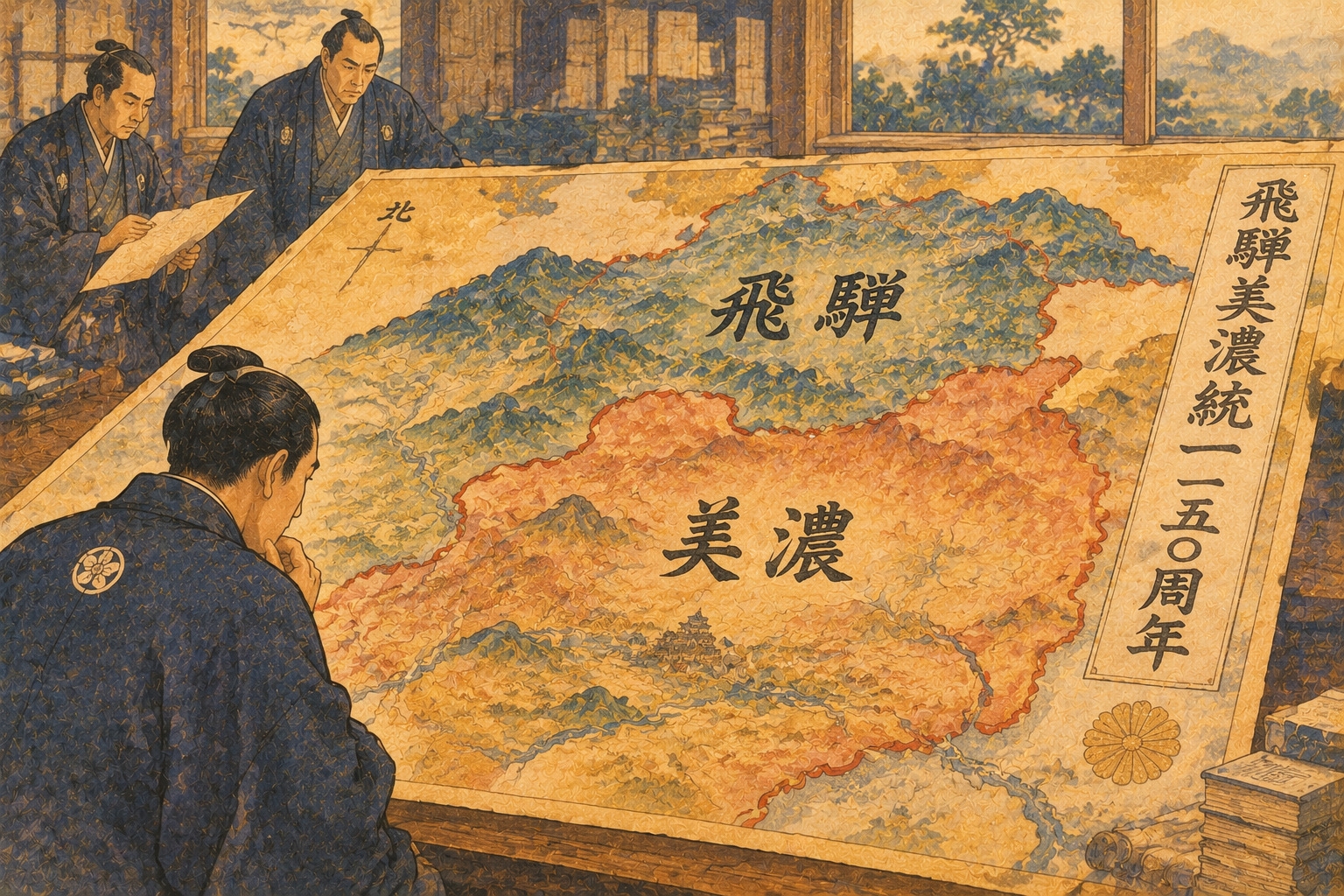
For its anniversary, the Gifu Prefectural Library mounted a separate display of maps and regional books. The institution describes holdings of about 160,000 maps and 180,000 local-history items; the exhibition connected changes in territory to 17 later events in the prefecture’s history. The library’s earlier 130th-anniversary display juxtaposed an 1872 map of Japanese prefectures, drawn when Mino and Hida had separate jurisdictions, and an 1880 official map of Gifu showing the merged area. These two images offer a particularly clear visual grammar for administrative history. The colors and lines changed; the mountains did not. Maps reveal the outcome but seldom explain how a letter arrived in a village, which records officials inherited or what households thought of the new administration. Read alongside notices and personal correspondence, their meaning becomes much richer.
A boundary that did not stop changing
Gifu did not become an unchanging container in 1876. Later Meiji adjustments altered small border areas, and in 2005 Yamaguchi village transferred from Nagano Prefecture through its merger into Nakatsugawa City. Local government boundaries also changed dramatically over generations of municipal consolidation. Official prefectural material currently lists 42 municipalities: 21 cities, 19 towns and two villages. That continuing evolution helps explain why 150 years is not merely a commemorative number. The same prefecture today must govern cities with major factories, valleys dependent on transport links, aging villages and globally recognized tourism destinations. No single historic administrative formula resolves their competing needs. The history invites questions about how shared services, political representation and regional identities can coexist across very different landscapes.
A small archive and a large question
The anniversary exhibition is titled Hida–Mino Merger, 150 Years: How Was Gifu Prefecture Born? Its official Japanese title uses the character 飛驒, a variant frequently rendered 飛騨 in contemporary usage. Running October 13 through November 27, 2026, it presents Meiji-era Gifu prefectural documents and material about how people experienced the merger. It is at the Gifu Prefectural Archives, 4 Yūhigaoka, Gifu City, on the first-floor exhibition hall. Admission is free, opening hours are 9 a.m.–4:30 p.m., and weekends and public holidays are generally closed, except for the designated November 3 opening. The listed telephone number is 058-263-6678. Readers should confirm any unscheduled closure before visiting. This article is based on the published catalog and announcements; it does not claim an on-site inspection of every object on display.
An anniversary shaped by paperwork, not pageantry
A separate prefectural commemoration was planned for August 23 in Gero, and the prefectural library used older maps and books to explore the subject in September and October. The archives’ autumn exhibition approaches the anniversary through the documents of the governing process. That division of labor is useful. Speeches and celebrations give a modern community a shared occasion; an archive can reveal whether the tidy official narrative captures what contemporary participants experienced. The 1876 letter, in particular, shows why local voices are indispensable. It is also worth being careful about titles and names: the old Hida district known as Mashita is not identical to the present-day administrative structure, and historical spellings appear differently across catalogs. Transparent translation is a stronger editorial choice than silently smoothing away those differences.
What it means to live inside an inherited line
The merger offers no simple moral ending. Administrative consolidation may make governance more coherent, yet central decisions can catch local communities by surprise. Regional distinctiveness can remain even when a prefectural border is stable for generations. The lesson of the Gifu archives is not that the 1876 outcome was inevitable, or that every resident greeted it in the same way. It is that a government decree, a map and a headman’s letter tell three different parts of the same story. Together they explain why one of Japan’s familiar prefectures looks the way it does. A century and a half later, Hida and Mino share political institutions without surrendering all the cultural differences that made them recognizable. The line drawn in 1876 persists, but its meaning is still worked out by the people living within it.
Sources and reporting method
The public archival catalog and municipal historical records take priority; contemporary reporting provides supplementary exhibition context. One 1876 letter is not evidence of a region-wide consensus.
- Gifu Prefectural Archives: exhibition announcement and visitor information
- Gifu Prefectural Archives: 1876 letter reacting to Chikuma abolition
- Gifu Prefectural Archives: Iwakura Tomomi’s notice of the merger
- Gifu Prefectural Archives: collection access and public information
- Gifu Prefectural Library: anniversary exhibition of maps and books
- Gifu Prefecture: 150th-anniversary ceremony announcement
- Takayama City Library: Chikuma Prefecture map and historical chronology
- Gifu Prefectural Library: historical maps, including the 1880 Gifu prefectural map
- Gifu Shimbun: November 4 report from the archival exhibition
- Gifu Prefectural Library: related anniversary materials
- Japan Center for Asian Historical Records: guide to Gifu archival holdings