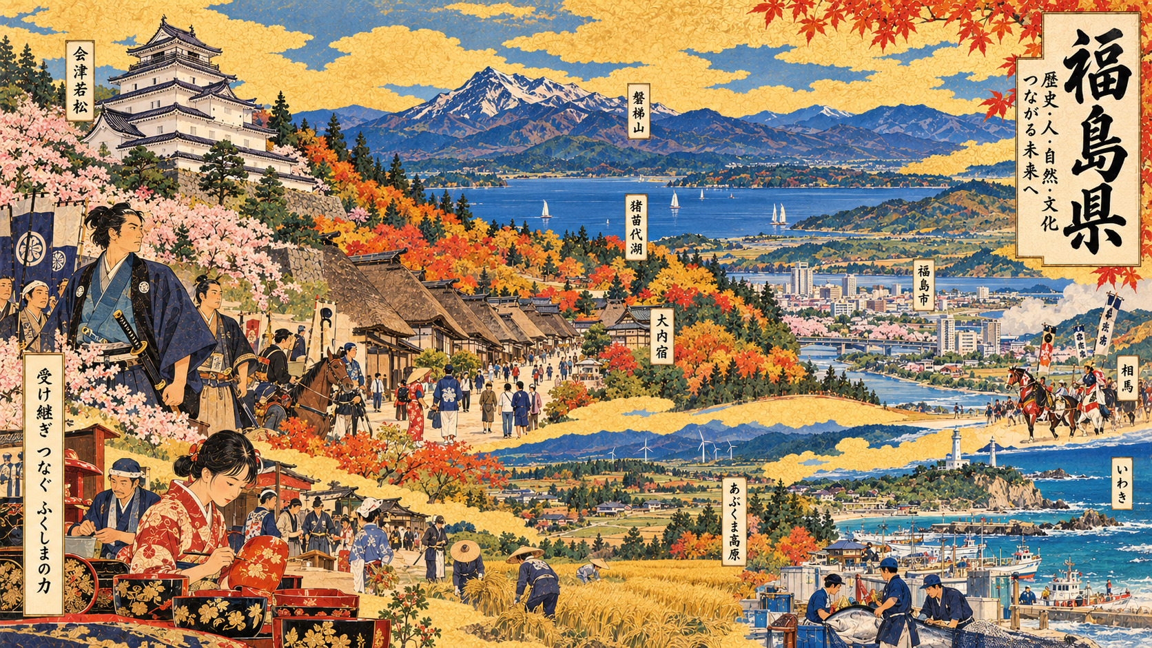
One prefecture, three Japans
Stand beside the lake at Inawashiro and Fukushima appears to be a place of mountain light and water. Walk through Aizu-Wakamatsu and you encounter the memory of a defeated samurai domain. Travel east toward the Pacific and a different history emerges: fishing ports, industrial infrastructure, communities rebuilding after the 2011 disaster. All three belong to the same prefecture, and none can stand for the whole.
In August 2026, Fukushima marked 150 years since the administrative union that created almost its present boundaries. Its anniversary is more than a ceremony. It invites a difficult question: how can a geographically vast, culturally varied prefecture preserve its communities while its population shrinks and the legacy of a nuclear accident remains unresolved?
What 150 years actually commemorates
Fukushima did not begin in 1876. Its settlements, trade routes, religious institutions, agricultural communities and domains have far older histories. August 21, 1876, marks the consolidation of the former Fukushima, Iwaki (Iwasaki, 磐前), and Wakamatsu prefectures under the early Meiji state’s administrative reforms. The merger established roughly the prefecture familiar today. The prefectural history archive records complicated earlier boundary changes, and the 1876 boundaries were not identical to the current ones.
It was a political reorganization of territories that were never culturally uniform. Understanding that difference is essential to understanding contemporary Fukushima: the administrative map brought multiple regional identities under one roof.
Aizu, Nakadori and Hamadori
Aizu, in the mountainous west, is associated with heavy winter snow, rice-growing basins, castles and traditional crafts. Nakadori—the central corridor—is home to Fukushima City, Koriyama and other urban and industrial centers connected by rail and highways. Hamadori runs along the Pacific, where fishing, ports, coastal settlements and energy facilities have shaped livelihoods.
Mountain barriers help account for stark differences in climate and movement. A snowy day in inland Aizu can coincide with comparatively mild coastal weather. These are not merely scenic distinctions. Geography influences access to medical care, school transport, industrial location, tourism seasons and the cost of maintaining public services.
The castle and the price of history
Aizu’s place in the national imagination owes much to the Boshin War of 1868–69. The Aizu domain fought on the losing side of the conflict that helped establish the Meiji government. The siege of Tsuruga Castle and the tragedy associated with the Byakkotai youth corps remain central to regional remembrance. They should be treated as history, not simplified into a heroic tourism narrative. Military decisions had profound consequences for families and local society.
The castle keep visible today is itself a reconstruction, completed in 1965. Its existence tells a second story, of a community choosing to make its past visible after the original structure was lost. The castle, local museums and preserved streets are opportunities to consider both the events of 1868 and how later generations have remembered them.
Canals, coal, railways—and a volcano
Meiji-era Fukushima was a place of infrastructure-building. The Asaka irrigation canal system, completed in 1882, helped transform agriculture around Koriyama. Coal mining in the Iwaki region and expansion of railway services tied the prefecture to the energy demands and markets of modernizing Japan. The prefecture’s official 150-year timeline places these transformations beside dramatic natural events.
Mount Bandai erupted in 1888, dramatically reshaping its surroundings. The celebrated ponds of Goshikinuma in the Urabandai area are part of a landscape formed through that volcanic history. Their beauty can invite visitors into a deeper understanding of geological hazard: in Fukushima, the scenery itself can be a record of upheaval.
The population question: 1,693,692 people
The prefecture’s October 28 statistical release estimated 1,693,692 residents and 754,127 households as of October 1, 2026. It reported 837,083 men and 856,609 women. The same monthly release recorded 641 births and 1,933 deaths, a natural decrease of 1,292; 1,879 people moved in and 2,012 moved out, a net migration loss of 133. Together these amounted to a decline of 1,425 over the reported monthly period.
The preliminary 2025 census count was 1,711,937, compared with 1,833,152 in 2020—a decline of 121,215, or 6.6%, across five years. Final 2025 census results were published in September 2026, so preliminary and finalized datasets should not be mixed without checking the definitions. The prefecture’s statistical review estimated that 34.3% of residents were aged 65 or older in 2025. These numbers translate into decisions over school consolidation, rural transport, elder care, vacant property and the viability of neighborhood commerce. But figures alone cannot tell us who wishes to stay or why others leave.
The 2011 rupture—and a recovery that cannot be reduced to slogans
The earthquake and tsunami of March 11, 2011, and the subsequent accident at the Fukushima Daiichi Nuclear Power Station altered the prefecture’s history in ways that cannot be confined to a chapter on reconstruction. Evacuation scattered households; access restrictions changed land use; livelihoods, community institutions and trust were disrupted. Recovery has been real, but uneven. Fukushima’s official reconstruction portal explains that evacuation orders were progressively lifted while difficult-to-return zones remain.
Some residents have returned. Others have established lives elsewhere, and still others face complicated choices shaped by family, employment, health, property and memory. A reopened road is an achievement; it is not proof that the social network once served by that road has been restored. Equally, the prefecture’s demographic decline predates 2011 and cannot be explained entirely by the nuclear disaster. Separating these forces matters for both policy and honest reporting.
Three lives that carried Fukushima far beyond Japan
Hideyo Noguchi (1876–1928), born in what is now Inawashiro, became an internationally known bacteriologist associated with the Rockefeller Institute. His career and death while studying yellow fever in West Africa belong to the history of global medicine, including scientific theories later revised by subsequent research. His hometown memorial preserves a distinctly local story behind an international career.
Yuji Koseki (1909–1989), born in Fukushima City, wrote music that became part of the soundscape of modern Japan—from the high-school baseball anthem “Eikan wa Kimi ni Kagayaku” to “Nagasaki no Kane.” Eiji Tsuburaya (1901–1970), born in Sukagawa, developed cinematic special-effects techniques that helped shape Godzilla and later Ultraman culture. The composer and the effects pioneer illustrate how the influence of a regional city can reach national rituals and global popular culture. They are not the only people who matter: artisans, teachers, farmers and fishermen also shaped the prefecture’s identity, often without recognition beyond their communities.
A journey that refuses a single itinerary
In Aizu-Wakamatsu, visit Tsuruga Castle with an understanding of its reconstruction, then use the surrounding streets to explore the city’s craft heritage. Ouchi-juku, a former post town with thatched roofs, illuminates the movement of people and goods before modern transport. In Urabandai, the Goshikinuma ponds invite walking and geological curiosity, while Lake Inawashiro connects scenery to water use and agriculture.
In Nakadori, seasonal places such as Hanamiyama in Fukushima City and the area around Mount Adatara near Nihonmatsu show why a single autumn photograph cannot represent the whole prefecture. On the coast, places around Soma and Iwaki combine fishing, cultural institutions and memorial sites. Visitors should check official opening information and current access restrictions, and approach disaster-related locations with respect for residents rather than as spectacles.
Culture is a living economy
Aizu lacquerware, Aizu-Hongo pottery, sake brewing, regional cooking and folk performance are often introduced as traditions. Yet they are also working economies dependent on makers, materials, apprentices, distribution and buyers. When a workshop closes or a craft loses its next generation, cultural history becomes an immediate economic problem. Conversely, new designs and markets can give inherited skills another life.
The future-facing side of Fukushima includes robotics and research projects in Hamadori, decommissioning-related work and new business ventures. Their presence alone does not establish success. The serious questions are whether jobs last, whether local suppliers benefit, whether residents have a voice and whether scientific expertise can become broadly shared prosperity.
What the next 150 years demand
The defining image of Fukushima in 2026 is not one of a prefecture frozen in a disaster, nor one of a place whose problems have already been solved. It is a region where mountain communities face aging, urban centers seek sustainable industries and coastal towns navigate both continuity and disruption. An administrative decision made in 1876 brought these distinct places together; their futures will not be identical.
To understand Fukushima, follow the numbers without mistaking them for the whole story. Listen for the regional accents, visit the workshops and public archives, study the landscape, and take seriously the choices of people deciding whether—and how—to stay. The next 150 years will be written not by a commemorative slogan, but by those choices.
Sources & reporting note
Based on Japanese prefectural, municipal, archival and memorial-organization sources. No original on-site reporting or direct interviews are claimed.
- Fukushima monthly population estimate (Oct. 2026)
- Final 2025 census results
- 150th anniversary announcement
- Fukushima Prefectural Historical Archives
- Fukushima 150-year timeline
- Fukushima statistics review, March 2026
- Fukushima disaster and evacuation portal
- Hideyo Noguchi Memorial Foundation
- Fukushima City: Yuji Koseki
- Sukagawa City: Eiji Tsuburaya
- Evacuee support and recovery
- Fukushima Prefectural Day history