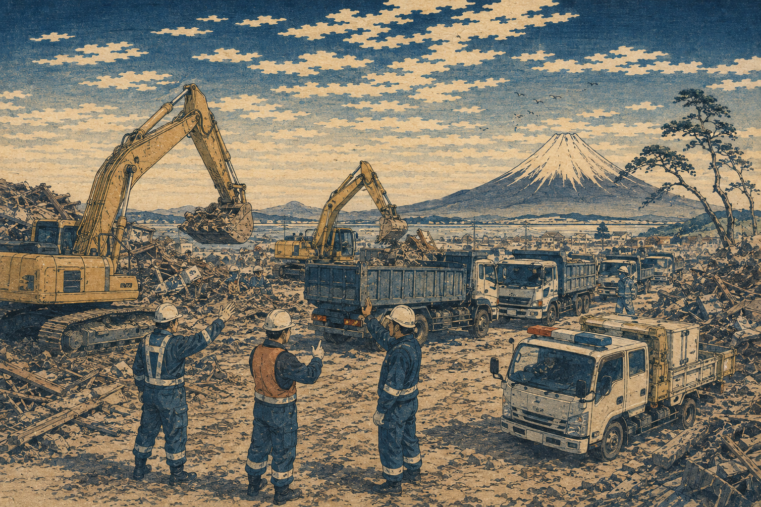
Before a road can be cleared, someone has to find the excavator. In the first hours after a landslide, flood or earthquake, the useful question is not how many machines exist somewhere in Japan. It is which backhoes, bulldozers and dump trucks are close enough, large enough and reachable enough to open a route now.
Japan’s Ministry of Land, Infrastructure, Transport and Tourism is trying to answer the first part of that question with data already generated by private machinery. On September 1, MLIT expanded a trial that collects manufacturer-held telematics—location and related operating data—from equipment owned by participating construction companies. Sumitomo Construction Machinery joined Komatsu, Caterpillar Japan, Kobelco Construction Machinery and Hitachi Construction Machinery, bringing the manufacturer group to five. The official participant count rose from roughly 1,800 companies in 2025 to about 2,000 participants in 2026; the published list also contains branch-office entries.
A maintenance technology becomes a public logistics layer
Construction-equipment telematics was built largely for commercial fleet management. A modern machine can report where it is, how long it has operated and information relevant to maintenance or utilization. Owners use those systems to reduce downtime, plan service, protect assets and assign equipment. The disaster trial repurposes a narrow portion of that private visibility for public response.
The data chain matters. Participating contractors are linked to regional branches of the Japan Federation of Construction Contractors or the National General Contractors Association of Japan, both of which have disaster agreements with MLIT. Each manufacturer extracts records for consenting owners. The Japan Construction Machinery and Construction Association—JCMA—aggregates the five feeds and sends the result to MLIT. The ministry then uses the information when considering how to secure and position machinery.
This does not abolish phone calls, contracts or field confirmation. It changes the order of work. Instead of beginning with a blank sheet and asking companies one by one what may be nearby, responders can begin with a candidate inventory and focus their calls on the machines most likely to matter.
What the government can actually see
MLIT’s data-flow diagram lists the manufacturer, machine type and model, standard bucket capacity, latitude and longitude, and the time at which the data was acquired. Those fields are modest compared with the full commercial dashboards available to equipment owners. They are also directly relevant to triage.
| Field in the published scheme | What it can help answer | What it does not establish by itself |
|---|---|---|
| Manufacturer, type and model | Whether a candidate is an excavator, bulldozer or another useful class | Installed attachment, mechanical condition or suitability for the debris |
| Standard bucket capacity | A rough indicator of digging and loading scale | Actual productivity, soil conditions or the total fleet required |
| Latitude and longitude | Which machines appear closest to the affected area or staging point | Whether roads, bridges, ports and low-bed trailers can carry them there |
| Acquisition timestamp | How fresh the location record is | Whether the machine has since moved or communications have failed |
| Participating owner | Whom officials should contact first | Operator availability, fuel, permission, compensation or competing assignments |
The timestamp may be the most revealing field. A machine is not a bridge or a warehouse; it moves. Komatsu said when it joined the 2025 pilot that its own records would be aggregated and updated every 24 hours and supplied for seven days. That was Komatsu’s company-specific implementation, not a published common interval for all five manufacturers. It nevertheless shows why responders must treat every pin as a dated observation rather than a live promise.
The 2026 change is not only scale. It is time.
The pilot launched in June 2025 with four manufacturers and roughly 1,800 companies. Its published triggers were reactive: a qualifying earthquake, or a large non-earthquake disaster already causing major damage around the affected area. The 2026 revision adds Sumitomo Construction Machinery, while the published participant count rises from roughly 1,800 companies to about 2,000 participants. Its larger innovation is permission to collect and use the data before a typhoon or heavy-rain event when major damage is judged highly likely.
When MLIT may activate the data pull
- Earthquake: seismic intensity 6-lower or greater nationwide, or 5-upper or greater within Tokyo’s 23 wards.
- Other large disaster: major damage is occurring around the affected area.
- Typhoon or heavy rain: major damage is judged highly likely, allowing preparation before impact.
Earthquakes offer almost no warning. Typhoons and extreme rainfall produce a forecast window, even when the exact track or basin remains uncertain. A pre-impact snapshot can help officials identify where equipment is concentrated, which regions may need reinforcement and what owners should be contacted before communications and roads deteriorate.
Japan’s road-clearance doctrine was written in debris
The trial sits inside a longer institutional history. MLIT created the Technical Emergency Control Force, known as TEC-FORCE, in 2008 to provide rapid technical support to disaster-hit local governments. Its teams survey damage, restore communications, advise on emergency works and bring specialized machinery into a response that may overwhelm local capacity.
The defining road-clearance operation came after the Great East Japan Earthquake in March 2011. Tohoku officials used the inland Tohoku Expressway and National Route 4 as a north–south spine, then cleared east–west roads toward the devastated Pacific coast like the teeth of a comb. The Tohoku Regional Development Bureau records that 11 routes were open by March 12, the day after the disaster, and 15 by March 15. Local construction companies, road administrators, police and the Self-Defense Forces converted a route strategy into physical access.
Law and planning evolved with later failures. A November 2014 amendment to the Disaster Countermeasures Basic Act strengthened the authority of road administrators to order the removal of obstructing vehicles and, when necessary, move them directly. In the year after the 2024 Noto Peninsula earthquake, the amended Road Act made road-clearance plans statutory in April 2025.
2008: TEC-FORCE is created as a standing technical emergency capability.
2011: Operation Comb Teeth opens 11 routes by March 12 and 15 by March 15.
2014: Road administrators gain stronger powers to move obstructing vehicles during disasters.
2024: Noto demonstrates that machinery may need to enter isolated areas from the sea.
2025: Road-clearance plans become statutory; the four-maker telematics pilot begins.
2026: The trial grows to five makers and adds pre-impact typhoon and heavy-rain use.
Noto exposed the difference between “near” and “reachable”
In Noto, landslides, collapsed road sections and damaged bridges cut access through the peninsula. MLIT’s official record includes heavy machinery being delivered from the sea at Fukami coast in Wajima. The nearest excavator on a map is not necessarily the first excavator that can arrive. A more distant unit with an open route, an available operator and a suitable transporter may be the better choice.
That lesson turns location data into one layer of a larger logistics problem. To become operational, the machine record must meet road-condition maps, port and beach access, staging areas, fuel supply, trailers, operators and priority routes. Japan’s new statutory road-clearance plans are designed to identify routes and responsible organizations in advance. The telematics trial could add a moving private-equipment layer to those plans.
A pin is not a deployable asset
Emergency managers often speak of resources as if they were interchangeable units. Construction machinery is not. Bucket size matters. So do hydraulic attachments, ground pressure, lifting capacity, transport weight and the skill of the operator. An excavator configured for ordinary earthwork may be wrong for broken concrete, submerged debris or unstable slopes.
Deployment also requires authority and economics. The owner may be working on another emergency, protecting a local waterway or clearing access to its own community. A machine may need a low-bed trailer and permits. Fuel may be scarce. The operator may be unable to reach the yard. The route may cross a bridge whose load capacity is uncertain.
None of those limitations invalidates the map. They define its proper role. The data can narrow a national search to a manageable list. Human responders still have to turn each record into a confirmed package: machine, attachment, operator, fuel, transport, route and agreement.
The difficult innovation is interoperability
Each manufacturer built its telematics platform for its own equipment, customers and service network. Commercial systems may track location, hours, fuel, faults and productivity, but the fields, update cycles and contracts are not identical. A disaster interface must extract only what has been authorized, normalize enough information to compare machines and preserve the boundary between public need and private operational data.
JCMA is a logical intermediary. Established in 1950, the association’s official mission includes research, technical development, standardization and support for emergency measures. It also serves as a Maintenance Agency for the ISO 15143 series, which contains construction-machine data schemas. MLIT has not said that this trial uses ISO 15143, so the standard should not be presented as the scheme’s technical specification. The association’s role does show that the project is as much about common language and governance as it is about GPS.
Pre-impact information creates a harder allocation problem
Collecting data before a storm offers time, but it also forces decisions under uncertainty. Typhoon tracks shift. Rain bands form outside the most likely forecast area. A roughly 100-kilometer square may cover the immediate target while missing a distant machine with better access, or it may contain equipment whose normal work is itself essential.
Every precaution has an opportunity cost. Asking a contractor to hold a machine in reserve can delay a project, interrupt local maintenance or deprive another district of the same resource. If two prefectures face simultaneous flooding, officials need priorities that are understood before the first request is made. Better visibility does not remove scarcity; it makes the allocation choices more explicit.
The privacy bargain is part of the infrastructure
Location data can reveal where a company keeps valuable equipment, where it is working and when it moves. That is commercially sensitive and can create security risks. The trial therefore rests on advance consent, manufacturer-controlled extraction and internal MLIT use. It is deliberately not a public crisis map.
That restriction may reduce the number of organizations that can use the information directly, but it may also be what makes participation possible. A national network cannot be sustained if owners believe emergency access will become routine surveillance or competitive intelligence. The data governance is not an administrative footnote; it is part of the operational design.
Five tests for a full national rollout
- Search time: How much faster does the system produce a usable candidate list?
- Conversion rate: What share of mapped candidates can be confirmed as deployable?
- Arrival time: Does the full package—machine, operator, fuel and transport—reach the priority site sooner?
- Interoperability: Can five manufacturer feeds be compared despite different fields and refresh cycles?
- Trust: Can MLIT prevent secondary use and retain voluntary participation over time?
The metric is not the number of dots
The 2026 expansion is easy to describe as a bigger database: five manufacturers and about 2,000 participating entities. That is not the result that matters. The real test is whether a road opens sooner, an isolated community is reached earlier or a pump, ambulance and power-repair crew can use the route before conditions worsen.
Operation Comb Teeth demonstrated that a limited number of machines can transform a disaster response when they are concentrated on the right corridors. Noto demonstrated that access to the machine can be as important as the machine’s location. The new trial moves the question one step earlier: can Japan identify its nearby private equipment before mud, water and broken communications make the search harder?
Finding the excavator is not the same as deploying it. But every hour spent searching is an hour subtracted from clearing the road. If the pilot succeeds, its achievement will not be a beautiful map. It will be the moment a dated location record becomes a working machine on the route that matters most.
Sources and methodology
- Ministry of Land, Infrastructure, Transport and Tourism, “Expansion of the initiative to aggregate and use construction-machinery location data during disasters” — September 1, 2026; five manufacturers, roughly 2,000 participants, disaster triggers and the approximately 100-kilometer-square data area.
- MLIT, press-release PDF and data-flow diagram — The aggregation chain, explicit data fields and internal-use restriction.
- MLIT, list of participating companies and offices — Thirty-three-page list dated September 1, 2026.
- MLIT, launch of the construction-machinery location-data trial — June 27, 2025; the original four-manufacturer, roughly 1,800-company pilot.
- MLIT, construction-machinery development and disaster-equipment program — Official program page for national maintenance, disaster machinery and the location-data trial.
- Komatsu, “Provision of construction equipment location information obtained from Komtrax during large-scale disasters” — Company-specific 2025 implementation, including stated 24-hour aggregation and seven-day provision.
- Japan Construction Machinery and Construction Association, organization profile — Official Japanese and English name, 1950 establishment and disaster-support function.
- JCMA, ISO 15143 Maintenance Agency portal — Institutional background on construction-machine data standardization; MLIT does not state that the trial itself uses ISO 15143.
- MLIT, creation of the Technical Emergency Control Force — The 2008 establishment of TEC-FORCE.
- Tohoku Regional Development Bureau, “Operation Comb Teeth” road clearance — Eleven routes opened by March 12, 2011, and fifteen by March 15.
- MLIT, infrastructure restoration after the 2024 Noto Peninsula earthquake — Road restoration and the sea-side delivery of heavy machinery at Fukami coast.
- MLIT, enactment and partial implementation of the amended Road Act — April 16, 2025; statutory road-clearance plans.
- MLIT white paper, vehicle removal under the amended Disaster Countermeasures Basic Act — The November 2014 reform empowering road administrators to move obstructing vehicles.
- National General Contractors Association of Japan, organization profile — Official English name and the federation’s prefectural construction-association structure.
This report cross-checked materials published through September 2, 2026. Official Japanese organization names, specialist terms and figures were verified against Japanese primary sources from MLIT, regional development bureaus, JCMA and participating companies. The report does not estimate the undisclosed total number of machines, a common refresh interval across all five manufacturers or a deployment-time target. The distinction between a mapped machine and a deployable machine is Japan.co.jp analysis based on the published data fields and the separate operational requirements documented in Japan’s road-clearance history.
Image rights: © 2026 Japan.co.jp. This AI-assisted editorial illustration may not be republished or reused without permission. For licensing, use the contact page.