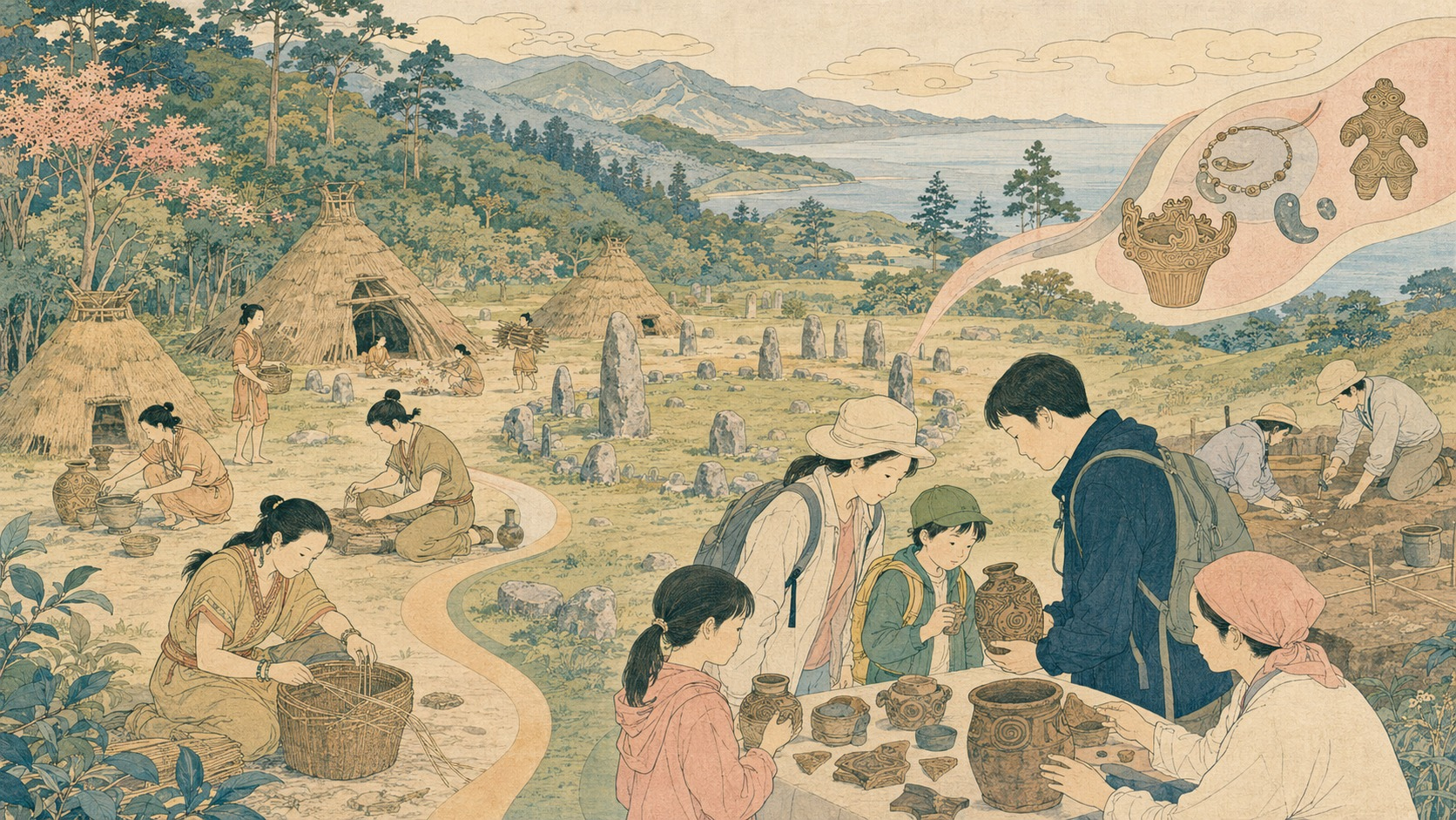
Ten thousand years will not fit in a display case. It cannot be contained by a potsherd, a reconstructed pit dwelling or a World Heritage emblem. In July 2026, inside Hokkaido’s restored red-brick former government office, a child can hold a piece of Jomon pottery and ask an archaeologist what its maker ate. Beneath that small encounter lies a record stretching from about 13,000 BCE to 400 BCE: a northern society that built settled lives before rice agriculture and the state.
On July 27, the Jomon Prehistoric Sites in Northern Japan mark five years since inscription on UNESCO’s World Heritage List. The anniversary gathering takes place a day earlier at the Red Brick Office, bringing Hokkaido and Aomori together for a public conversation, quizzes and opportunities to handle real pottery and stone tools. At the Hokkaido Museum, a long-running special exhibition introduces the prefecture’s six component sites and one associated site. Replicas of Hakodate’s National Treasure hollow dogu, “Kakku,” and Chitose’s animal-shaped clay figure, “Bibi-chan,” are placed beside related objects from Kanto to ask how ideas and people moved.
There is plenty to celebrate. But a fifth anniversary is not an occasion to display the certificate again. World Heritage is less a trophy granting ownership of the past than a covenant to deliver it to the future. Most of the authentic remains are kept safely underground and cannot be seen. The 17 sites are scattered across four prefectures, often beyond convenient public transportation. The surge of curiosity after inscription has begun to settle. From the sixth year, the durable measures will be conservation, teaching, research and local benefit—not the number of commemorative goods sold.
One heritage property, 17 chapters
The title says “sites,” plural, but this is not a tourism label applied to similar ruins. UNESCO inscribed a single serial property. Odai Yamamoto in Aomori holds evidence from the threshold of sedentary life. Settlements with shell middens show its development. Sannai Maruyama reveals a large residential center. Mounds, cemeteries and stone circles show increasingly elaborate ritual and memorial landscapes. Rather than ask one place to represent ten millennia, the nomination arranged different times and ecosystems into a long sequence.
The components are six sites in Hokkaido, eight in Aomori, one in Iwate and two in Akita: Kakinoshima, Kitakogane, Ofune, Irie, Takasago and Kiusu; Odai Yamamoto, Tagoyano, Futatsumori, Sannai Maruyama, Komakino, Omori Katsuyama, Kamegaoka and Korekawa; Goshono; and Isedotai and Oyu. Hokkaido’s Washinoki and Aomori’s Choshichiyachi are associated sites that add context without forming part of the inscribed components.
| Region | Component sites | What the group contributes |
|---|---|---|
| Hokkaido | Kakinoshima, Kitakogane, Ofune, Irie, Takasago, Kiusu | Maritime and forest resources, durable settlements, care, cemeteries and communal earthworks |
| Aomori | Odai Yamamoto, Tagoyano, Futatsumori, Sannai Maruyama, Komakino, Omori Katsuyama, Kamegaoka, Korekawa | The advent of pottery, large settlements, coastal and inland adaptation, ritual and craft |
| Iwate | Goshono | An inland river-terrace settlement, earth-roofed dwellings, mounds and ritual space |
| Akita | Isedotai, Oyu | Monumental stone circles, communal burial and ceremonial landscapes |
The property covers 141.9 hectares, with 984.8 hectares of buffer zones. Those figures describe a management obligation, not the size of its meaning. What binds the sites is not architectural uniformity. It is the range of answers people found beside bays, rivers, lakes, coasts, hills and forests while sustaining permanent or recurrent settlements without large-scale conversion to farmland.
Why pre-agricultural sedentism changes world history
Older accounts of prehistory often resembled a staircase: mobile foragers settled down only after adopting agriculture; stored surplus then produced cities and states. Northern Japan complicates that ladder. People used heavy, breakable pottery, dug substantial homes, made cemeteries and returned over generations to the same places long before irrigated rice farming transformed the landscape.
At Odai Yamamoto on Aomori’s Tsugaru Peninsula, plain pottery fragments found with late Paleolithic-style stone tools have been dated to around 13,000 BCE. Carbonized residue indicates cooking. They are among the earliest known pots in Northeast Asia, and they carry no cord design. The word Jomon means cord marking: after the American zoologist Edward S. Morse excavated the Omori shell mound in 1877, the cord-marked pattern on many sherds became the name for the pottery and, eventually, the period. The earliest vessel at the World Heritage property thus predates the decoration that named it.
Sedentary life did not depend on one crop. Warming after the Ice Age spread deciduous forests rich in acorns, chestnuts and walnuts. Warm and cold currents supported abundant marine life; salmon and trout moved up rivers. Pottery expanded boiling, detoxification and storage. Bows, nets, hooks, polished stone, wood and lacquer joined seasonal resources into a resilient repertoire.
UNESCO criterion (iii) recognizes exceptional testimony to a globally rare settled hunter-fisher-gatherer society with a complex spiritual life. Criterion (v) recognizes an outstanding pattern of settlement and land use adapted to diverse ecosystems without becoming an agrarian society. This is not a history of people who failed to develop. It is a history of development along another path.
Hokkaido’s six sites—from the shore to a landscape of the dead
The six Hokkaido components do not repeat a generic Jomon village. Five lie in and around the Oshima Peninsula and Uchiura Bay; one is inland at Chitose. Together they assign different archaeological weight to dwelling, food, care, death and coordinated labor.
| Site | Broad date and setting | What can be read there |
|---|---|---|
| Kakinoshima, Hakodate | About 7000–1000 BCE | A long settlement sequence, clay tablets bearing children’s footprints, net sinkers and a U-shaped earthwork over 190 meters long |
| Kitakogane, Date | About 5000–2000 BCE | Settlement movement with changing sea levels, shell middens, a ritual spring and intensive use of fish, shellfish and marine mammals |
| Ofune, Hakodate | About 3500–2000 BCE | Deep pit dwellings, a regional settlement hub, mounds and ritual use of a whale vertebra |
| Irie, Toyako | About 3500–800 BCE | Shell midden and cemetery, including a person who survived severe muscular atrophy with care |
| Takasago, Toyako | Centered around 1000 BCE | Burials with red pigment, tooth extraction, a pregnant woman and ecological signs of cooling |
| Kiusu, Chitose | Around 1200 BCE | Nine ring-shaped earthwork cemeteries, communal engineering and controlled approaches |
Kakinoshima: a child’s footprint held in clay
Kakinoshima occupies a coastal terrace in Minamikayabe, Hakodate, with traces spanning roughly six thousand years. Residential and burial areas were separated, and large numbers of stone net sinkers testify to fishing. Its most intimate finds are clay tablets impressed with children’s feet. Perhaps they remembered a child who died, or belonged to a rite of passage; archaeology cannot safely choose. Yet each indentation returns the museum category “clay object” to an individual body.
A U-shaped earthwork created around 2000 BCE extends for more than 190 meters, among the largest of its kind in Japan. Soil, pottery, stone tools and plant and animal remains accumulated through repeated acts, probably including burial and ritual. The monument was not raised in one architectural campaign. Deposition—discarding, offering, returning and remembering—became structure over time.
Kitakogane and Ofune: the sea was a pantry and a moving map
Kitakogane at Date has yielded clams, oysters, scallops, tuna, flounder, seals and whales. A shell midden is more than ancient refuse. Bone and shell archive season, water temperature, fishing grounds and technique. As the Jomon transgression raised the sea and later change shifted the shoreline, people moved the settlement. At a spring, large quantities of grinding stones and their bases were deliberately broken or deposited, while deer crania were arranged nearby. Everyday tools appear to have been retired and returned to a charged place.
Ofune in Hakodate was a hub of large, deeply excavated pit dwellings. Greater depth could insulate a house, but demanded construction and maintenance. Pottery, stone and bone tools, botanical and faunal remains, mounds and a whale vertebra link the sea to the inland forest and daily work to ritual. Sedentism here did not mean stillness. It was the capacity to pull near and distant resources into one enduring place.
Irie and Takasago: bones record care, illness and death
One adult at the Irie shell mound lived with a condition involving muscular atrophy and is estimated to have survived for at least a decade after its onset. In a society where gathering, carrying and fishing mattered directly to survival, that span is difficult to imagine as an individual achievement alone. Other people likely supplied food, movement and daily assistance. There is no need to romanticize the community. The skeleton’s quieter point is stronger: care is not a modern welfare invention but an old human capacity.
At nearby Takasago, graves contained red iron-oxide pigment. Human remains preserve evidence of deliberate tooth extraction and include a woman buried with an unborn child. Shellfish and fish species also register a cooler environment. The dead were not simply disposed of; bodies were prepared, colored and accompanied according to procedure. Yet reducing those procedures to the modern category “religion” can overstate the evidence. Who led burial and what red meant cannot be fully recovered.
Kiusu: a community outlined in earth
At Kiusu in Chitose, nine large circular burial earthworks have been identified, eight visible at the surface. People excavated broad circular depressions and piled the removed soil around them. The largest is about 83 meters across on its outer edge, with roughly 4.7 meters from the top of the bank to the bottom. An estimated 3,000 cubic meters of earth was moved. Without metal shovels or wheeled hauling, how many people, days and agreements did that require?
Openings in the banks and approaches into the cemeteries suggest that movement itself may have been formalized. Kiusu’s monumentality lies not in soaring stone but in a deepened void and the mass of earth relocated around it. A guidance center opened in 2025, making the site easier to understand. Chitose also asks visitors to remain on the designated route so the surface is not trampled. The more visible an archaeological place is, the more behavior becomes part of its conservation.
Washinoki: a ring of stone protected above an expressway
Washinoki in Mori is an associated site rather than an inscribed component, but it carries one of the anniversary’s most instructive preservation stories. A pre-expressway survey in 2003 found a stone circle measuring 36.9 by 33.8 meters, composed of 602 stones. Ash from Mount Komagatake’s 1640 eruption had helped preserve it.
The answer was not a simple choice between road and archaeology. After local campaigning, engineers routed a tunnel beneath the site. Vibration was continuously monitored; some sections were excavated without powered machinery. Access remains limited and generally requires a special tour. Heritage tourism often treats opening everything as an unquestioned good. Washinoki shows that the best form of access can sometimes be restraint.
Making buried remains legible without making them false
Most of the authentic remains at the 17 sites were reburied after excavation. Soil is the most stable storehouse against rain, freeze-thaw, roots and feet. Interpretive buildings, reconstructed-looking forms and modern shells marking a midden are not themselves Jomon structures. UNESCO’s evaluation distinguishes display replicas, placed over or near protected remains, from the archaeological fabric below.
This creates a difficult public language. A visitor shown only grass may leave without grasping the value. A visitor shown a vivid reconstruction may mistake a hypothesis for a photograph of the past. Sections, excavation images, tactile replicas, augmented reality and a skilled guide can work together—provided each says what is known, inferred and unknown. Refusing to fill every silence with certainty is not weak interpretation. It is one of archaeology’s most valuable lessons.
Dogu, mounds and graves—and the discipline not to read too much
Clay figurines, footprint tablets, lacquerware, stone rods, circles, graves and ritual deposits show that life was not exhausted by obtaining calories. “Kakku,” the hollow dogu found at the Chobonaino site in Hakodate, is a National Treasure. Chitose’s “Bibi-chan” gives animal form to clay. The 2026 Hokkaido Museum exhibition compares them with objects from Kanto, asking visitors to see Hokkaido not as an isolated edge but as part of networks through which stone, technique and form traveled.
But a dogu cannot simply be labeled goddess, fertility charm or healing substitute. Breakage, placement and regional difference support hypotheses, not access to a maker’s inner explanation. Good exhibitions preserve the question. They show the density of evidence and the edge of uncertainty at once.
Eighteen years to inscription: assembling a northern sequence
The World Heritage campaign was also a history of argument and editing. In 2003, the governors of Hokkaido and the three northern Tohoku prefectures agreed to seek inscription. Four prefectures and their municipalities submitted a proposal in 2007. The sites entered Japan’s UNESCO tentative list in 2009. A Hokkaido citizens’ council was established in 2012 to support lectures, guiding, petitions and cooperation. The property became Japan’s nomination candidate in 2019, was formally submitted in January 2020, received a favorable ICOMOS recommendation and was inscribed on July 27, 2021.
There were serious questions. Could 17 northern sites speak for all Jomon culture? The selection and argument were revised repeatedly. The final property does not claim to package every Jomon society across the archipelago. It presents a testable sequence of the emergence, development and maturity of sedentary life in northern environments around the Tsugaru Strait. That limit is not a deficiency. It is the boundary that gives the claim intellectual shape.
Protection does not end at inscription
Every component is protected as a national Historic Site or Special Historic Site under Japan’s Law for the Protection of Cultural Properties. Buffer zones, monitoring and a coordinated management framework reinforce those designations. Yet UNESCO’s inscription documents also identified continuing work: modern “non-compliant elements” that intrude into views, mitigation of their impact, and long-term public acquisition where private land remains within components.
Well-preserved buried deposits can be destroyed by one development, a change in drainage or gradual erosion. Climate change is therefore an archaeological issue. Heavy rain cuts slopes and riverbanks; heat and vegetation alter maintenance; coastal hazards complicate access. In a region of volcanoes, earthquakes and tsunamis, disaster planning must protect people first, but also collections, field records and redundant digital archives. “Future generations” means staff, budgets and recoverable data after the next emergency.
The tourism surge is entering ordinary time
In fiscal 2024, Kakinoshima, Ofune and the Hakodate Jomon Culture Center recorded 80,150 visits, down 8,601, or 10%, from the prior year. Kakinoshima received 30,027, Ofune 19,329 and the center 30,794. Local reporting connected the decline to fewer group visitors and a shortage of bus drivers. The post-inscription peak has passed.
Decline is not the same as failure. The combined Ofune and culture-center figure remained about 1.75 times their fiscal 2020 total of 28,631, before inscription, while Kakinoshima did not open fully to the public until July 2022. A World Heritage effect remains. But Minamikayabe is roughly an hour by road from central Hakodate, and television reporting has found many city visitors unaware that World Heritage sites lie within Hakodate at all. The sixth-year problem is the gap between awareness and access.
For 2026, Hakodate Bus is selling a “Jomon Campus” day pass from July 25 through October 4, connected with a photo rally, limited foods and free-entry events. Official multilingual travel maps offer model routes, while “JOMON TRAVELERS” lets people collect digital seals across the 17 sites. Play can open the door. It should not make collecting a stamp faster than understanding the place.
Education turns an object into a question
Letting the public handle genuine material at the Red Brick anniversary event matters. Cord impressions, a stone tool’s weight and a sharp fracture cannot be conveyed completely by a screen. Aomori’s traveling “hands-on World Heritage course,” launched in 2009, had reached more than 13,000 participants in 191 organizations by 2026. Specialists bring real pottery, stone tools and dogu to schools and community groups. Heritage reaches children who cannot reach a remote site.
The next educational step is not memorizing the right answer, but reasoning from evidence. What was cooked in this carbonized residue? In what season was a shell gathered? How did distant stone arrive? Does variation in graves prove rank, or can it be explained differently? Archaeology becomes training in inference under incomplete information—and in remaining open to refutation.
What the 2026 celebrations connect
The anniversary is not a single day. The Hokkaido Museum exhibition runs from July 17 to November 29. Oshima marks July 26 as “Oshima Jomon Day,” with free entry at the Hakodate Jomon Culture Center, a squid-shaped clay-object strap in Mori, a forum and travel programs. At Sannai Maruyama in Aomori, an international symposium on July 26 considers “Jomon Sites and Asian Prehistory—Life, Prayer, Exchange,” while an exhibition examines maritime connections between the northern Jomon world and Asia.
That is the anniversary’s best direction: not to close the celebration inside Hokkaido, but to cross the Tsugaru Strait and then widen the view to Northeast Asian prehistory. Jomon people did not live within modern prefectural borders. The movement of obsidian, asphalt, stone, techniques and forms makes the strait a road as much as a barrier.
Do not leave Hokkaido blank after the Jomon period
A ten-thousand-year story is powerful. That makes it especially important not to draw a straight identity line from Jomon people to a single modern “Japanese” or Ainu population. Archaeological cultures do not map one-to-one onto contemporary ethnic groups. After wet-rice farming spread through much of Honshu around two thousand years ago, Hokkaido developed the Epi-Jomon culture, interacting with Yayoi societies to the south and Sakhalin and the continent to the north. Satsumon and Okhotsk cultures later interacted, contributing to the historical formation of Ainu culture.
Continuity and transformation are research questions, not slogans. Museums and guides should not stop Hokkaido’s history at 400 BCE. Epi-Jomon, Satsumon, Okhotsk and Ainu histories, relations with wajin, and modern colonization belong to the same long landscape. If enthusiasm for prehistory hides the later history of an Indigenous people, it forfeits the moral force of taking the long view.
Eight measures for the sixth year
- Conservation: publish site-level trends for erosion, drainage, vegetation, trampling and disaster risk, with the actions and budget attached.
- Education: count school outreach, teacher training, use of learning materials and tactile loans—not only admissions.
- Research: release field reports, 3D records, dating and scientific analyses, while reducing unprocessed collections.
- Local participation: show how guides, preservation groups, young residents and local businesses share decisions and labor.
- Access: audit public transport, bad-weather information, accessible routes and multilingual interpretation site by site.
- Tourism quality: give dwell time, repeat visits, understanding, dispersal and environmental load the same weight as head counts.
- Local benefit: measure how much visitor spending remains with food, lodging, transport, guiding and crafts, and returns to conservation.
- Historical integrity: separate evidence from hypothesis and connect Jomon interpretation to Hokkaido’s later and Ainu histories.
Not every one of the 17 sites should receive an equal number of visitors. Some are fragile, seasonally restricted or poorly served by transport. Digital interpretation and regional museums can absorb pressure; hubs can direct curiosity toward smaller places. A global brand tends to concentrate attention, while conservation demands dispersal. Timed access, transit and honest information must manage that contradiction.
World Heritage is an excavation toward the future
Archaeology digs into soil to find the past. Managing World Heritage digs into the present for a future that does not yet exist. It asks what to protect, who has authority to tell the story, and how benefit and burden should be shared.
The small footprints at Kakinoshima carry a child whose name and voice disappeared. The skeleton at Irie preserves years in which someone helped a weakened person. The rings of soil at Kiusu record many people joining the same work. It is easy to compress these into “the Jomon were amazing.” The harder task is to pass on the fine-grained evidence, the limits of interpretation and the region’s longer history so that another generation can form its own questions.
On July 27, 2026, the fifth anniversary is not an arrival. The 17 places did not survive for more than ten thousand years in order to become World Heritage. The work of year six is to keep their preserved silence from being covered by tourism noise—without returning it to a silence no one can hear. The deepest form of celebration is not pride in the past. It is renewing a promise to the future.
Sources and method
This article is based primarily on the UNESCO World Heritage Centre’s nomination, evaluation, decision and management documents; records from Japan’s Agency for Cultural Affairs; the four-prefecture Jomon organization; Hokkaido and Aomori agencies; municipalities; and the Hokkaido Museum. Details of 2026 events reflect official announcements available on July 25. Tourism analysis cross-checks the published fiscal 2024 totals and local reporting. Claims about spirituality and population continuity distinguish archaeological evidence from interpretation; the article does not present Jomon life as a utopia or as a direct portrait of one modern ethnic identity.
- UNESCO World Heritage Centre: Jomon Prehistoric Sites in Northern Japan
- UNESCO: 2021 inscription decision (44 COM 8B.18)
- UNESCO: nomination, evaluation and management documents
- Agency for Cultural Affairs: the Jomon property
- Official Jomon property site: the 17 components
- Official Jomon property site: culture and environment
- Official fifth-anniversary event at the Red Brick Office
- Hokkaido Museum: 2026 Jomon special exhibition
- Kakinoshima Site
- Kitakogane Site
- Ofune Site
- Irie Site
- Takasago Site
- Kiusu Earthwork Burial Circles
- Washinoki Site
- Northern Jomon civic council: path to inscription
- University Museum, University of Tokyo: Morse and cord-marked pottery
- Hokkaido News Link: fiscal 2024 Hakodate visitor totals
- Hokkaido history portal: Epi-Jomon culture
- Hokkaido history portal: Okhotsk, Satsumon and Ainu culture