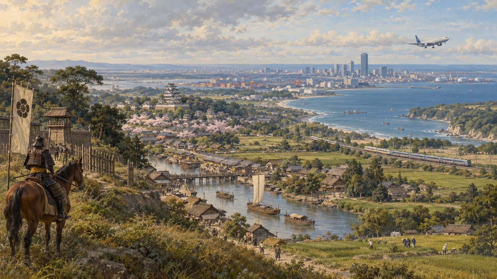
Chiba cannot be understood simply as “the prefecture next to Tokyo.” To the west lies one of Japan’s densest urban corridors; to the north, the Tone River and Shimōsa uplands; to the east, the long Kujūkuri coast; and to the south, the mountainous, maritime Bōsō Peninsula. Narita Airport, petrochemical complexes, major farming districts, fishing ports, commuter suburbs, castle towns and beach resorts all sit inside one prefecture.
The name “Chiba” is also far older than the modern prefectural boundary. Its story runs through the medieval Chiba clan, the Satomi and Later Hōjō, Edo-period domains, Meiji prefectural consolidation, postwar industrialization, Narita Airport and Makuhari New City.
“Chiba” and “Bōsō” are not exactly the same thing
The historic regional name Bōsō combines Awa, Kazusa and Shimōsa, the three old provinces that covered the peninsula and adjacent areas.
Their borders did not match the modern prefecture. Shimōsa extended into parts of today’s Ibaraki, Saitama and Tokyo. Chiba Prefecture is a Meiji administrative creation; Bōsō is a much older geographical and cultural world.
A landscape inhabited long before Tokyo existed
Chiba’s human history reaches into the Paleolithic, while Jōmon settlements left large shell middens along the bay and on inland uplands. Kasori Shell Mounds in Chiba City are among Japan’s best-known examples.
Early life here already combined coastal resources with inland settlement. Seafood, salt, woodland resources and farming connected the shore with the plateau thousands of years before the Tokyo metropolitan region existed.
1126: the beginning of Chiba’s medieval city story
Chiba City dates its foundation story to June 1, 1126, when Chiba Tsuneshige moved his base from what is now Ōji in Midori Ward to the Inohana area and adopted the Chiba name. The city marked its 900th anniversary in 2026.
His son Chiba Tsunetane supported Minamoto no Yoritomo after Yoritomo’s defeat at Ishibashiyama in 1180 and became an important early Kamakura shogunate retainer. The Chiba family subsequently acquired estates across Japan and became one of the shogunate’s leading warrior lineages.
Sengoku Bōsō: Satomi, Chiba and the Later Hōjō
Late-medieval Bōsō was politically fragmented. In the south, the Satomi developed into a major Sengoku family and fought the Later Hōjō across Tokyo Bay.
In the north, Sekiyado became a strategic river-transport position contested by the Yanada, Koga kubō, Uesugi and Later Hōjō. Taking a castle could mean taking control of boats, tolls and the movement of people and goods.
1590: entry into the Tokugawa order
After Toyotomi Hideyoshi destroyed the Later Hōjō in the Odawara campaign, Tokugawa Ieyasu entered Kantō. Bōsō became strategically important as the region immediately east of Edo.
The Satomi were dispossessed in 1614, while central and northern Bōsō remained a patchwork of domains, shogunal land and hatamoto holdings rather than one unified large domain.
Food, fish, soy sauce and river commerce for Edo
During the Edo period, Bōsō supplied the capital with rice, vegetables, fish and soy sauce. Tone and Edo River commerce expanded, helping Sawara become a prosperous river town and Chōshi a center of fishing and brewing.
Sawara remains one of the most practical places to experience this history today, with merchant streets along the Ono River and strong associations with surveyor Inō Tadataka.
Sakura: castle town, Dutch learning and medicine
Sakura Castle guarded the eastern approach to Edo. The Hotta family ruled much of the later Edo period, and Hotta Masayoshi became an important shogunal official during Japan’s opening to foreign powers.
In 1843, physician Satō Taizen established Juntendō, helping make Sakura a center of Western medical learning. Today Sakura Castle Park, the National Museum of Japanese History, the former Hotta residence and Juntendō Memorial Hall make Sakura one of Chiba’s strongest history destinations.
June 15, 1873: Chiba Prefecture is born
After abolition of the domains, Bōsō was briefly divided among prefectures including Kisarazu, Inba and Niihari.
On June 15, 1873, Kisarazu and Inba were merged to form Chiba Prefecture, with the government placed in Chiba. In 1875, the Katori, Kaijō and Sōsa districts of former Niihari Prefecture were added, producing something close to the modern boundary.
June 15 is now Chiba Prefectural Citizens’ Day.
Railways changed the distance to Tokyo
In 1894, rail service opened between Ichikawa and Sakura. That corridor eventually became part of the Sōbu Line network.
Rail moved agricultural produce and commuters and later provided the skeleton for Chiba’s expansion into the Tokyo labor and housing market.
Chiba City was also a military city
Chiba became a city in 1921 and developed around government, education and military installations, including railway troops and army schools.
Air raids in 1945 heavily damaged the urban center, forcing postwar reconstruction.
The bay became an industrial corridor
Kawasaki Steel’s Chiba works began blast-furnace operations in 1953. Chiba Port formally opened in 1954, and the Keiyō industrial-development plan followed in 1958.
Steel, petrochemicals, energy and logistics spread along the coast through Chiba, Ichihara, Sodegaura and Kisarazu. A prefecture known for farming and fishing also became one of Japan’s major industrial regions.
Northwest Chiba became metropolitan Tokyo
From the high-growth era onward, Ichikawa, Funabashi, Matsudo, Kashiwa, Urayasu, Narashino and Nagareyama expanded rapidly as commuter cities.
JR Sōbu, Jōban and Keiyō lines, Tokyo Metro Tōzai Line, Keisei, Tōbu and Tsukuba Express now bind northwest Chiba directly to central Tokyo.
1978: Narita Airport
Narita International Airport opened in 1978 and turned Chiba into a principal international gateway.
It is also a major cargo hub, supporting logistics, hotels and aviation-related employment across the Narita region.
Makuhari New City
Makuhari Messe opened in 1989, followed by Chiba Marine Stadium and Makuhari Techno Garden in 1990. JR Keiyō Line access to Tokyo also strengthened around the same period.
Makuhari developed as a planned mix of offices, conventions, hotels, universities, housing, retail and sports—one of the clearest symbols of Chiba’s move from industrial periphery to metropolitan business center.
2025 population: 6,257,225—and the first census decline
The final 2025 census counted 6,257,225 people in Chiba, sixth among Japan’s prefectures. That was 27,255 fewer than in 2020.
It was the first census decline in Chiba’s history since the national census began in 1920.
But population change is highly uneven. Twelve municipalities, concentrated in the northwest, gained population. Chiba City had the largest numerical increase at 19,895; Nagareyama had the highest growth rate at 7.6%, with Inzai close behind at 7.5%. Meanwhile, 25 cities and 17 towns/villages lost population.
28.2% are 65 or older
| Age group | Population | Share |
|---|---|---|
| Under 15 | 667,457 | 10.7% |
| 15–64 | 3,827,568 | 61.2% |
| 65+ | 1,762,045 | 28.2% |
Chiba is slightly younger than Japan overall: the national 65+ share was 29.4%.
That average, however, hides major local contrasts. Young households continue to enter Nagareyama, Inzai and parts of Chiba City, while southern and eastern areas face more acute issues of transport, health care, shopping access and vacant homes.
Foreign residents reached a record 240,425
The 2025 census counted 240,425 foreign residents, 3.8% of the prefectural population. That was an increase of 78,078, or 48.1%, from 2020 and the highest level ever recorded.
Chiba City had the largest number, 42,914. Tomisato had the highest local share, 8.9%. The largest nationality groups were Chinese, Vietnamese and Nepalese residents.
Modern Chiba’s labor market—in aviation, logistics, manufacturing, agriculture, care work and education—can no longer be understood without its international population.
Households are getting smaller
Chiba had 2,881,044 general households. Of those, 1,132,305 were one-person households, or 39.7%.
The average general household contained just 2.12 people. Population decline therefore does not automatically mean demand for housing, transport or services falls at the same rate.
Six practical Chibas
| Region | Places | What it feels like |
|---|---|---|
| Northwest | Ichikawa, Funabashi, Matsudo, Kashiwa, Nagareyama, Urayasu | Dense Tokyo commuter belt; railway-centered living. |
| Chiba City / Makuhari | Chiba Station, prefectural offices, Makuhari, Inage | Government, retail, universities, events and bayfront urban life. |
| Inba / Narita | Narita, Sakura, Inzai | Airport logistics, new towns and historic castle communities. |
| Eastern / Kujūkuri | Chōshi, Asahi, Tōgane, Kujūkuri | Farming, fishing, open Pacific coast and marine industries. |
| Inner Bōsō | Ichihara, Kisarazu, Sodegaura, Futtsu | Heavy industry, Aqua-Line and Tokyo Bay tourism. |
| Southern Bōsō | Tateyama, Kamogawa, Katsuura, Ōtaki, Minamibōsō | Tourism, fishing, mountains and a mild maritime climate. |
Living in Chiba: railway prefecture and car prefecture at once
In the northwest, life can be highly rail-oriented. Walking distance from a station can matter as much as municipality when choosing where to live.
In central, southern and eastern Bōsō, a car is often far more useful. Trains reach the peninsula, but service frequency and last-mile connections vary widely.
The Aqua-Line changed Kisarazu’s position
The Tokyo Bay Aqua-Line opened in 1997, directly linking Kisarazu with Kawasaki.
It pulled Kisarazu and Sodegaura more strongly into the Tokyo–Kanagawa commuting, shopping and logistics sphere. Umihotaru parking area became a destination in its own right, though weekend congestion remains a practical issue.
Agriculture: much more than peanuts
Chiba ranked fourth nationally in agricultural output in 2024.
The prefecture benefits from relatively mild weather, flat land and direct access to the huge Tokyo market. Vegetables, rice, livestock, flowers and eggs all matter alongside the famous Chiba peanut.
The coast is not one thing
Chōshi is a Pacific fishing and soy-sauce city at the Tone River mouth. Kujūkuri is a long sandy coast with surfing culture. Inner Bōsō faces calmer Tokyo Bay. Southern Bōsō combines rocky coastline, fishing ports, flower cultivation and mild winters.
Travel planning improves immediately once “the Chiba coast” is broken into these very different landscapes.
Best places for understanding Chiba’s history
| Place | Why go |
|---|---|
| Inohana, Chiba City | Chiba clan origins and the 900-year city story. |
| Sakura | Castle town, National Museum of Japanese History, Hotta and Juntendō sites. |
| Sawara | Historic river commerce and Inō Tadataka. |
| Sekiyado | Tone/Edo river control, castle history and flood engineering. |
| Tateyama | Satomi history and the southern gateway to Tokyo Bay. |
| Kasori Shell Mounds | Jōmon settlement and shell-midden culture. |
Practical travel notes
Chiba is close to Tokyo—but not all of Chiba is close. Ichikawa or Urayasu may be less than an hour from central Tokyo, while Tateyama, Chōshi or Katsuura are substantially farther.
Narita Airport is in Chiba Prefecture. Do not assume the airport is physically in Tokyo; allow transport time to Tokyo Station, Shinjuku or Shibuya.
A car can transform a Bōsō itinerary. Rail works well for major towns, but coastal viewpoints, farms and mountain areas often require buses or a car.
Weather matters. Typhoons, heavy rain, coastal wind and river flooding can disrupt roads and trains.
Climate varies inside the prefecture. Dense northwest Chiba and southern Bōsō do not feel the same in winter or summer.
To understand the economy, look at the bay, airport and fields together
Chiba’s economic identity is unusually mixed: steel and petrochemicals on Tokyo Bay, aviation and logistics around Narita, farming in Hokuso and Kujūkuri, fisheries around Chōshi and southern Bōsō, and service and event industries in Makuhari.
The next Chiba: growth and shrinkage at the same time
Chiba’s total population has begun to decline, but growth continues in selected northwest corridors and new-town areas.
The prefecture therefore has to plan simultaneously for expanding schools and transport in some municipalities while addressing aging, medical access, vacant homes and shrinking transit elsewhere.
The most useful way to read Chiba
On a Tokyo-centered map, Chiba looks like a peninsula extending east from the capital.
Historically, a better interpretation is that the Tone River, Tokyo Bay, Pacific Ocean and Bōsō Peninsula have repeatedly reorganized how people, goods and power move.
The medieval Chiba clan, Edo river traffic, modern railways, Narita Airport and today’s logistics economy all belong to the same larger story: Chiba has repeatedly mattered because it is a place of movement.
Sources
- Chiba Prefecture, 2025 Census final population results
- Chiba Prefecture, Chiba by the Numbers
- Chiba Prefecture, municipality list
- Chiba City, 900-year historical timeline
- Chiba City, Chiba clan history
- Chiba Prefecture, history and development timeline
- Chiba Prefecture, agriculture, forestry and fisheries overview