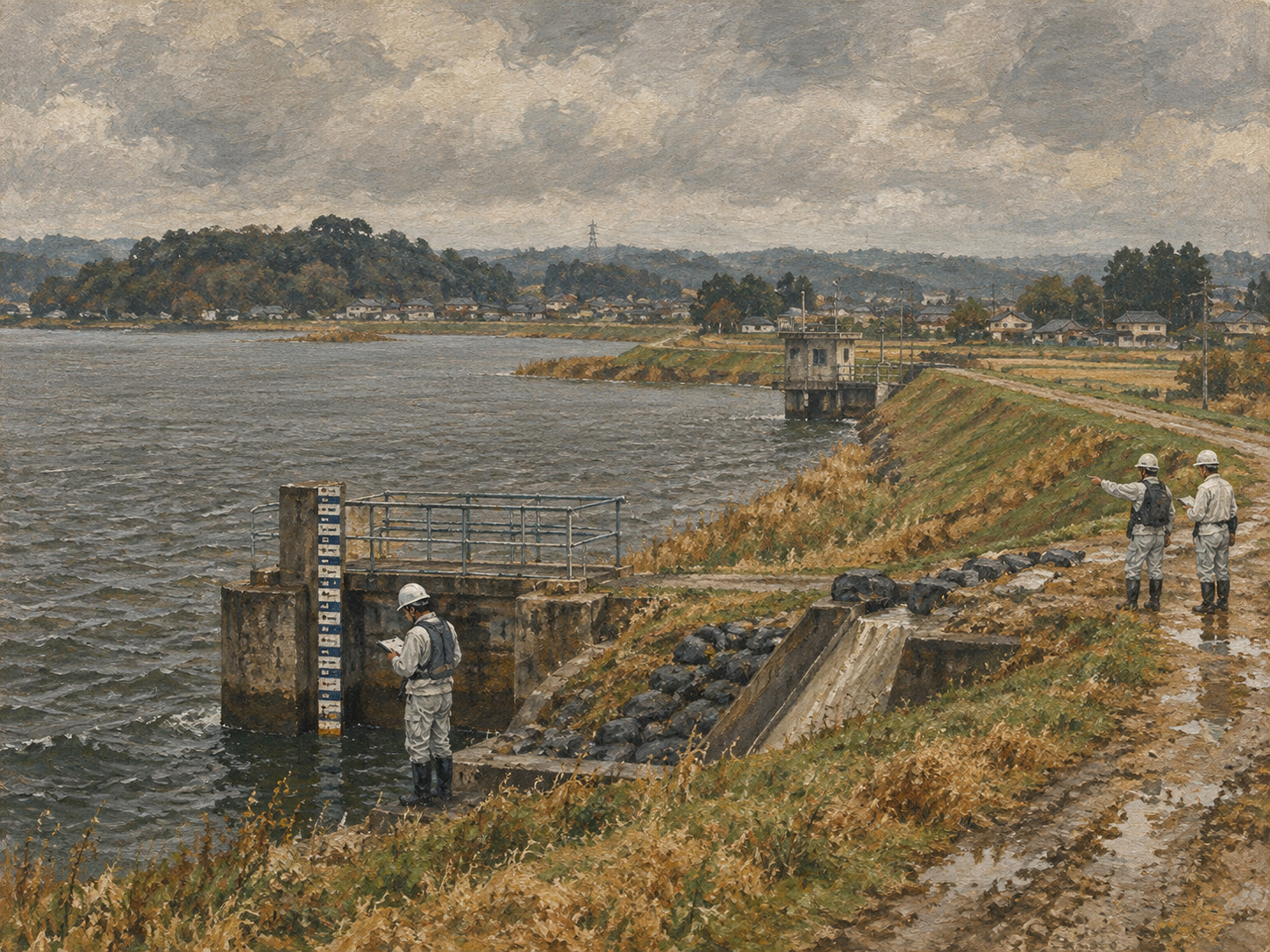
A flood-warning threshold is not just a number. A lake level of 2.8 meters means one thing when the levee is intact and something very different after that levee has failed and emergency works are still under way.
That is the logic behind Chiba Prefecture’s temporary operating rule for North Inba Lake. Beginning September 28, the prefecture lowered the level at which it sends Level 4 flood-danger information to Narita, Inzai and Sakae from 4.25 meters to 2.65 meters. It also created a temporary Level 5 flood-occurrence notification at 2.80 meters, where no such threshold had previously been set for the lake.
Chiba is warning 1.60 meters earlier
The Level 4 threshold has been cut by 1.60 meters—about 38% below the old gauge level.
That does not mean the physical water level at which flooding becomes possible has somehow been redefined. It means the safety margin around the lake has changed because the levee system has been damaged.
North Inba Lake is not formally designated as a water-level notification river under the relevant framework, but Chiba had already been operating it in a manner similar to one. After the breach, the prefecture recalibrated that local operating rule to reflect a weakened structure.
Typhoon No. 25 breached North Inba Lake and the Kadokawa drainage channel
On September 22, torrential rain from Typhoon No. 25 breached the prefecture-managed North Inba Lake levee at the Funakata reclamation area in Narita and also breached part of the levee along the Kadokawa agricultural drainage channel in Shimokata, Narita.
Chiba’s first announcement described the North Inba Lake breach as approximately 100 meters. A later restoration-status page identifies the affected Funakata section as 72.6 meters. The difference reflects the distinction between an initial emergency estimate and the later engineering length used for restoration management.
The failures caused large-scale flooding around North Inba Lake and the Nagato River. The Ministry of Land, Infrastructure, Transport and Tourism dispatched TEC-FORCE personnel, and on September 25 Chiba Prefecture, the Japan Water Agency and the Kanto Regional Development Bureau formed “Team Inbanuma” to coordinate drainage and emergency restoration.
Danger now depends on structural weakness, not water level alone
Flood operations normally focus heavily on how high the river or lake has risen relative to levees, banks and surrounding land.
After a breach, the continuity and strength of that protection system itself is compromised. Even after an emergency closure, the damaged section may consist of temporary fill, large sandbags, rock, sheet material or other provisional works rather than a fully restored levee.
Waiting for the old 4.25-meter threshold would therefore assume a degree of structural resilience that no longer exists.
What Level 4 and Level 5 mean
Japan reorganized its disaster-weather information on May 29, 2026 to align river flooding, heavy rain, landslides and storm surge more directly with the five-level warning system.
Level 4 is the stage at which people in dangerous locations should evacuate. For North Inba Lake, Chiba now sends Level 4 flood-danger information at a gauge level of 2.65 meters during the emergency-restoration period.
Level 5 corresponds to a disaster that has occurred or is immediately threatening, when people who remain in danger must take whatever action can still protect life. Chiba had not previously set a Level 5 flood-occurrence threshold for North Inba Lake because the lake is not formally designated as a water-level notification river. The temporary rule sets one at 2.80 meters.
The prefectural notification and a municipality’s evacuation order are related but not identical. Chiba provides river information; municipal governments make local evacuation decisions using that information alongside rainfall, inundation, road and field conditions.
Why North Inba Lake operates outside the formal water-level notification designation
Japan’s water-level notification system is designed for rivers where timely gauge information can support evacuation even when full flood forecasting is not conducted in the same manner as for larger designated rivers.
North Inba Lake itself is not formally designated under that category. Chiba has instead operated a comparable local notification system.
The September 28 change therefore did not alter the lake’s legal designation. It changed the prefecture’s operational thresholds because the physical system had been damaged.
Inba Lake was once known as a “rampaging lake”
The Japan Water Agency describes Inba Lake historically as an “abare-numa”—a lake notorious for repeated flooding.
Flood-control and water-use schemes were attempted from the Edo period but repeatedly struggled with the terrain and hydrology. After World War II, reclamation and irrigation/drainage works began in 1946 partly to increase food production.
As industrial-water demand grew during Japan’s rapid economic expansion, the project was reorganized in 1963 as the Inba Lake Development Project under the Water Resources Development Public Corporation. The project was completed in 1968.
The lake is really a managed water system
Modern Inba Lake is both a natural water body and engineered infrastructure.
The Inba shortcut channel connects North and West Inba Lakes. The Nagato River connects the lake system to the Tone River. Inba Pumping Station can discharge floodwater toward the Tone; Owada Pumping Station can discharge toward Tokyo Bay. Sakaenaoshi Gate and pumping facilities help regulate water levels and transfers.
Those facilities support flood control, irrigation and water supply together. A levee breach therefore changes the behavior of a system, not just one shoreline.
Why “Team Inbanuma” was necessary
Different parts of that system involve different operators.
Chiba Prefecture manages key river and levee assets. The Japan Water Agency operates Inba Lake development facilities. The national government provides TEC-FORCE teams and emergency river-engineering support.
On September 25, the three bodies created Team Inbanuma to coordinate drainage, emergency closure, equipment, access and restoration. It is an organizational response to the same problem the lower gauge threshold addresses: normal divisions of responsibility are less useful during a system-wide emergency.
Emergency closures progressed by September 30
On October 1, Chiba announced that emergency rough closures at the Kadokawa collection channel and Nagato River breach sites had been completed September 30 using large sandbags, water-blocking sheets and other materials.
At the North Inba Lake Funakata site, emergency closure work was still being shown in progress on the prefecture’s October 1 restoration page.
A rough closure is not a permanent levee. That distinction explains why the lower notification thresholds remain temporary until emergency restoration is judged complete.
Changing the warning rule is itself part of restoration
Disaster recovery is usually pictured as earthmoving, pumping and reconstruction. Operational rules also need repair.
If a levee is weakened, drainage capacity reduced or surrounding ground destabilized, using the old warning threshold can delay action even if the numerical gauge reading is accurate.
The North Inba Lake change is a practical example of recalibrating real-time information to the post-disaster landscape.
What changes for Narita, Inzai and Sakae
The lower threshold gives municipal governments earlier notice.
Receiving Level 4 information at 2.65 meters rather than 4.25 meters can create additional time to prepare shelters, communicate with residents, support people who need assistance, consider road controls and inspect vulnerable areas.
But residents should not interpret 2.65 meters as a guarantee of safety below that level. Local drainage failure, tributary flooding and road inundation can occur independently of the North Inba Lake gauge.
Flood warning is a layered information problem
Japan’s 2026 information reform aims to make warning levels easier to connect with public action. That does not make flood risk reducible to one number.
Water level, rainfall, basin rainfall indices, cameras, field patrols, levee condition, pumping-station status and road flooding all contribute to the decision picture.
The North Inba case adds one more layer explicitly: structural damage itself becomes an input into the warning threshold.
When will the old 4.25-meter threshold return?
Chiba’s notice says the temporary system will remain in place until emergency restoration of the breached locations is complete.
As of October 2, however, the public documents reviewed for this article do not specify a date for returning to 4.25 meters or a detailed engineering checklist defining exactly when the former safety margin is considered restored.
Disaster experience changes numbers
The history of flood control is not only the history of higher levees and larger pumps. It is also the history of changing when officials warn, who receives that warning and how early local governments act.
Inba Lake has been difficult to control since the Edo period. Postwar Japan transformed it into a vast managed flood-control and water-supply system. Typhoon No. 25 nevertheless demonstrated that even an engineered system can lose the assumptions built into its normal operating rules.
One of Chiba’s first responses was therefore not a new concrete wall but a new number.
From 4.25 meters to 2.65 meters: that 1.60-meter difference is a temporary buffer designed to convert the weakness of a damaged levee into more time for human decisions.
Sources
- Chiba Prefecture, operation of water-level information after the North Inba Lake breach
- Chiba Prefecture, North Inba Lake levee breach
- Chiba Prefecture, restoration status around Inba Lake
- Chiba Prefecture, formation of Team Inbanuma
- Chiba Prefecture, rough closure of the Kadokawa channel and Nagato River
- Chiba Prefecture, five-level warning system
- Japan Water Agency, Inba Lake Development Project
- Japan Water Agency, history of the Water Resources Development Public Corporation