A feasibility study, not yet a satellite order
On July 6, Japanese radar-satellite company Synspective said it would support a Japan–Thailand feasibility study on low-Earth-orbit satellite constellations. It will provide synthetic-aperture-radar data and knowledge gained from developing and operating its StriX constellation.
The government framework sits above the company. Japan’s Ministry of Economy, Trade and Industry and Thailand’s Ministry of Higher Education, Science, Research and Innovation signed a Memorandum of Cooperation announced June 30. The study is to involve JAXA, Thailand’s Geo-Informatics and Space Technology Development Agency—GISTDA—and industry participants.
No StriX purchase or Thai constellation deployment has been announced. The work is meant to test needs, technology, economics and partnership structures before concrete projects are chosen.
Radar illuminates the ground with radio waves
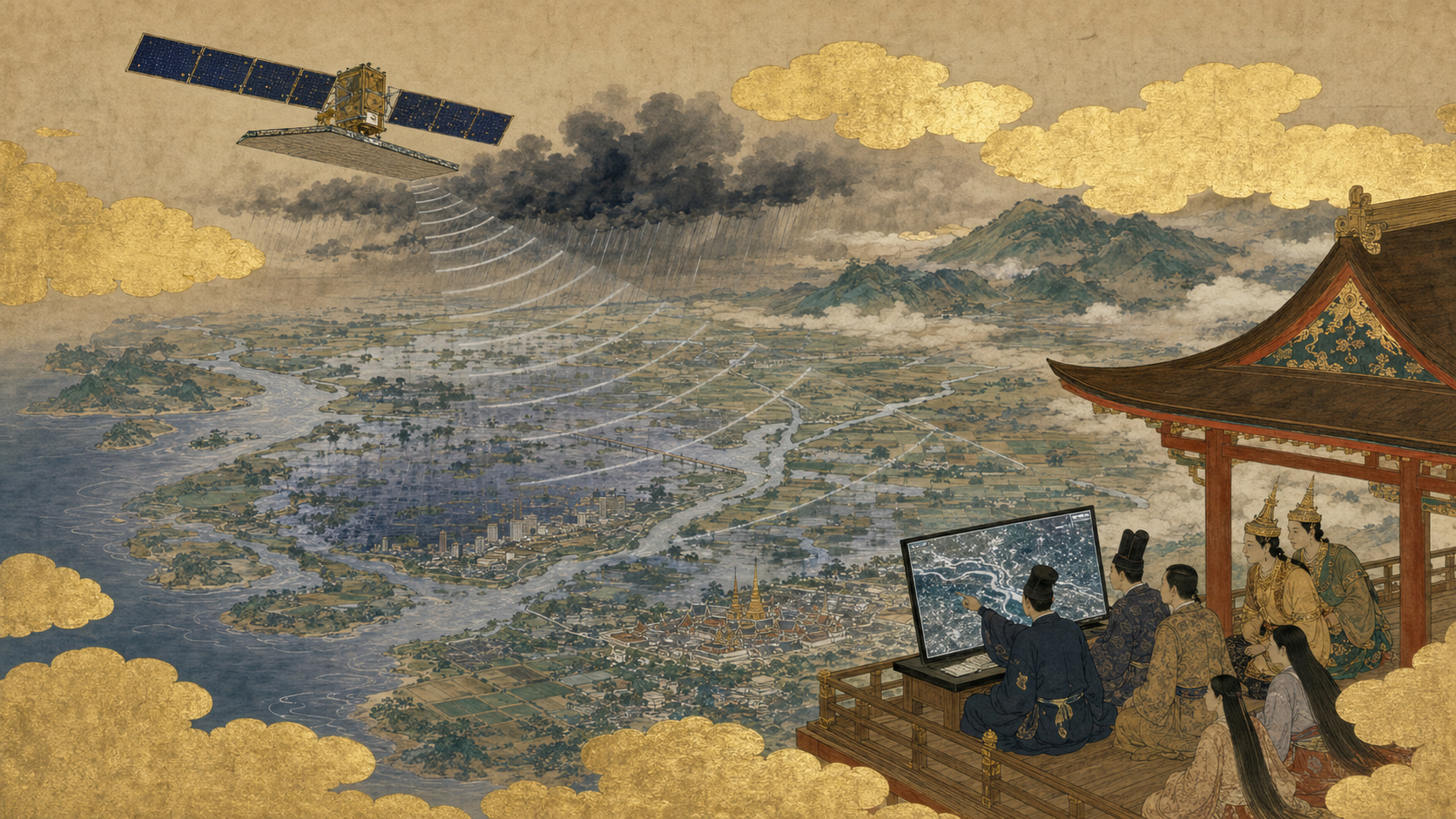
Optical satellites passively record sunlight reflected from Earth. SAR is active: an antenna sends microwave pulses toward the surface and measures the returning echoes. The travel time locates objects in range; Doppler changes and spacecraft motion build detail along the flight direction.
A physically modest antenna can behave like a much larger one because software combines echoes collected from many positions along the orbit. That synthesized aperture gives the technology its name.
The resulting image is not a photograph. Brightness depends on geometry, roughness, moisture, material and wavelength. Smooth water often reflects energy away and appears dark; buildings can create strong bright returns; vegetation produces complex scattering.
Why Thailand is almost a textbook SAR market
Thailand’s rainy season brings persistent cloud exactly when authorities need to see floods, reservoirs, crops, roads and cities. Optical satellites may wait days for a clear opening. Radar can collect at night and through most weather.
The Chao Phraya basin concentrates people, farms, industry and logistics in a flood-prone plain. Mountainous northern regions face landslides and forest disturbance. Long coastlines require monitoring for erosion, aquaculture, ports and offshore activity.
No sensor is universal. SAR’s ability to work during cloud makes it an essential layer, particularly when combined with optical images, weather radar, gauges and field reports.
Floodwater: simple idea, difficult map
Open water is often dark in SAR because its smooth surface reflects the radar pulse away. Comparing pre-event and post-event scenes can reveal newly inundated areas even beneath storm clouds.
But cities complicate the signal. Buildings produce bright double-bounce reflections, trees may conceal water below their canopies and wind roughens water. Permanent ponds must be separated from temporary flooding. Terrain and viewing angle create shadows.
A useful flood product therefore combines radar processing, elevation models, historical water masks and local validation. The operational question is not “can SAR see water?” but “can a trustworthy map reach emergency managers before conditions change?”
From Thailand’s 2011 flood to climate-era resilience
The 2011 floods submerged large areas of central Thailand, killed hundreds, disrupted millions of lives and shut industrial estates supplying global automotive and electronics chains. The disaster demonstrated that a regional flood can become a worldwide supply shock.
Satellite observations helped map the event, but revisit time, cloud and data-delivery constraints limited speed. Since then, commercial constellations, cloud processing and machine learning have shortened the path from orbit to map.
The historical lesson is that disaster imagery has economic value far beyond relief. Manufacturers, insurers, banks and trading partners need to understand which factories, roads and suppliers are exposed.
What a constellation changes
One satellite revisits according to its orbit and may miss the most important hour. Multiple satellites distributed around Earth create more observation opportunities and shorter waiting time.
For SAR, constellation operations are demanding. Satellites consume power while imaging, generate large data volumes and must aim side-looking beams without conflicts. Ground systems schedule customer requests, avoid overloading batteries and storage, route data to antennas and process products.
Synspective’s contribution is therefore not only imagery. Thailand can study how a fleet is planned, commanded, maintained and translated into service-level promises.
| Layer | Study question | Possible outcome |
|---|---|---|
| Mission needs | Which Thai problems require sovereign or assured access? | Priority use cases and service levels. |
| Space segment | Own satellites, hosted payloads or purchased data? | Constellation architecture and procurement model. |
| Ground segment | Where are antennas, computing and archives located? | National and shared infrastructure plan. |
| Applications | How does data reach ministries and businesses? | Flood, agriculture, infrastructure and maritime products. |
| Industry | Which capabilities should Thailand build locally? | Training, components, software and operations roles. |
Japan’s long radar lineage
Japan has operated spaceborne SAR since JERS-1 in the 1990s and developed L-band radar through ALOS and ALOS-2. JAXA used these systems for mapping, disasters, land deformation, agriculture and forest monitoring. ALOS-4 continues that national lineage.
L-band penetrates vegetation more deeply and is valuable for forests and crustal deformation. Synspective’s compact StriX satellites use a different commercial architecture designed for frequent observation and scalable production. Different wavelengths and mission designs serve different problems.
The Japan–Thailand study can combine public-mission experience with commercial speed. It should not assume one sensor replaces all others.
Synspective’s path from government R&D to market
Synspective was founded in 2018, building on Japanese technology associated with the government’s ImPACT program. Its name combines “synthetic” and “perspective,” reflecting a business built around SAR satellites and analytics.
The company has launched successive StriX spacecraft, learned to operate a constellation and developed products including flood-damage assessment and land-displacement monitoring. Its business challenge is familiar to Earth observation: customers often want answers rather than raw complex radar data.
A feasibility study in Thailand is a market-development tool, but also a test of whether Japanese commercial space can transfer operating knowledge rather than simply export images.
InSAR: measuring motion too small to see
Interferometric SAR compares the phase of radar signals collected from similar positions at different times. Tiny changes in path length create interference patterns that can reveal ground movement at centimetre or even millimetre scales under suitable conditions.
Thailand could use InSAR to monitor subsidence around Bangkok, deformation near dams, slopes, railways, mines and construction. Groundwater extraction and soft sediments make subsidence a long-term urban risk.
InSAR does not directly measure vertical movement alone; it measures displacement along the radar line of sight. Atmospheric delay, vegetation and orbit differences add noise. Ground GNSS and engineering surveys remain necessary.
Rice fields, water and food security
Radar responds to surface moisture, plant structure and flooding, making it useful for mapping rice cultivation. Time-series images can help estimate planting calendars, crop area and storm damage when cloud blocks optical sensors.
Models require local varieties, irrigation practice, field boundaries and ground samples. A method trained in Japan cannot simply be copied to every Thai province. GISTDA and agricultural agencies provide essential context.
Applications can support national crop statistics, drought management, credit and index insurance. The commercial customer might be a ministry, miller, bank or insurer rather than the individual farmer.
Infrastructure and the Eastern Economic Corridor
Thailand is expanding rail, ports, industry and cities. Repeated SAR can track construction, settlement and deformation across wide areas without installing a sensor on every structure.
Persistent-scatterer InSAR uses stable reflectors such as buildings and bridges to create long motion histories. It can prioritize locations for field inspection but does not replace structural engineers.
Infrastructure products need liability rules. If an algorithm fails to flag movement, who is responsible? Feasibility work should define thresholds, validation and how alerts enter official maintenance systems.
Forests, fires and carbon
Thailand’s forests and plantations are difficult to monitor consistently under cloud. Radar can help detect clearing, estimate structure and follow landscape change. Combined with optical and field inventories, it supports forest management and carbon accounting.
Radar is sensitive to biomass but can saturate in dense forest, depending on wavelength. Plantation cycles may resemble forest loss without context. Fire detection often benefits from thermal sensors, while SAR maps damage and recovery.
Carbon-market claims require transparent models and independent verification. Satellite data strengthen evidence but should not become an automatic credit machine.
Maritime and national-security uses
Thailand has coasts on the Gulf of Thailand and Andaman Sea, busy ports, fisheries and offshore infrastructure. SAR can detect ships independently of daylight and often when AIS signals are absent.
Commercial maritime awareness supports illegal-fishing enforcement, spill response, port management and search and rescue. It can also reveal military activity. The original government memorandum explicitly recognizes LEO constellations as infrastructure relevant to public life, industry and security.
Data policy must distinguish routine commercial products from sensitive tasking. Export control, customer screening, storage and cyber protection belong in system design.
Thailand’s GISTDA is not a beginner
GISTDA has long operated geospatial programs and Thailand’s THEOS Earth-observation missions. It runs ground and application capabilities, supports mapping and disasters and participates in ASEAN and international partnerships.
The study is therefore not Japan teaching a country with no experience. It is a negotiation between established Thai geospatial institutions and Japanese agency and industry capabilities.
The best partnership builds Thai autonomy: analysts, operators, software, components and decision systems—not permanent dependence on imported pixels.
Buy data, buy satellites or build together?
Thailand can purchase commercial imagery immediately, acquire dedicated capacity, place payloads on partner spacecraft, buy satellites, or co-develop a national constellation. Each option trades cost, schedule, control and industrial learning.
Buying data is fast and diversified but offers less control in crisis. Owning satellites assures tasking but requires capital, replenishment, ground systems and skilled operations. Joint development can transfer knowledge but increases complexity.
A rigorous feasibility study compares total life-cycle cost, not just spacecraft price. Launch, insurance, spectrum, collision avoidance, data processing and replacement belong in the calculation.
Local validation is where projects succeed
Satellite algorithms can look impressive in a demonstration and fail in routine government use. Thailand needs test sites across urban, agricultural, forest, mountain and coastal conditions, with local records to measure false alarms and missed detections.
Users should be involved before product design. Emergency officials may need simple polygons and road status, not radar images. Engineers may require displacement time series with uncertainty. Farmers’ agencies need seasonal statistics.
The study succeeds if it defines decisions, service latency and accuracy requirements before selecting hardware.
How to judge what comes next
Look for named pilot regions, participating Thai ministries, data-delivery targets and budgets. Watch whether the parties choose a data-service contract, joint satellite, ground facility or training program.
Measure how quickly flood products reach local officials, whether InSAR alerts lead to inspections and whether Thai researchers can reproduce the processing. Count local companies qualified into the supply chain.
SAR is powerful because clouds do not end observation. Partnership is powerful only if organizational clouds—unclear ownership, slow procurement and missing validation—do not end action. The feasibility study’s task is to clear both.
Sources and further reading
- Synspective, July 6, 2026 — feasibility-study scope and participants.
- JAXA ALOS-2 — Japanese SAR history, disaster and forest applications.
- ESA Earth Observation: SAR — radar fundamentals.
- GISTDA — Thailand’s geospatial and space institution.
- UN-SPIDER — satellite applications in disaster management.
- World Bank Thailand — development, climate and disaster context.