From seven spacecraft to a daily service
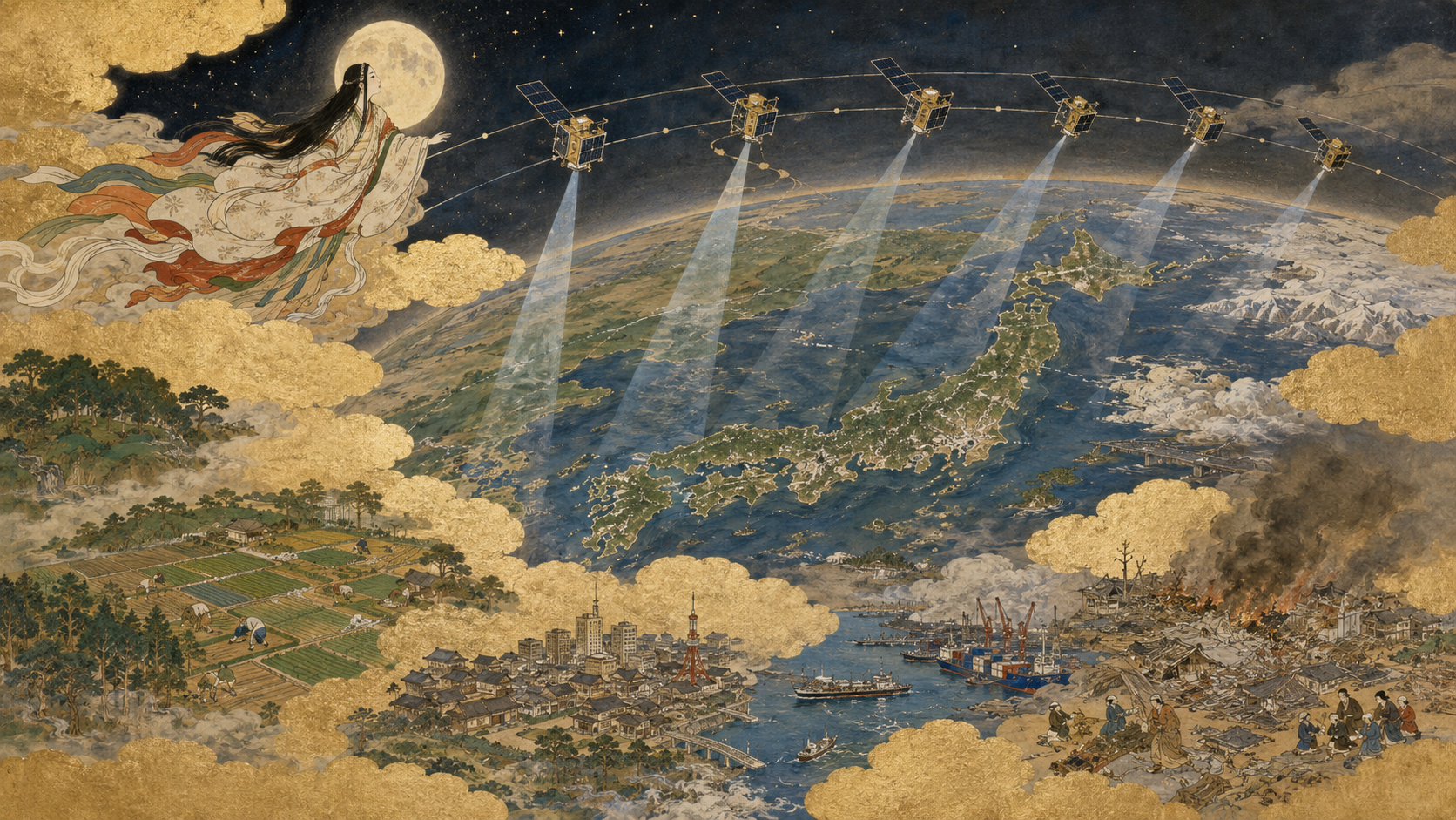
Axelspace’s seven GRUS-3 optical Earth-observation satellites were launched together on SpaceX’s Transporter-17 mission on July 7. All seven returned first signals and completed the critical initial-operations phase. Their larger purpose is not the launch spectacle: Axelspace says the expanded fleet is designed to create once-daily imaging opportunities for the same place across areas north of 25 degrees latitude.
That boundary includes Japan, most of Europe, much of North America and broad parts of northern and central Asia. It does not mean GRUS-3 photographs every square kilometre every day. It means orbital geometry and spacecraft pointing should permit daily revisit of requested targets within the service region, subject to capacity, weather, tasking and operations.
Revisit is a probability machine
A polar-orbiting satellite circles Earth while the planet rotates underneath. Its camera observes a strip, not a hemisphere. One spacecraft may wait days before geometry again permits it to photograph a chosen field, bridge or forest.
Add spacecraft in coordinated orbital planes and the waiting time falls. More passes also create more chances to obtain a usable image before a deadline. Revisit therefore converts a satellite from an occasional picture-maker into a monitoring system.
Four terms should not be confused: revisit is how soon a satellite can see a place again; refresh is how often a usable new product is actually delivered; latency is the delay from collection to customer; and persistence means near-continuous awareness. GRUS-3 promises improved revisit, not persistence.
Why the latitude boundary exists
GRUS spacecraft use near-polar, sun-synchronous-type geometry. High-inclination ground tracks converge toward the poles, so northern locations receive more overlapping opportunities than equatorial ones. Agile pointing can widen the accessible corridor, but it cannot repeal orbital mechanics.
North of 25 degrees is consequently a product definition, not a political map. Tokyo lies near 36 degrees north, Seoul near 38, Beijing near 40, Paris near 49 and much of the continental United States north of the threshold. Southeast Asia, equatorial Africa and most of South America require a different service claim.
Daily does not mean cloud-free
GRUS-3 is an optical system: it records sunlight reflected from Earth. Night and opaque cloud defeat the observation. A daily chance can therefore produce several consecutive cloudy scenes during a typhoon or rainy season—the very moment emergency managers want imagery most.
Frequency still helps. If each pass has only a limited chance of clear sky, repeated independent opportunities improve the odds of securing at least one useful view. In practice, cloud persistence is not perfectly independent, so planners combine optical constellations with weather forecasts, archival baselines and all-weather synthetic-aperture radar.
The honest product is not “one clear picture per day.” It is a faster sequence of attempts and, when conditions cooperate, a denser time series.
A short history: from rare national pictures to commercial streams
Early civilian Earth observation was dominated by large government missions. The United States’ Landsat program, beginning in 1972, established the value of repeated, calibrated views for land change. France’s SPOT introduced stronger commercial tasking and off-nadir viewing. Japan developed MOS, JERS and the ADEOS and ALOS families, building expertise in both optical and radar observation.
Those systems produced scientifically powerful records, but a single large satellite usually revisited slowly and procurement cycles lasted years. The 2000s brought commercial high-resolution spacecraft; the 2010s brought standardized small satellites, cheaper rideshare launches, cloud computing and application programming interfaces. The economic unit shifted from “buy an image” toward “subscribe to a changing map.”
GRUS-3 belongs to that transition. Its competitive claim is not the sharpest pixel on the market. It is a useful balance among resolution, geographic coverage, consistency, price and repeat frequency.
Japan’s small-satellite lineage
Axelspace was founded in 2008 by engineers influenced by the University of Tokyo’s microsatellite movement and Japan’s Hodoyoshi philosophy: build capable spacecraft more quickly and economically by questioning requirements inherited from large national missions.
The company first developed custom microsatellites, then launched the first GRUS Earth-observation spacecraft in 2018. AxelGlobe turned the hardware into a service spanning tasking, ground communications, processing, cataloguing and delivery.
Seven similar GRUS-3 units mark a manufacturing and operational transition. A constellation succeeds only if repeated spacecraft can be assembled, tested, calibrated and replaced economically. The product is the factory and software as much as the camera.
Resolution is only one axis
Customers often ask first how small an object the camera can distinguish. Spatial resolution matters, but it is only one dimension. Spectral bands determine which colours and near-infrared signals can be measured; radiometric quality determines sensitivity to brightness differences; geometric accuracy determines whether pixels align with maps; temporal resolution determines how often change can be observed.
A very sharp image collected twice a year may be less useful for crop emergence or rapid construction than a moderately detailed image collected consistently. Conversely, daily imagery cannot identify an object smaller than its pixels. The correct system matches all four resolutions to a decision.
Agriculture: watch the curve, not the postcard
Crops change gradually, making agriculture a natural time-series market. Red and near-infrared measurements can reveal vegetation vigour, planting progress, harvest timing and abnormal development. Frequent scenes help analysts distinguish a persistent problem from a single noisy observation.
Daily opportunities are particularly useful during short decision windows: after frost, hail or drought; before irrigation; or while insurers estimate damage. Yet satellite colour does not directly equal yield. Models need crop type, soil, weather and field observations, and small or mixed fields can blur inside pixels.
The teaching point is simple: imagery becomes agricultural intelligence only after agronomy and local validation are added.
Mapping and construction: change as evidence
Base maps age. Roads open, buildings rise and coastlines move. A repeatable constellation can flag change, allowing human editors to inspect only places likely to need updates instead of remapping everything.
Construction firms can document progress across scattered sites; governments can compare permits with visible development; utilities can monitor corridors. Consistent viewing geometry and geometric calibration matter because apparent movement caused by angle or shadow can masquerade as real change.
For legal or contractual use, provenance also matters: collection time, processing history, positional uncertainty and an auditable chain of custody.
Disaster recovery: the baseline is as valuable as the aftermath
After earthquakes, landslides, wildfire or volcanic activity, responders need to know what changed. A constellation that has routinely imaged an area may already possess the “before” view. That archive can be more valuable than a hurried post-disaster collection alone.
Daily revisit can follow blocked roads, debris removal, temporary settlements and rebuilding. Optical colour is intuitive for decision-makers, but smoke and storm cloud may hide the first hours. Radar, aircraft and drones are complements; no single sensor wins every phase.
Speed must include the whole chain. An image collected today but delivered and interpreted three days later is not a daily operational product.
Environmental enforcement: observation is not conviction
Repeated imagery can expose forest clearing, mine expansion, waste dumping, unlicensed construction or changes near protected coasts. High frequency narrows the time window in which a change occurred and helps enforcement agencies prioritize inspections.
But pixels rarely prove intent or legal responsibility. Clouds, seasonal vegetation, shadows and legitimate land use can generate false alarms. Agencies need cadastral boundaries, permits, ownership records and ground investigation.
The most useful workflow is triage: automated change detection produces leads; analysts assess confidence; authorized officials verify and act.
The hidden ground system
Seven satellites can generate more collection opportunities than a manual operations team can exploit. Customers submit competing requests; software checks cloud forecasts and geometry; schedulers allocate camera time; ground stations receive data; pipelines correct and catalogue imagery.
Axelspace’s partnerships for ground-station access and automation are therefore central to the promise. A pass missed because no station can receive it is lost capacity. A backlog in processing converts fast orbital revisit into slow delivery.
Constellation economics reward utilization. The more images each spacecraft can collect, downlink and sell without conflicts, the better fixed launch and manufacturing costs are spread across customers.
Calibration: making seven cameras speak one language
A time series is trustworthy only if brightness or position changes reflect Earth rather than differences between spacecraft. GRUS-3A and GRUS-3G must produce measurements close enough that analysts can compare them.
Teams image known ground targets, compare overlapping scenes, model sensor response and correct geometry. Cross-calibration with established missions can help. This work is quieter than launch but determines whether automated analytics mistake one camera’s personality for a change on the ground.
Competition and complementarity
GRUS-3 enters a crowded market that includes government systems such as Landsat and Europe’s Copernicus Sentinels, commercial very-high-resolution providers, large smallsat fleets and radar constellations. Free public data offers long, calibrated records; premium systems may offer sharper detail or rapid tasking.
Axelspace can compete through a particular bundle: Japan-based engineering, frequent regional coverage, responsive commercial terms and integration into customers’ workflows. It can also complement public missions—using broad free imagery to detect change, then tasking GRUS for a more timely or detailed follow-up.
Questions a customer should ask
| Claim | Operational question | Evidence to request |
|---|---|---|
| Daily revisit | For which latitude, look angle and season? | Target-specific access statistics |
| Daily monitoring | What happens under persistent cloud? | Usable-image and cloud-free rates |
| Fast delivery | How long from exposure to API? | Median and worst-case latency |
| Consistent analytics | Are all seven sensors cross-calibrated? | Radiometric and geometric validation |
| Scalable service | How are conflicting tasks prioritized? | Capacity and service-level terms |
What to watch next
First-light imagery is only the opening test. Watch for completion of commissioning, published image specifications, cross-satellite calibration, sustained downlink performance and the formal start of GRUS-3 commercial service. Then examine real delivery statistics rather than orbital potential alone.
The important metric will be decision-ready observations delivered per target, not spacecraft launched. If Axelspace can make seven cameras behave like one reliable instrument, daily revisit north of 25 degrees could give farmers, mapmakers and emergency teams something more useful than a beautiful picture: a dependable record of change.
Sources and further reading
- Axelspace News — GRUS-3 launch, first signals, service plans and company announcements.
- Axelspace, July 10, 2026 — completion of critical operations for all seven satellites.
- Exolaunch: Transporter-17 — launch integration and deployment context.
- USGS Landsat Missions — the long-running public Earth-observation record.
- ESA Sentinel-2 — optical constellation and revisit context.
- FAO Earth Observation — agricultural statistics and satellite-data applications.
- JAXA ALOS-3 — Japan’s optical Earth-observation heritage and applications.